Give us feedback!

Cross all Covered Bridges in Oregon
›Go to Dream PageDream out of
Stats for this Dream
On Your list: -
Your Check-offs: -
Friends with Dream: 0
Total Check-offs: -
Advertisement
-
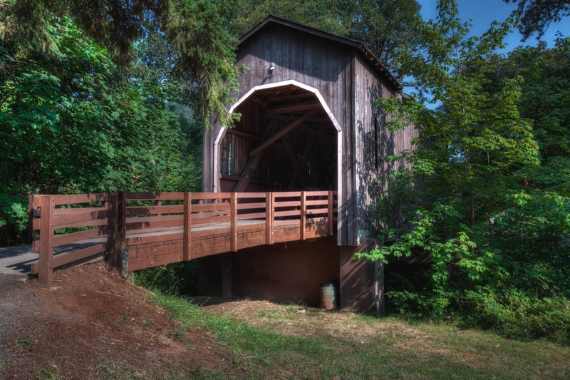
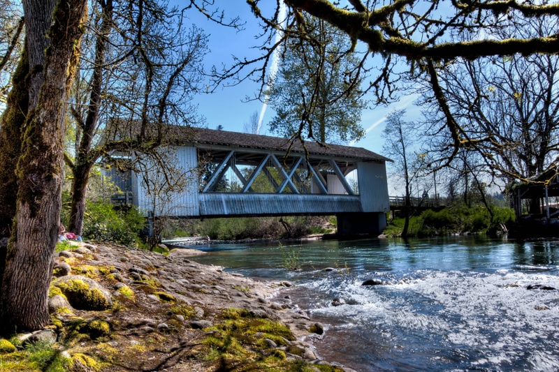
Cross Stayton–Jordan Bridge, Stayton, Oregon
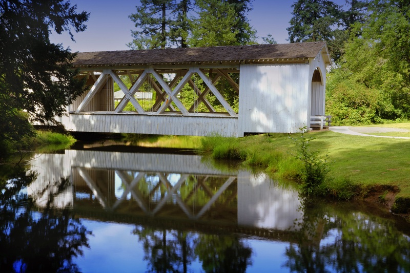 A quick word about the place...Flag as inappropriate ›Stayton–Jordan Bridge is a covered bridge in Stayton in Marion County in the U.S. state of Oregon. Built in 1998, it carries foot traffic over the Salem Power Canal in Pioneer Park. The canal is a diversion from the North Santiam River. A predecessor of the 1998 structure was a covered bridge spanning Thomas Creek near Lyons in Linn County. Built in 1937, it was one of seven similar Linn County covered bridges with large side openings. Known as theJordan Bridge, it took its name from the rural community of Jordan, which was nearby. In 1986, after Linn County officials decided to replace the bridge, a group of Stayton residents acquired the dismantled structure and, with the help of volunteers and Marine Corps reservists, rebuilt it in Stayton. The rebuilt bridge, spanning the power canal, opened to pedestrian traffic in 1988. However, in December 1994, Christmas lights set fire to the bridge roof,due to kids shooting at...SHOW MORE
 -
Cross Rochester Covered Bridge, Douglas County, Oregon
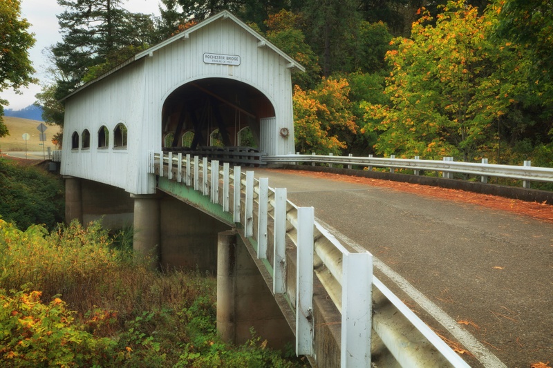 A quick word about the place...Flag as inappropriate ›Rochester Covered Bridge is a covered bridge in Douglas County in the U.S. state of Oregon. Built by Floyd Frear in 1933, it carries Rochester Road over Calapooya Creek about 3 miles (5 km) west of Sutherlin. The bridge design, whichHistoric Highway Bridges of Oregoncalls "unique among Oregon's housed structures", includes side windows with curved tops. The bridge has four windows on each side, portals with flat arched openings, and exposed false beams at the gable ends. According to the Oregon Department of Transportation, after county workers burned down another covered bridge in the vicinity in the late 1950s, a group of armed local residents guarded the Rochester Bridge one night to protect it from the same fate. The next day, county commissioners told the residents that the bridge would not be burned. In 1969, the county remodeled the bridge by replacing portal boarding, approaches, and abutments. Oregon's Covered...SHOW MORE
 -
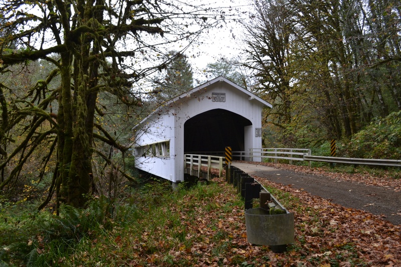
Cross Gallon House Covered Bridge, Oregon
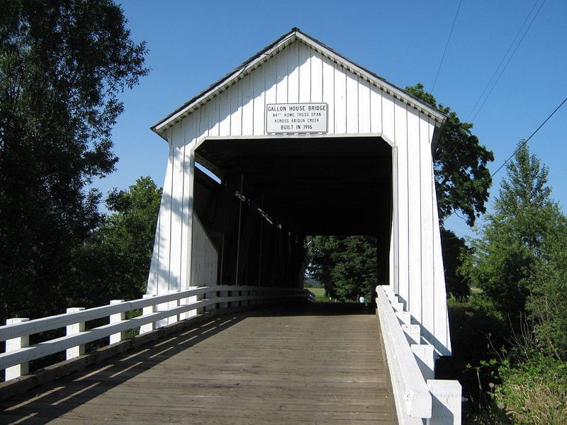 A quick word about the place...Flag as inappropriate ›Gallon House Bridge (also Gallonhouse Bridge) is a wooden covered bridge spanning Abiqua Creek in rural Marion County, Oregon, United States built in 1916. The 84 foot (26 m) long bridge derived its name during prohibition when it was a meeting place for bootleggers and moonshiners. The bridge was swept off its footings in the December 1964 flood, but was restored immediately after. Gallon House Bridge is approximately two miles NNW of the city of Silverton west of Oregon Route 214 on Gallon House Road.
 -
Cross Weddle Covered Bridge, Oregon
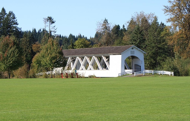 A quick word about the place...Flag as inappropriate ›The Weddle Bridge is a 120-foot (37 m) long wooden covered bridge located in Sweet Home, Oregon, United States. The bridge originally spanned Thomas Creek near Scio, Oregon. It was bypassed in 1980 by a concrete bridge. The unused bridge became a safety issue and the span was disassembled in October 1987. In 1989, residents in Sweet Home rallied to rebuild the Weddle Bridge across Ames Creek in Sweet Home. The bridge was temporarily closed in 2005 after an engineering inspection determined that repairs were necessary. The Sweet Home Economic Development Group, using proceeds from the Oregon Jamboree country music festival, contributed $20,000 toward the project. Other local companies and individuals also contributed funds and building materials necessary to repair the bridge. The bridge has been the site for numerous weddings and community events.SHOW MORE
 -
Cross Short Covered Bridge, Oregon
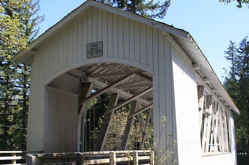 A quick word about the place...Flag as inappropriate ›The Short Bridge spans the South Santiam River 12 miles east of Sweet Home, Oregon near the community of Cascadia. The 105-foot Howe truss type bridge was built in 1945. It is named for Gordon Short, a long-time area resident. The bridge is listed on the National Register of Historic Places.
 -
Cross Hannah Covered Bridge, Oregon
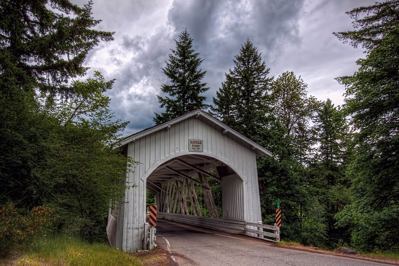 A quick word about the place...Flag as inappropriate ›The Hannah Bridge is a covered bridge in Linn County in the U.S. state of Oregon. It was added to the National Register of Historic Places as Hannah Bridge in 1979. Carrying Burmester Creek Road, the bridge crosses Thomas Creek about 1.5 miles (2.4 km) from Jordan. It is one of three remaining covered bridges along Thomas Creek; the others are the Shimanek Bridge and the Gilkey Bridge. Hannah Bridge, 105 feet (32 m) long, was constructed in 1936. It is named for John Joseph Hannah, a pioneer who arrived in Oregon in 1853 and settled a land claim of 151 acres (61 ha) between Thomas Creek and Bilyeu Creek. He built one of the first sawmills in the area.
 -
Cross Hoffman Covered Bridge, Oregon
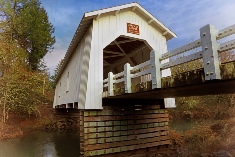 A quick word about the place...Flag as inappropriate ›The Hoffman Bridge is a covered bridge near Crabtree in Linn County in the U.S. state of Oregon. It was added to the National Register of Historic Places as Crabtree Creek – Hoffman Covered Bridge in 1987. The bridge crosses Crabtree Creek about 1 mile (1.6 km) northeast of Crabtree. Hungry Hill Drive crosses the 90-foot (27 m) bridge. Constructed in 1936, the bridge was named after its builder, Lee Hoffman. The creek and the nearby community were named after John Crabtree, who settled here in 1845.
 -
Cross North Fork of the Yachats Bridge, Oregon
 A quick word about the place...Flag as inappropriate ›The North Fork of the Yachats Bridge is a covered bridge in Lincoln County in the U.S. state of Oregon. The bridge carries North Fork Yachats River Road over the north fork of the Yachats River, about 9 miles (14 km) northeast (by river roads) of Yachats and the Pacific Ocean. The structure was added to the National Register of Historic Places in 1979. Otis Hamer, a veteran constructor of bridges, built the queen post truss structure for Lincoln County in 1938. It was the last of his covered bridges. At 42 feet (13 m) long, the bridge is one of the shortest covered bridges in Oregon. It is one of only two covered bridges in Lincoln County that are open to vehicular traffic; the other is the Chitwood Bridge. The weight limit on the bridge is eight tons; large trucks and recreational vehicles (RV)s are not allowed. After an accident damaged the bridge in 1987, county crews repaired it. They returned in 1989 for a more complete...SHOW MORE
 -
Cross Wildcat Creek Covered Bridge, Oregon
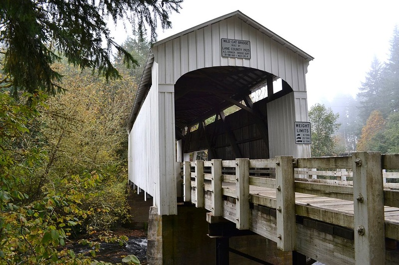 A quick word about the place...Flag as inappropriate ›Wildcat Creek Bridge is a covered bridge built in 1925 at Austa, near Walton, in the U.S. state of Oregon. It uses Howe truss engineering and was listed on the National Register of Historic Places in 1979. The 75-foot (23 m) bridge carries Austa Road over Wildcat Creek near its confluence with the Siuslaw River. The bridge is among those for which Lane County minted commemorative coins between 2005 and July 2012 for sale to the public to raise funds to maintain and repair covered bridges. Lane County owns 17 covered bridges, 14 of which are open to traffic. Through 2012, the county produced a total of 325 Wildcat Creek Bridge coins.
 -
Cross Wendling Covered Bridge, Oregon
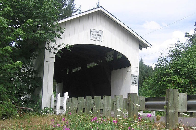 A quick word about the place...Flag as inappropriate ›The Wendling Bridge, located in Lane County, Oregon, is listed on the National Register of Historic Places. It is located in the unincorporated community of Wendling.
 -
Cross Stewart Covered Bridge, Oregon
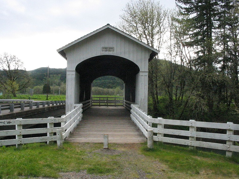 A quick word about the place...Flag as inappropriate ›Stewart Bridge is a Howe truss covered bridge built in 1930 near Walden, Oregon, United States, in Lane County. It was listed on the National Register of Historic Places in 1979. It is 60 feet (18 m) long and crosses Mosby Creek, a tributary of the Row River.
 -
Cross Ritner Creek Covered Bridge, Oregon
 A quick word about the place...Flag as inappropriate ›The Ritner Creek Bridge was the last covered bridge on a state highway in Oregon. It was on Oregon Route 223 (OR 223) between Pedee and Kings Valley, about 15 miles (24 km) south of Dallas, or 10 miles (16 km) north of the junction with U.S. Route 20 (US 20) in Wren. Built in 1927, in 1976 the bridge was lifted from its foundation and relocated just downstream of its original site and replaced by a concrete bridge. The bridge was constructed in 1927 by Hamer and Curry Contractors to Oregon State Highway Commission plans. The initial construction cost was $6,964. The original portal design was rounded at the edges but was changed to a square design in the early 1960s to accommodate larger loads to pass. The 73-foot long bridge was named for pioneer Sebastian Ritner who arrived in the area in 1845. In 1974 the bridge was declared structurally unsafe and scheduled for removal. Local residents started a petition to keep the...SHOW MORE
 -
Cross Pengra Covered Bridge, Oregon
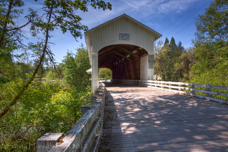 A quick word about the place...Flag as inappropriate ›The Pengra Bridge is a covered bridge near Jasper in the U.S. state of Oregon. The 120-foot (37 m) Howe truss structure carries Place Road over Fall Creek in Lane County. It replaced an earlier bridge, built in 1904, that crossed the creek a few feet further upsteam. Pengra Bridge was named in honor of B. J. Pengra, a government surveyor. The bridge was listed on the National Register of Historic Places in 1979. The lower chords of the bridge, at 16 by 18 inches (41 by 46 cm) by 126 feet (38 m), are among the longest timbers ever used in an Oregon bridge. Timbers of this size simplified some aspects of construction but required special techniques to finish and position at the site. Other features of the bridge include ribbon windows under the eaves, a side window on one side, and semi-elliptical arched portals. Weather and traffic weakened the bridge over time, and it was temporarily closed in 1979. With the help of state...SHOW MORE
 -
Cross Parvin Covered Bridge, Oregon
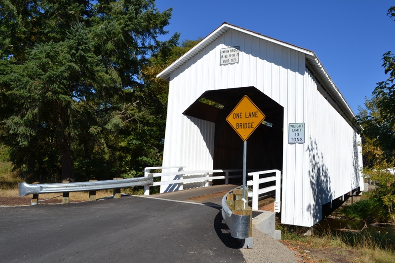 A quick word about the place...Flag as inappropriate ›The Parvin Bridge is a covered bridge located in Lane County, Oregon, U.S. near Dexter. It was built in 1921 as a single-lane 75-foot (23 m) bridge across Lost Creek, a tributary of the Middle Fork Willamette River. The bridge was a replacement for a 66-foot (20 m) Howe truss design which failed a 1917 inspection by bridge inspector J. W. McArthur. He wrote, "An old bridge. Chords badly worm eaten. Downstream chord has been reinforced in middle by a timber bolted on. Wood is but little better than a powder from worm action. All signs indicate a new bridge in from 2 to 4 years." George W. Breeding constructed the present bridge at the same site in 1921 for $3,617, equivalent to $48 thousand today. It is also a Howe truss and includes a 62-foot (19 m) eastern approach and a 17-foot (5.2 m) western approach. Roadwork in the mid-1970s realigned the road to bypass the bridge, being accessible only to pedestrians afterwards. A...SHOW MORE
 -
Cross Mosby Creek Covered Bridge, Oregon
 A quick word about the place...Flag as inappropriate ›The Mosby Creek Bridge, also called the Layng Bridge, is a historic Howe truss covered bridge located near Cottage Grove, Oregon, United States. The bridge crosses Mosby Creek and was constructed in 1920, making it the oldest covered bridge in Lane County. The Mosby Creek Bridge was built in 1920 for a cost of $4125 (US$48,726 in 2016) by Walter and Miller Sorenson. The bridge was named after the pioneer David Mosby. He settled east of present-day Cottage Grove near the current site of the bridge on a 1,600 acres (650 ha) land claim. Unique design elements of the Mosby Creek Bridge include semi-circular portal arches (the entrances to the bridge), ribbon openings at the roofline, and board-and-batten siding, as well as modifications to the basic Howe truss design. In 1990, the bridge underwent a major restoration. In 2002, the corrugated metal roof that capped the bridge's gable roof was replaced with synthetic material, as...SHOW MORE
 -
Cross Dorena Covered Bridge, Oregon
 A quick word about the place...Flag as inappropriate ›The Dorena Bridge is a covered bridge near Dorena in Lane County, Oregon in the United States. It is listed on the National Register of Historic Places. The 105-foot (32 m) structure crosses the Row River near the upper end of Dorena Reservoir.
 -
Cross Coyote Creek Covered Bridge, Oregon
 A quick word about the place...Flag as inappropriate ›The Coyote Creek Bridge near Crow, Oregon, United States, is listed on the National Register of Historic Places. The 60-foot (18 m) Howe truss structure, built in 1922, carries Battle Creek Road over Coyote Creek.
 -
Cross Chambers Covered Covered Railway Bridge, Oregon
 A quick word about the place...Flag as inappropriate ›The Chambers Covered Bridge is a covered bridge located in Cottage Grove, Oregon, United States. It is 78 feet (24 m) long and spans the Coast Fork Willamette River. It was built in 1925 to carry rail traffic hauling logs from the Lorane Valley to the J.H. Chambers Mill, a lumber mill which was located on an area between South Highway 99 and the Coast Fork Willamette River. The mill closed in the 1950s after a second fire burned the mill down. The railroad tracks were removed and the bridge was left. The mill property is now being developed as a housing development called Riverwalk. The Chambers Covered Railroad Bridge is the only remaining fully covered railroad bridge west of the Mississippi River. Chambers Covered Bridge was removed in 2010 and replaced with a carefully constructed bridge that is identical to the previous one. The new bridge is now open for pedestrians.SHOW MORE
 -
Cross Belknap Covered Bridge, Oregon
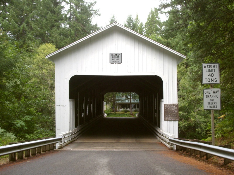 A quick word about the place...Flag as inappropriate ›The Belknap Bridge (also McKenzie River Bridge) crosses the McKenzie River near the unincorporated community of Rainbow in Lane County, Oregon, United States. It is approximately three miles west of the town of McKenzie Bridge which is named after the bridge. It is the fourth covered bridge built on the site. The bridge is well maintained and open to traffic. The Belknap Bridge is listed on the National Register of Historic Places. Lane County was the first in Oregon to build covered bridges on a large scale. Today, the county has more surviving covered bridges than any other county west of the Mississippi River, a total of 17 bridges, including 14 that are still open to traffic. There has been a covered bridge at the Belknap Bridge site since 1890 as four different bridge structures. The original Belknap Bridge was built in 1890 by Mr. T. Thomson. It was named for a pioneer family that settled in the McKenzie River area...SHOW MORE
 -
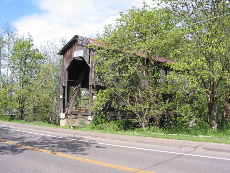
Cross Lost Creek Covered Bridge, Oregon
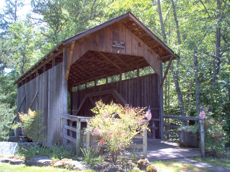 A quick word about the place...Flag as inappropriate ›The Lost Creek Bridge is a covered bridge near the unincorporated community of Lake Creek, in the U.S. state of Oregon, about 15 miles (24 km) east-northeast of Medford. The bridge, at 39 feet (12 m) long, is the shortest covered bridge in Oregon. It carries Lost Creek Road over Lost Creek, a tributary of Little Butte Creek. The bridge was added to the National Register of Historic Places in 1979. In that same year, it was closed to vehicle traffic. A newer concrete bridge runs parallel to the wooden bridge and serves as a bypass. Anecdotal accounts and limited evidence suggest that the bridge might have been built as early as 1878. If confirmed, this would make it the oldest standing covered bridge in the state. The Oregon Department of Transportation says that the official construction date of 1919 may actually refer to a renovation of an older bridge. The truss of the bridge is a queen post-style modified by cross members...SHOW MORE
 -
Cross Antelope Creek Covered Bridge, Oregon
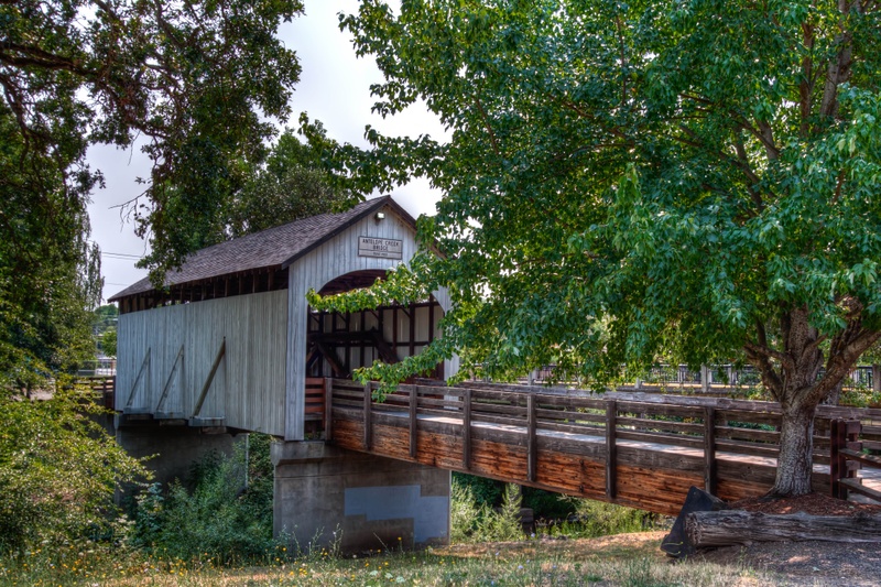 A quick word about the place...Flag as inappropriate ›The Antelope Creek Bridge is a wooden, covered bridge originally built in 1922 by Jackson County, Oregon bridge-building brothers Wesley and Lyal Hartman over Antelope Creek, north of Medford, Oregon. The bridge was bypassed in 1975 following the construction of a newer span. It was listed on the National Register of Historic Places in 1979 but delisted in 1988 shortly after having been moved to Eagle Point, Oregon about 8 miles away. In its original location, the bridge had been left to deteriorate, having been replaced by a modern vehicular bridge. In order to save the bridge and give it a new home, in 1987 volunteers took it down and reassembled it over Little Butte Creek in Eagle Point, Oregon where it replaced an earlier covered bridge that had washed away. Since then it has served proudly as a pedestrian bridge, approached through Eagle Point’s Veteran’s Memorial Park. The bridge crossing at scenic Little...SHOW MORE
 -
Cross Rock O' the Range Covered Bridge, Oregon
 A quick word about the place...Flag as inappropriate ›The Rock O' the Range Bridge, also called the Swalley Canal Bridge, is a bridge located north of Bend, Oregon, U.S., on a street adjacent to U.S. Route 97. It is the only covered span in the state of Oregon on the east side of the Cascade Range. It is also one of very few privately owned covered bridges in Oregon. William Bowen, a proprietor of land north of Bend, was forced to build an access road across the Swalley Canal to access his property. His bridge was inspired by the Goodpasture Bridge in Lane County. Bowen hired Maurice Olson to build the bridge; it was finished in 1963 for $4500 ($34,782 in 2016). High loads have damaged the portal boards and roof braces, due to an unusually short 9-foot (270 cm) clearance. Though the Rock O' The Range Bridge has a roof on it, it is technically not a covered bridge according to the World Guide because it is not supported by a truss.The World Guide appended a letter to the...SHOW MORE
 -
Cross Sandy Creek Covered Bridge, Oregon
 A quick word about the place...Flag as inappropriate ›Sandy Creek Bridge is a covered bridge spanning Sandy Creek near the community of Remote in southwestern Oregon in the United States. The bridge crosses the creek near its mouth on the Coquille River in Coos County. Built in 1921, the bridge carried Oregon Route 42 over the creek until bypassed by a newer bridge in 1949. In 1984, after restoration by volunteers from the Lions Club of Myrtle Point, the structure became a pedestrian bridge in a county park at the same site. It is the only remaining covered bridge in Coos County. Special features of the bridge include large side openings and a truss made of two crossed Howe truss members on each chord. The bridge is 60 feet (18 m) long. It was added the National Register of Historic Places in 1979.
 -
Cross McKee Covered Bridge, Oregon
 A quick word about the place...Flag as inappropriate ›The McKee Bridge is a covered bridge in Jackson County in the U.S. state of Oregon. Built on land donated by Adelbert (Deb) McKee, a stage station operator, the bridge originally carried a road over the Applegate River that linked the Blue Ledge Copper Mine to Jacksonville. The site originally included an ore-hauler rest stop, about halfway between the mine and the city, where relief horses were stationed. The bridge, about 8 miles (13 km) north of the California border, carried mining and logging traffic from the year of its construction, 1917, through 1956. Since 1956, area residents, assisted at times by government funding, have maintained the bridge, which is used by pedestrians but not by motor vehicles. McKee Picnic Ground in the Rogue River – Siskiyou National Forest is at the west end of the bridge along the river. The picnic ground and bridge are about 8.5 miles (13.7 km) south of Ruch along Applegate Road. The...SHOW MORE
 -
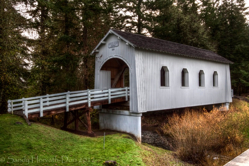
Cross Earnest Covered Bridge, Oregon
 A quick word about the place...Flag as inappropriate ›The Earnest Bridge, located near Marcola, Oregon, is listed on the National Register of Historic Places. The name is spelled Ernest Bridge in some documents, including the NRHP listing, but spelled Earnest Bridge in the NRHP nomination and in signage on the bridge itself.
 -
Cross Lake Creek (Nelson Mountain) Covered Bridge, Oregon
 A quick word about the place...Flag as inappropriate ›The Lake Creek Bridge also known as the Nelson Mountain Bridge, near Greenleaf, in the U.S. state of Oregon, is listed on the National Register of Historic Places. The 105-foot (32 m) covered bridge, built in 1928, carries Nelson Mountain Road over Lake Creek in Lane County. Notable features of the bridge include upper and lower truss chords made of one-piece old-growth timbers, narrow ribbon windows at the eaves, and portals that are truncated rectangular arches. A renovation in 1984 added new reinforced concrete abutments, new flooring, and other alterations to increase the bridge's load capacity.
 -
Cross Unity Covered Bridge, Oregon
 A quick word about the place...Flag as inappropriate ›Unity Bridge (World Guide Number 37-20-170) is an historic 90-foot (27 m) long covered bridge over Fall Creek at Unity near Lowell in Lane County, Oregon, United States. Also known as Unity Covered Bridge and Unity Creek Bridge, it was built in 1936 at a cost $4,400 by Lane County using the Howe truss system. Its east side features a full-length window with its own roof so that drivers can see oncoming cars. The Unity Bridge was preceded by a covered bridge built in 1890. Limited to foot-traffic only after 1936, it was removed in 1953. The Unity Bridge, which replaced the original bridge, is 0.75 miles (1.2 km) further upstream. It is about 1 mile (1.6 km) downstream of the dam impounding Fall Creek Lake. County officials temporarily closed the bridge for repairs in 1986. Work included a new floor, exterior painting, repair of piers and guardrails, and vandalism cleanup. The bridge carries Lowell–Unity Road over the...SHOW MORE
 -
Cross Neal Lane Covered Bridge, Oregon
 A quick word about the place...Flag as inappropriate ›The Neal Lane Bridge, also known as the South Myrtle Creek Bridge, near the town of Myrtle Creek has at least two distinctions: it is one of the shortest covered bridges in Oregon, and the only roofed span in Oregon using a kingpost truss design. The wooden bridge is just 42 feet long, and the addition of the narrow windows make it appear even shorter. The bridge spans Myrtle Creek, a stream used heavily for irrigation. Travelers crossing the bridge will note its cross-wise plank flooring, a single window on either side, a metal roof and a 5-ton weight limit. One local resident claims to have been a workman on the bridge in 1939, disputing the construction date of 1929. The site at Myrtle Creek was originally settled in 1851. It was sold to John Hall in 1862, who established the town in 1865. The name Myrtle Creek was in recognition of the nearby groves of Oregon Myrtle, an evergreen tree distinguished by a strong camphor...SHOW MORE
 -
Cross Grave Creek Covered Bridge, Oregon
 A quick word about the place...Flag as inappropriate ›The Grave Creek Bridge is a covered bridge in Josephine County in the U.S. state of Oregon. It carries Sunny Valley Loop Road over Grave Creek about 15 miles (24 km) north of Grants Pass and within sight of Interstate 5 (I-5). Built in 1920, it originally carried U.S. Route 99, the Pacific Highway. The only remaining covered bridge in Josephine County, it is "Oregon's most viewed covered bridge" because of its location near I-5. The structure was added to the National Register of Historic Places in 1979. It was closed for repairs in the late 1990s and reopened in 2001. The 105-foot (32 m) Howe truss bridge features six Gothic windows on each side as well as rounded portals and a shake roof. The original architects were A. A. Clausen and J. Elmer Nelson.
 -
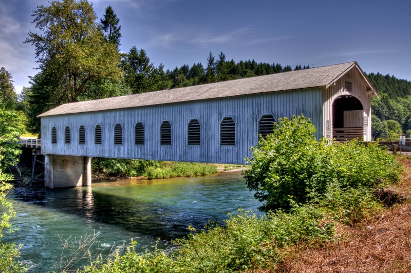
Cross Office Covered Bridge, Oregon
 A quick word about the place...Flag as inappropriate ›The Office Bridge (also called Westfir Covered Bridge) is a covered bridge in Westfir, Lane County, Oregon, U.S. crossing the North Fork Middle Fork Willamette River at the south end of the Aufderheide National Scenic Byway and edge of the Willamette National Forest. It is Oregon's longest covered bridge at 180 ft (55 m), and is one of only two in the state using triple Howe truss construction. It is the only covered bridge west of the Mississippi River which has a separate pedestrian walkway. The bridge is a replacement for a 1941 bridge which washed away. It was built in 1944 by the Westfir Lumber Company to carry logging trucks and lumber trucks to the company's lumber mill and mill pond. The company headquarters and offices were located across the river beside National Forest Development Road 19, in what is now a bed and breakfast. The bed and breakfast retains the company's walk-in safe. The company-owned town of Westfir...SHOW MORE
 -
Cross Milo Academy Covered Bridge, Oregon
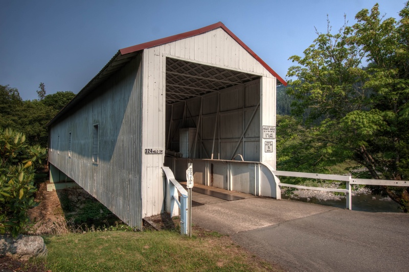 A quick word about the place...Flag as inappropriate ›The bridge at the Seventh Day Adventist Academy near Milo is one-of-a-kind in Oregon covered bridge history. The covering certainly is not a structural necessity but fills an aesthetic need, as it is Oregon's only steel bridge housed in wood. The World Guide Number now ends with a letter, indicating the span is not a true truss supported bridge. Since 1920, residents had a covered bridge serving the academy across the South Umpqua River. When the wooden covered bridge was replaced with a steel span, the community felt it had lost a part of its identity. The steel structure was then modified to include the wooden housing, and today the white covered bridge stands as a reminder to the residents of their previous covered bridge. The bridge is privately owned and maintained by the Seventh Day Adventist Church. The area was settled prior to the 1880s and the post office was established in 1884. Originally known as Perdue, the...SHOW MORE
 -
Cross Pass Creek Covered Bridge, Oregon
 A quick word about the place...Flag as inappropriate ›Although the official date of construction of the current Pass Creek Bridge is listed as 1925, members of the Umpqua Historic Preservation Society attest the span was constructed in 1906. Mamie Krewson Matoon, who was born in 1894, remembered a covered bridge over Pass Creek as a child. "It was an old bridge at the time. Long before Drain had lights, we packed a lantern on dark nights when going through it in a hack drawn by two horses." The original bridge at this site was built in the 1870s along the Overland Stage Route, as Drain was an important junction which linked the Willamette Valley and Jacksonville. An 1895-era photograph shows the wagon bridge and adjacent railroad bridge, both being covered. The wooden rail span was replaced soon after. Old timers recall the Pass Creek Bridge provided excitement when a horse-drawn wagon crashed through the floor around 1920 while hauling supplies for a Thanksgiving turkey...SHOW MORE
 -
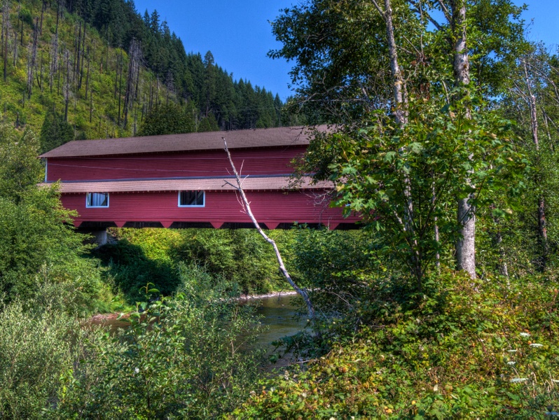
Cross Shimanek Covered Bridge, Oregon
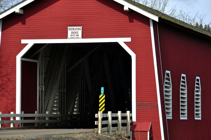 A quick word about the place...Flag as inappropriate ›The Shimanek Bridge is a covered bridge near Scio in Linn County in the U.S. state of Oregon. It was added to the National Register of Historic Places as Thomas Creek – Shimanek Covered Bridge in 1987. The bridge, 130 feet (40 m) long, was completed in 1966. Replacing a similar structure severely damaged by the Columbus Day Storm of 1962, it is the fifth bridge at this location. The fourth bridge had been built in 1927, and the first is thought to have dated to 1861. Carrying Richardson Gap Road, the bridge crosses Thomas Creek about 2 miles (3 km) east of Scio. It is the longest covered bridge in Linn County and the newest. A county crew renovated the structure in 2002, repairing damage caused by a flood in 1996. In November 2015, the bridge was closed for repairs after an inspection revealed "serious decay". Temporary repairs were expected to take weeks. More substantial repairs may not occur for up to two years...SHOW MORE
 -
Cross Larwood Covered Bridge, Oregon
 A quick word about the place...Flag as inappropriate ›The Larwood Bridge is a covered bridge near Lacomb in Linn County in the U.S. state of Oregon. It was added to the National Register of Historic Places in 1979. The bridge crosses Crabtree Creek at Larwood Wayside Park, where the Roaring River empties into the creek, about 3 miles (5 km) north of Lacomb. The 105-foot (32 m) bridge carries Fish Hatchery Road over the creek. Built in 1939, the bridge was repaired in 2002. It was named after William Larwood, who settled here in 1888, built a store and blacksmith shop, and operated a post office. The bridge had two predecessors, one over the creek and another over the river, adjacent to one another. Both no longer exist.
 -
Cross Lowell Covered Bridge, Oregon
 A quick word about the place...Flag as inappropriate ›Lowell Bridge is a covered bridge in Lowell, Oregon, United States. The original bridge was built in 1907. The current bridge was built in 1945. It was listed on the National Register of Historic Places in 1979. Before the Lowell Bridge was constructed, pioneer Amos Hyland settled on the Middle Fork Willamette River in 1874, and established the town of Lowell, which he named after his birthplace of Lowell, Maine.The founding of the town coincided with construction of a railroad through the settlement. At the site of the current bridge, Hyland operated a ferry across the river. The ferry operated until 1907, when a bridge was built by Nels Roney,who was also the builder of the Shelton-McMurphey-Johnson House in Eugene. An accident occurred in 1945 when a truck caused major damage to the bridge. It was replaced by the current bridge, which is the widest in the state.In 1953, in preparation for the flooding expected to be caused...SHOW MORE
 -
Cross Deadwood Creek Covered Bridge, Oregon
 A quick word about the place...Flag as inappropriate ›The Deadwood Creek Bridge is a covered bridge in western Lane County in the U.S. state of Oregon. Built in 1932, the 105-foot (32 m) Howe truss structure carries Deadwood Loop Road over Deadwood Creek. The crossing lies upstream of the rural community of Deadwood in the Siuslaw National Forest of the Central Oregon Coast Range. The bridge was added to the National Register of Historic Places in 1979. A concrete bridge carrying Deadwood Road bypassed the covered bridge in the 1970s, and the older structure fell into disrepair. Lane County officials decided to pay for repairs, and by 1986 the bridge was fully restored.
 -
Cross Goodpasture Covered Bridge, Oregon
 A quick word about the place...Flag as inappropriate ›The Goodpasture Bridge spans the McKenzie River near the community of Vida in Lane County, Oregon, United States. It is the second longest covered bridge and one of the most photographed covered bridges in the state. The Goodpasture Bridge is listed on the National Register of Historic Places. Lane County was the first Oregon county to build covered bridges on a large scale. Today, the county has more surviving covered bridges than any other county west of the Mississippi River, with a total of 17 bridges, including 14 that are still open to traffic. The county's engineering division maintains the covered bridges that are open to traffic, including the Goodpasture Bridge. The Goodpasture Bridge was built in 1938, and cost $13,154 to construct. It was named for Benjamin Franklin Goodpasture, a pioneer farmer who had settled near the bridge site. The bridge crosses the McKenzie River two miles west of the community of Vida. At...SHOW MORE
 -
Cross Gilkey Covered Bridge, Oregon
 A quick word about the place...Flag as inappropriate ›The Gilkey Bridge is a covered bridge in Linn County in the U.S. state of Oregon. It was added to the National Register of Historic Places as Thomas Creek – Gilkey Covered Bridge in 1987. Carrying Goar Road, the bridge crosses Thomas Creek about 3.5 miles (5.6 km) southwest of Scio. Gilkey Bridge and a covered railroad bridge next to it crossed the creek at the former community of Gilkey. Gilkey was a station on the Southern Pacific Railway line between Crabtree and Shelburn. The station, established in 1880, was named for Allen and William Gilkey. Allen Gilkey came to Oregon in the early 1850s and settled nearby. The bridge, 120 feet (37 m) long, was constructed in 1939. Damaged by an overloaded vehicle in 1997, it was closed for repairs, then reopened to traffic in 1998.SHOW MORE
 -
Cross Drift Creek Covered Bridge, Oregon
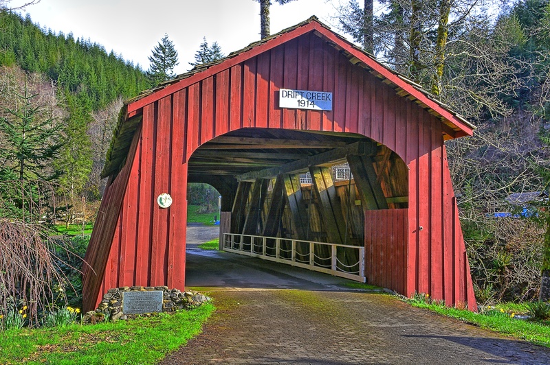 A quick word about the place...Flag as inappropriate ›The Drift Creek Bridge is a covered bridge in Lincoln County in the U.S. state of Oregon. Built in 1914, the structure originally carried Drift Creek County Road over Drift Creek. The creek flows into Siletz Bay of the Pacific Ocean south of Lincoln City. The original bridge, about 1.5 miles (2.4 km) from the ocean, once carried the main north–south route along the coast. Newer bridges later carried most of the north–south traffic and, after a concrete bridge bypassed the Drift Creek Bridge in the 1960s, Lincoln County preserved it as a pedestrian crossing and a monument to 19th-century pioneers. In 1988, however, county officials closed the bridge entirely after rot and insect damage made the structure unsafe. The county dismantled the bridge in 1997 and gave the timbers to Laura and Kerry Sweitz, who owned land 8 miles (13 km) north of the Drift Creek site. In 2000, the Sweitz family rebuilt the bridge over Bear...SHOW MORE
 -
Cross Chitwood Covered Bridge, Oregon
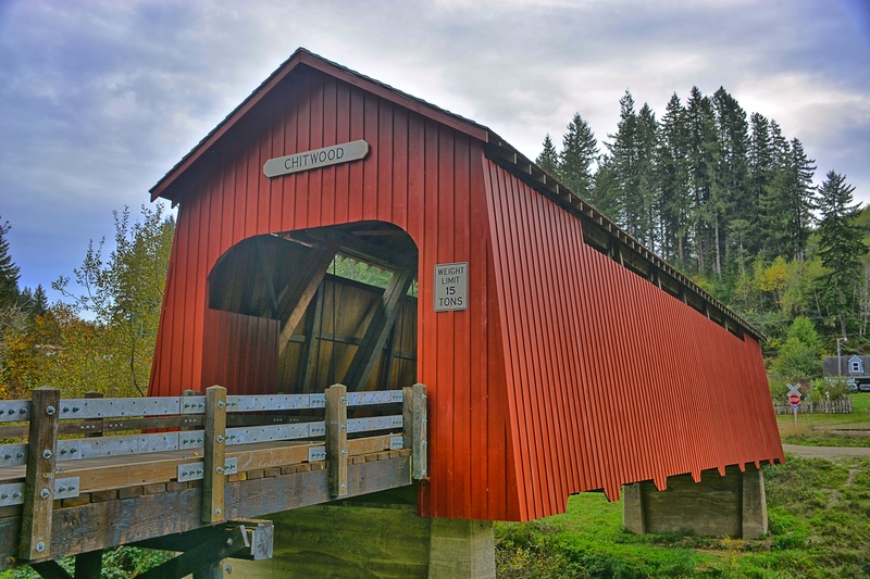 A quick word about the place...Flag as inappropriate ›The Chitwood Bridge is a covered bridge in Lincoln County in the U.S. state of Oregon. The bridge carries Chitwood Road, off U.S. Route 20, over the Yaquina River at Chitwood. The structure was added to the National Register of Historic Places in 1979. Historically, Chitwood was a station on the railway line between Corvallis and Toledo. It was named for Joshua Chitwood, who lived nearby during construction of the railway, 1881–85. Trains still use the railway, but they no longer stop in Chitwood. Lincoln County built the covered bridge in 1926. Scheduled for demolition, it was instead improved in 1984 through a federally funded restoration project. The Howe truss bridge is 96 feet (29 m) long.
 -
Cross Centennial Covered Bridge, Oregon
 A quick word about the place...Flag as inappropriate ›The Centennial Covered Bridge is a covered bridge located in Cottage Grove, Oregon, United States. It is 84 feet (26 m) long, 10 feet (3.0 m) wide and 14 feet (4.3 m) high. It spans the Coast Fork Willamette River alongside Main Street, carrying only bicycle and pedestrian traffic. It was built in 1987, the hundredth year since the founding of the city. It was constructed mostly by volunteers from timbers salvaged from the Meadows and Brumbaugh bridges, which were dismantled in 1979.
 -
Cross Currin Covered Bridge, Oregon
 A quick word about the place...Flag as inappropriate ›The Currin Bridge is a Howe truss covered bridge near Cottage Grove, Oregon, United States. It crosses the Row River. The Currin Bridge was built in 1925 to replace another bridge built in 1883. The lowest bid received by Lane County for construction of the bridge was $6,250, so the county decided to build the bridge on its own for $4,205, saving $2,495 of taxpayers' money. The bridge was named after an early pioneer family. The Currin Bridge is the only bridge in Oregon that is painted two different colors. The Currin Bridge has white portals and red sides. It is one of seven covered bridges in the immediate area. In 1979, Lane County completed a new concrete bridge nearby the Currin Bridge and closed the old bridge to traffic. The new bridge is only a few feet away from the Currin Bridge, which is still accessible by pedestrians. In 1987, the bridge had work done fumigating for insects and structural repair, and in the...SHOW MORE
 -
Cross Irish Bend Covered Bridge, Oregon
 A quick word about the place...Flag as inappropriate ›Irish Bend Covered Bridge is a wooden covered bridge near Corvallis, Oregon, United States. It was constructed in 1954 and originally spanned the Willamette Slough on Irish Bend Road near Monroe. However, in 1975 Irish Bend Road was realigned and the bridge fell into a state of disrepair. The bridge was added to the National Register of Historic Places in 1979. It was eventually dismantled in 1988 to make way for a more modern concrete span. Through negotiations with Benton County and Oregon State University (OSU), an agreement was reached to reconstruct the bridge on university property. $30,000 was raised by the Irish Bend Advisory Committee, and Benton County provided an additional $30,000 to fund the project, which was completed in 1989. Due to the relocation, the bridge was removed from the National Register in 1989. It was relisted in 2013. Today, the bridge is part of a path through the research farm between 35th and...SHOW MORE
 -
Cross Harris Covered Bridge, Oregon
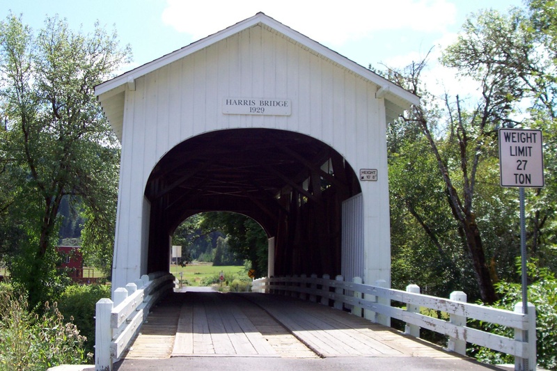 A quick word about the place...Flag as inappropriate ›The Harris Bridge, located near Wren, Oregon, is a covered bridge listed on the National Register of Historic Places. Harris Bridge was named for George Harris, an early settler.
 -
Cross Fisher School Covered Bridge, Oregon
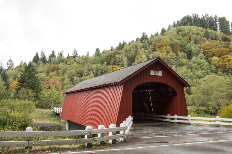 A quick word about the place...Flag as inappropriate ›The Fisher Bridge is located in the rugged foothills of Lincoln County. The structure spans Five Rivers, so named because of the five streams of Alder Creek, Cougar Creek, Buck Creek, Crab Creek and Cherry Creek which make up the stream. According to a 1942 Lincoln County bridge report, the Fisher Bridge was built in 1927 at a cost of $1,800. The dispute in the date of construction may have been due to the renovation of the span in 1927. Other county records show the cost to build the span in 1919 was $2,500. According to George Melvin, a workman who helped to build the bridge, a group of farmers aided in construction by cutting large trees in the area which they shaped into logs with the use of broadaxes. After the main framework was completed, it was enclosed with lumber cut at the saw mill operated by the Olsen brothers. During the 1970s, residents of the Fisher community rallied to preserve the bridge, which was slated...SHOW MORE
 -
Cross Crawfordsville Covered Bridge, Oregon
 A quick word about the place...Flag as inappropriate ›The area of Crawfordsville was named for Philemon Crawford, who settled in the area and on whose land the town was established in the 1870s. The Crawfordsville Bridge displays another version of Linn County’s open truss style. The roofed span, built in 1932, shows a narrow slit window on both sides of the structure. Originally the portals were rounded, but were later enlarged by State Highway employees to allow larger loads. Linn County turned the structure over to the Highway Commission when the road was designated a state highway. In 1963, the bridge was bypassed and the state relinquished control to Linn County. The title has since passed to the Linn County Parks and Recreation Department. Little upkeep or repair occurred in the 1970s. In 1976, crews involved with the filming of the television movie, The Flood, painted the span, and local residents repainted some of the bridge’s interior in the early...SHOW MORE
 -
Cross Hayden Covered Bridge, Oregon
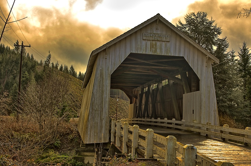 A quick word about the place...Flag as inappropriate ›Hayden Bridge, a Howe truss structure, spans the Alsea River about 2 miles (3.2 km) west of Alsea, Oregon, United States. Constructed in 1918, the 91-foot (28 m) span is one of only seven remaining covered bridges in Oregon that were built before 1920. Similar spans such as the Mill Creek Bridge crossed the Alsea or one of its tributaries in the same vicinity, but only the Hayden Bridge has survived. It was added to the National Register of Historic Places in 1979. Located along Hayden Road just south of Oregon Route 34, the bridge was either partly or completely rebuilt in 1945. Changes included larger and less rounded bridge portals that could accommodate larger vehicles. Narrow openings under the side-wall eaves on both sides of the span illuminated the interior. The bridge, repaired again in 2003, required further work in 2006 after a logging truck crashed into it. Of the more than 600 covered bridges once found in Oregon...SHOW MORE
 -
Cross Cedar Crossing Covered Bridge, Oregon
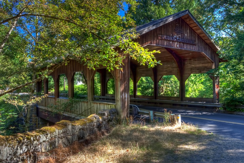 A quick word about the place...Flag as inappropriate ›Although not a true covered bridge as no truss is used for support, Cedar Crossing represents Oregon's commitment to a history rich in covered bridge lore. Don Clark, former Multnomah County Executive, lobbied for the county to build a covered span. He suggested that the bridge "be over a stream where the foliage is thick and turns to shades of yellow and orange in the autumn and children can peer out windows to see the waters below." One of Clark's ancestors, who had settled in Multnomah County, helped to promote a bridge across the Willamette. The location for the roofed bridge was found when engineers decided to replace the narrow, deteriorating wooden truss bridge crossing Johnson Creek in southeast Portland. Work to demolish the old bridge began in November 1981, and soon after, workers cut the stone abutments to accommodate the greater width of the new bridge. The installation of the decking, siding, and roofing was...SHOW MORE
 -
Cross Cavitt Creek Covered Bridge, Oregon
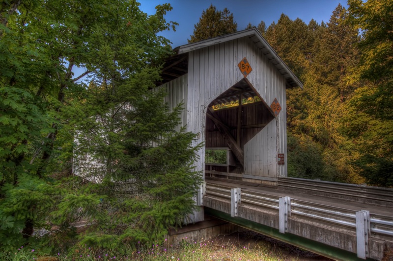 A quick word about the place...Flag as inappropriate ›The Cavitt Creek Bridge, crossing Little River at the junction with Cavitt Creek, is another of the wooden structures built by Floyd Frear, noted Douglas County builder. The design features Tudor arch portals to accommodate heavy log truck usage, and the upper and lower chords utilize raw logs as its members. Each side of the roofed structure sports three windows, and long narrow slits above each truss allow "daylighting" as well as ventilation for the bridge interior. The bridge has a metal roof and a floor with longitudinal running planks. The covered structure sits on concrete piers. The area surrounding the bridge site was settled in the early 1880's and named for Robert Cavitt, who settled on a tributary of Little River. This covered bridge was included in the thematic nomination of Oregon's covered bridges to the National Register in 1979, but was not listed at the request of the County. Directions: From I-5 take...SHOW MORE
Check out other Dreams from this list
-
1.
 Cross Stayton–Jordan...
-
2.
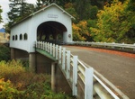 Cross Rochester Covered...
-
3.
 Cross Gallon House...
-
4.
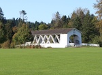 Cross Weddle Covered...
-
5.
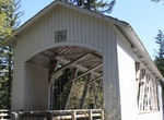 Cross Short Covered...
-
6.
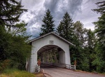 Cross Hannah Covered...
-
7.
 Cross Hoffman Covered...
-
8.
 Cross North Fork of the...
-
9.
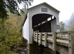 Cross Wildcat Creek...
-
10.
 Cross Wendling Covered...
-
11.
 Cross Stewart Covered...
-
12.
 Cross Ritner Creek...
-
13.
 Cross Pengra Covered...
-
14.
 Cross Parvin Covered...
-
15.
 Cross Mosby Creek Covered...
-
16.
 Cross Dorena Covered...
-
17.
 Cross Coyote Creek...
-
18.
 Cross Chambers Covered...
-
19.
 Cross Belknap Covered...
-
20.
 Cross Lost Creek Covered...
-
21.
 Cross Antelope Creek...
-
22.
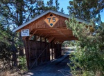 Cross Rock O' the Range...
-
23.
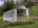 Cross Sandy Creek Covered...
-
24.
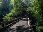 Cross McKee Covered...
-
25.
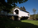 Cross Earnest Covered...
-
26.
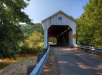 Cross Lake Creek (Nelson...
-
27.
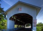 Cross Unity Covered...
-
28.
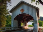 Cross Neal Lane Covered...
-
29.
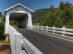 Cross Grave Creek Covered...
-
30.
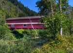 Cross Office Covered...
-
31.
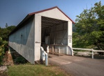 Cross Milo Academy...
-
32.
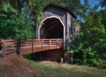 Cross Pass Creek Covered...
-
33.
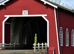 Cross Shimanek Covered...
-
34.
 Cross Larwood Covered...
-
35.
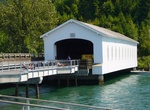 Cross Lowell Covered...
-
36.
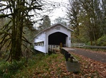 Cross Deadwood Creek...
-
37.
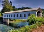 Cross Goodpasture Covered...
-
38.
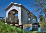 Cross Gilkey Covered...
-
39.
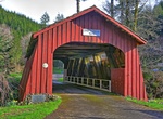 Cross Drift Creek Covered...
-
40.
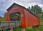 Cross Chitwood Covered...
-
41.
 Cross Centennial Covered...
-
42.
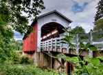 Cross Currin Covered...
-
43.
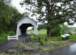 Cross Irish Bend Covered...
-
44.
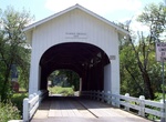 Cross Harris Covered...
-
45.
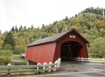 Cross Fisher School...
-
46.
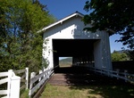 Cross Crawfordsville...
-
47.
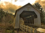 Cross Hayden Covered...
-
48.
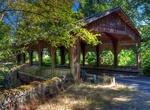 Cross Cedar Crossing...
-
49.
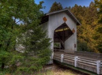 Cross Cavitt Creek...