Give us feedback!

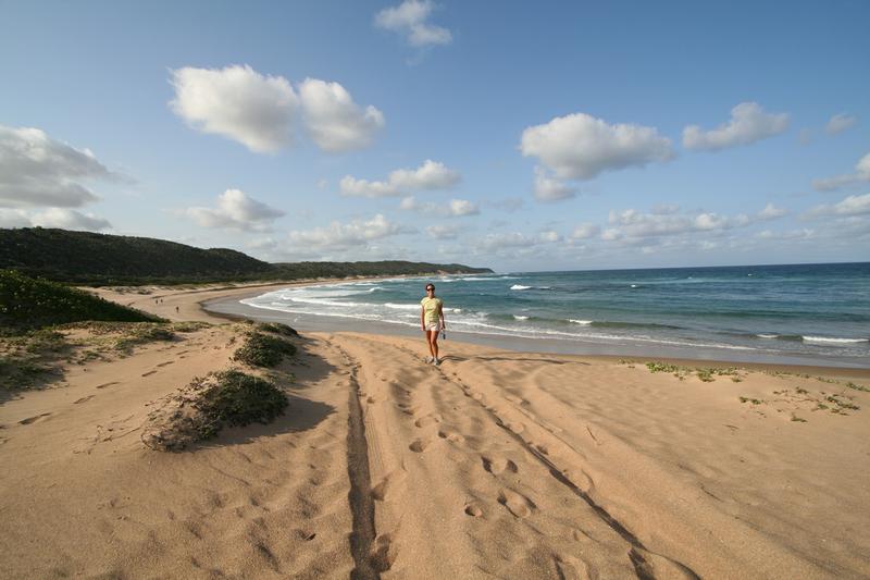
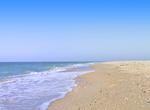
Visit Top 20 Best Remote Beaches on Earth
›Go to Dream PageDream out of
Stats for this Dream
On Your list: -
Your Check-offs: -
Friends with Dream: 0
Total Check-offs: -
Advertisement
-
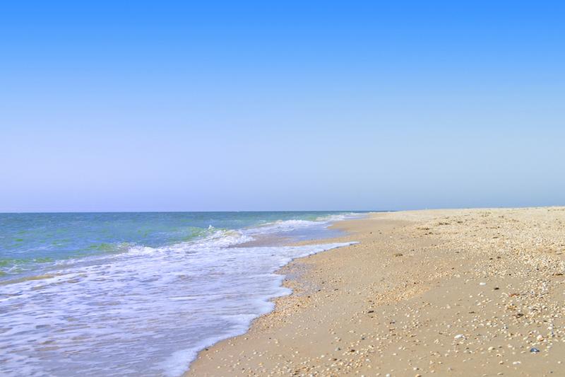
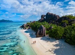
Relax on Anse Source d'Argent Beach, La Digue, Seychelles
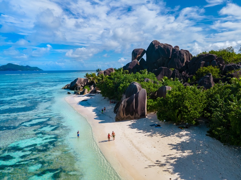 A quick word about the place...Flag as inappropriate ›La Digue, one of the principal islands in the Indian Ocean archipelago of Seychelles off the coast of Madagascar, is renowned for its relaxed, tropical setting and its most famous beach, Anse Source D’Argent Beach, does nothing but reinforce that reputation. Towering granite boulders shaped by weather and time are hemmed in by pink sand creating a surreal landscape with the ever present palms swaying in the breeze. The shallow turquoise ocean water is protected by a coral reef making for excellent swimming and snorkeling conditions. The beach is consistently rated among the top 10 beaches in the world. Don’t miss Anse Source D’Argent Beach when your dreams take you to Seychelles. Be sure to include a visit to this world class beach on your list to spend time relaxing, exploring and admiring the view between sailing and diving adventures.SHOW MORE
 -
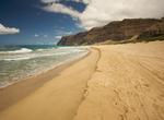
Relax on Polihale State Park Beach, Kauai, Hawaii
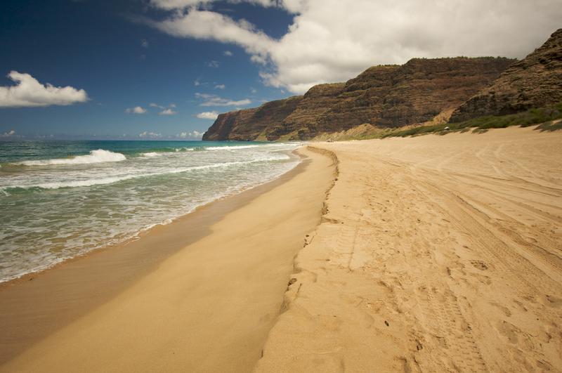 A quick word about the place...Flag as inappropriate ›Polihale State Park is a remote wild beach on the western side of the Hawaiian island of Kauai. It is the western most publicly accessible area in Hawaii, although the privately owned island of Niihau is further west. The beach is miles away from the town of Kekaha, and it can only be reached via poorly marked, dirt sugarcane roads, making a four wheel drive vehicle preferable. The park is several miles long, yet only Queen's Pond offers safe swimming. The park is located at the western end of Kauai and has many miles of shoreline that averages about 300 feet from the barrier dunes to the surf line. Sand dunes along the beach can reach heights nearing 100 feet. Driving on the beach is permitted, but obtaining a tow truck would be expensive. The only road to the park is dirt, with many ruts and potholes, and is difficult to access by non-4WD vehicles. The park is located to the north of the Pacific Missile Range Facility...SHOW MORE
 -
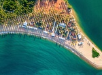
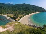
Relax on Praia do Gunga (Gunga's Beach), Brazil
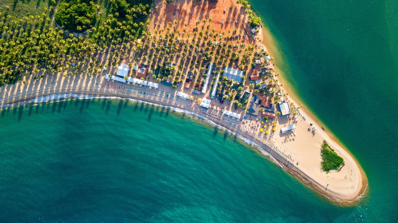 A quick word about the place...Flag as inappropriate ›Praia do Gunga (Gunga's beach) is located 20 miles south of Maceió, Alagoas. It is considered as one of the most beautiful beaches in Brazil. The beach is surrounded by coconut trees and it positioned right between the Atlantic Ocean and Lagoa do Roteiro (Roteiro Lake). This position guarantees a unique color of the ocean surrounding the beach. It is bluer during the low tides and it turns greener during the high tides when the ocean waters meet the lake waters. This beach is part of the Roteiro region and you can get there by boat from Barra de São Miguel or by car driving through a private property. This is a very popular tourist site with many entertainment options such as boat trips to nearby "natural aquarium" or beaches such as Barra de São Miguel. There are small boats and kayaks available for rental there.SHOW MORE
 -
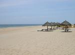
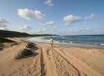
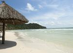
Relax on Playon de Mismaloya, Mexico
 A quick word about the place...Flag as inappropriate ›Playon de Mismaloya in Mexico is more than 40 miles of coastline with nothing to see but sand and waves. Located 60 miles south of Puerto Vallarta, Playon de Mismaloya is more than a sanctuary for turtles: It's also a postcard-perfect hideaway for people who want to escape the rest of the world for a spell. The only way to access it is by rowboat, from Hotelito Desconocido. The beach is one of the most important sanctuaries for turtles, which hatch between June and January.
 -
Dive Rocktail Bay, South Africa (UNESCO site)
 A quick word about the place...Flag as inappropriate ›Rocktail Bay is located in northern KwaZulu-Natal, South Africa at the northern end of the World Heritage Site iSimangaliso Wetland Park. The bay combines miles and miles of pristine and undeveloped coastline with pristine forests with wetlands and marine ecology. The string of lakes, marshes, coral reefs and secluded beaches, make this north-eastern corner of South Africa a sub-tropical paradise. The warm sea attracts a huge diversity of marine life including leatherback and loggerhead turtles that lay their eggs in the soft sand during summer. Ragged-tooth sharks congregate off rocky reefs and bottlenose dolphins leap joyously in the wave break. Whale sharks are known to investigate boats and humpback whales migrate here in winter.
 -
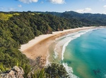
Relax on New Chums Beach, New Zealand
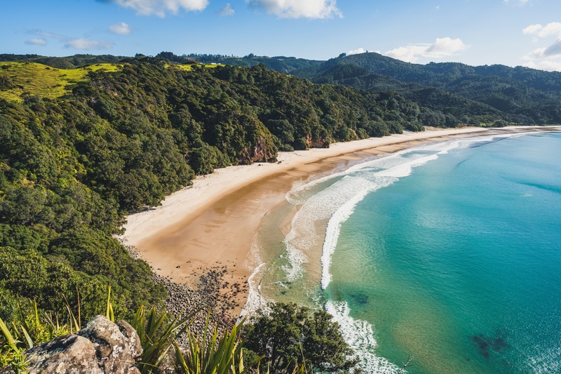 A quick word about the place...Flag as inappropriate ›It may be tricky to reach New Chums Beach, nine miles east of Coromandel town centre, but it’s worth it. New Chum’s Beach is on the Coromandel Peninsula and is one of the finest beaches you will find in New Zealand. Voted one of the Top 20 Beaches in the world in 2006 by The Observer, remains a gem to those who know of it’s existence and a true discovery tour for the first time visitor. The walk to the beach takes approximately 30 to 40 minutes. Wade through the lagoon at the northern end of Whangapoua Beach to the rocks, and finally onto the track leading to the saddle and your first glimpse of New Chums beach. Enjoy a leisurely walk the length of this pristine white sandy beach or the joys of searching for sea life or surfing the swells. This stunning stretch of golden sand is fringed by Pohutukawa and native forest and is deserted for most of the year. Alternatively the amazing Otama Bay, also in the...SHOW MORE
 -
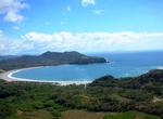
Relax on Playa Carrillo, Costa Rica
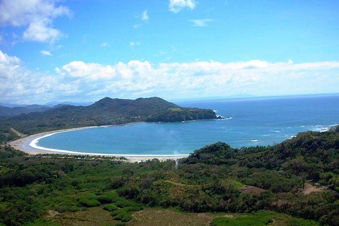 A quick word about the place...Flag as inappropriate ›Carrillo Beach, situated along the Pacific Coast of Costa Rica's Nicoya Peninsula, is known for its jewel among Pacific beaches. The beach is south of the popular surfer’s paradise of Samara Beach and is one of the least developed spots on the Peninsula. Known among divers for its excellent coral reef teeming with marine life, the beach is protected by rocky headlands, providing calm, warm water for swimmers. The town of Puerto Carrillo itself is very small (less than 500 full-time residents) and is predominantly a sport-fishing village with a variety of nice hotels, restaurants and tour operators. The beautiful white sand beach it's popular with swimmers and it's an ideal beach for your kids. Carrillo also offers beautiful and secluded small beaches near by, El Roble is a rocky beach with its own waterfall and tide pools. Playa El Sur, beautiful medium size beach surrounded by palm trees (only accessible by boat) The...SHOW MORE
 -
Visit Panglao Island, Philippines
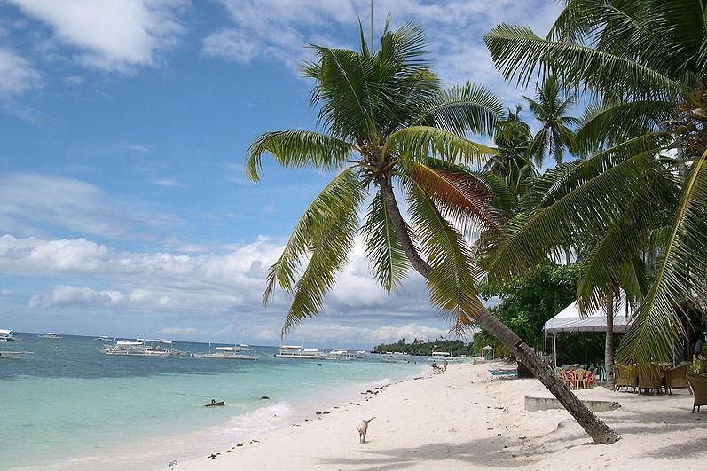 A quick word about the place...Flag as inappropriate ›Panglao is an island in the Philippines located in the Central Visayas. Panglao is located southwest of the island of Bohol and east of Cebu. It is a popular tourist destination in the Philippines and includes several small islands like Gak-ang, Pontod, and Balicasag. Panglao has a terrain that range from plain, hilly to mountainous. Panglao is made of Maribojoc Limestone, the youngest of the limestone units found in the western area of Bohol. The limestone composition halted the development of an airport ascoralline limestone is soluble which causes formation of caves and sinkholes. One interesting geological feature found in the island is the Hinagdanan Cave which has an underground water source. The cave is an important water source as the island has no rivers or lakes. About 250 new species of crustaceans and 2500 new species of mollusks were found around the island. The discovery was the work of the Panglao Marine...SHOW MORE
 -
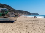
Relax on Praia de Salema, Portugal
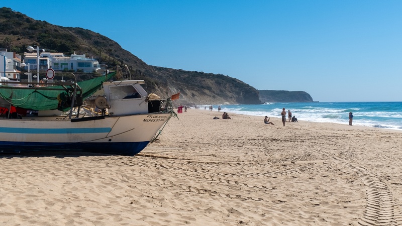 A quick word about the place...Flag as inappropriate ›Praia de Salema beach and the numerous coves and beaches nearby are an idyllic haven for water sports enthusiasts who come to surf, sail, fish and swim in one of the most favorable climates in Europe. The beach has a beautiful promenade, as well as cafes and restaurant terraces overlooking the sea. Praia de Salema Beach in Algarve is a paradise to those who are seeking tranquility and an escape from the crowd. The golden sand beach, colorful fishing boats, the picturesque fishing village and the scenic cliffs are just some of the beautiful images that welcome visitors at Praia de Salema Beach. The Salema village is home to a number of fishermen who still cast their nets daily and moor their fishing boats on the shore.In the village of Salema, there are also some ruins of a Roman villa, as well as of an old fish canning factory, testifying to the area as longstanding fishing traditions.SHOW MORE
 -
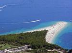
Relax on Zlatni Rat Beach (Golden Horn Beach), Croatia
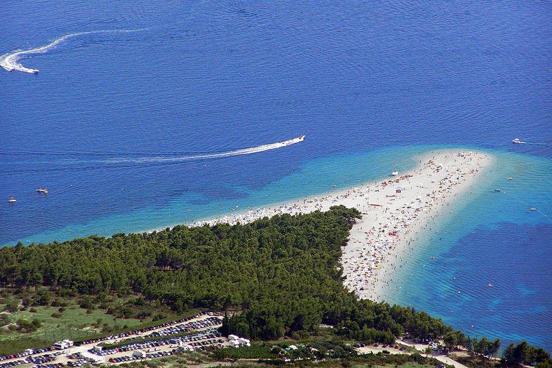 A quick word about the place...Flag as inappropriate ›Zlatni Rat (Golden Cape or Golden Horn) is a narrow white pebble beach near Bol, located 2 km west of Bol harbour, on the southern coast of the island of Brač, Croatia. The shape of the beach shifts with the changes in tide, currents and wind, veering out into the sea 634 m long. A reliable afternoon westerly wind known as a Maestral, together with clear and somewhat cool water make the beach a destination for windsurfers. The beach is bordered by a pine tree grove in which one can find remnants of a Roman villa rustica, including a swimming pool. The westmost edge of the beach and several coves to the west of the main beach are clothing-optional.
 -
Surf La Pedrera, Uruguay
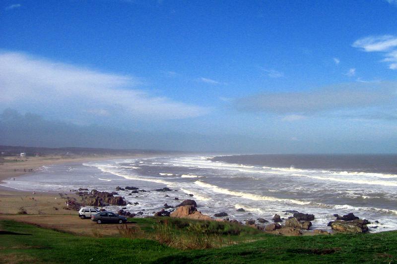 A quick word about the place...Flag as inappropriate ›La Pedrera is a village and resort on the Atlantic Coast of Uruguay. Being one´s of Uruguay surfing best spots, La Pedrera enjoys of incredible beaches with very nice weather from December to Mid/End April, and best waves in March and April. Although it has a very small permanent population, in summer it is an important coastal resort. La Pedrera is also famous for its proximity to the Valle de la Luna, which extend to Santa Isabel de la Pedrera. La Pedrera beach is small beautiful jewel near Rocha, Uruguay (240km east from its capital Montevideo). The town is divided in two by a rock hill from where you can have beatuiful ocean views and great sunsets. La Pedrera´s hippie night vibe has some great food and drink pubs where you can relax and enjoy some good music. During Carnival it gets crazy because there are many people, but if you like that it is a party to witness and partake!SHOW MORE
 -
Relax on Agonda Beach, Goa, India
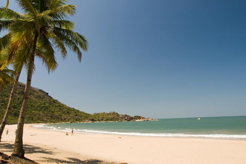 A quick word about the place...Flag as inappropriate ›Agonda is a three-kilometer long, beautiful cove of white sand, warm water, secluded in the palms. Also known as the silent beach, Agonda is the undiscovered paradise of Goa. The ideal place to laze and relax as not many tourists visit this area. Everything is in walking distance but it's also fun to hop on a scooter and visit the other small beaches around Aguada. Agonda village is on the way to Benaulim, just 6 kms north of the Palolem beach. There are a reasonable variety of restaurants and very friendly people in the town.
 -
Visit Ko Lanta Yai Island, Thailand
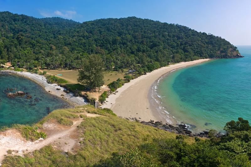 A quick word about the place...Flag as inappropriate ›Ko Lanta Yai is located in the Andaman Sea off the west coast of Thailand, between the Phi Phi Islands islands and the mainland. The two largest islands in the Krabi district are Ko Lanta Noi and Ko Lanta Yai. Although both are inhabited, Ko Lanta Yai is the primary tourist destination. Measuring 30 km long and 6 km wide, the island forms part of the Ko Lanta archipelago, which covers an area of 180 km². The area was designated as Park No.62 of Thailand in 1990. Less well known than the neighbouring Phi Phi and Phuket islands, Lanta is relatively less developed with most of the accommodation available being basic bamboo huts. There are very few paved roads on the island, mostly to the north, and they deteriorate gradually towards the southern end. Ban Saladan, the main town and port, is located at the northern tip of the island and is served by ferries from Krabi, Phuket and Phi Phi. The main beaches are located on the...SHOW MORE
 -
Visit Phú Quốc Island, Vietnam
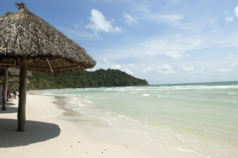 A quick word about the place...Flag as inappropriate ›Phú Quốc is the largest island in Vietnam and is becoming one of the most popular tourist destinations of Vietnam. Tourism plays an important part of the economy with the beaches being the main attraction. Phu Quoc is served by Phu Quoc Airport with air links to Ho Chi Minh City (Saigon)'s Tan Son Nhat Airport and Rach Gia's Rach Gia Airport. Plans are in progress for a new international airport for the island. Phu Quoc is also linked with Rach Gia and Hà Tiên by fast ferry hydrofoils. Phu Quoc is famous for its two traditional products: fish sauce and black pepper. The rich fishing grounds offshore provides the anchovy catch from which the prized sauce is made. Pepper cultivation is located inland in the center of the island. More recently a pearl farm was established. The island's monsoonal sub-equatorial climate is characterized by distinct rainy (June to November) and dry seasons (December to May). The...SHOW MORE
 -
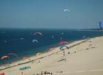
See The Great Dune of Pyla (Pilat), France
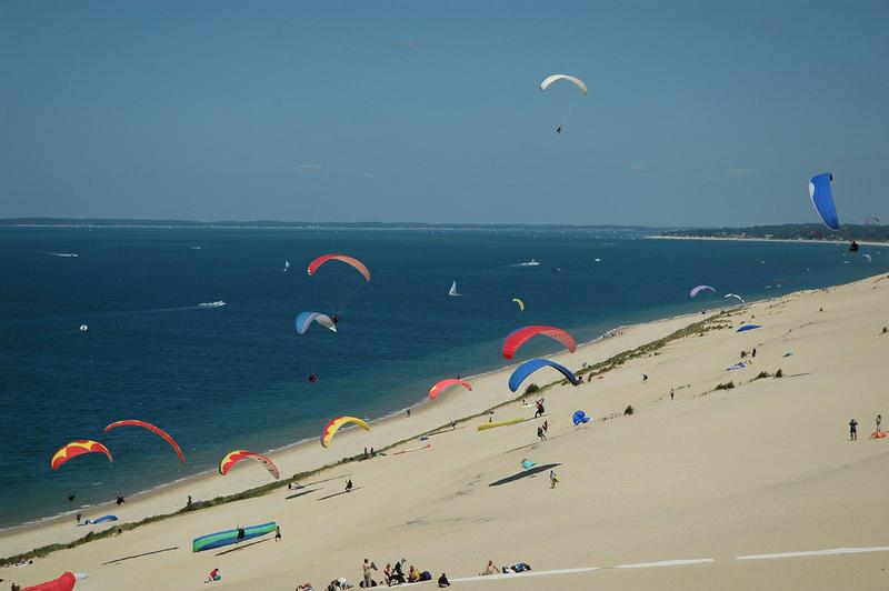 A quick word about the place...Flag as inappropriate ›The Great Dune of Pyla (or Pilat) is the tallest sand dune in Europe. It is located in La Teste-de-Buch in the Arcachon Bay area, France, 60 km from Bordeaux. Pilat is sometimes spelled Pyla, hence the alternative name "dune of Pyla". More accurately, Pyla is the name of the closest town, Pyla-sur-Mer, which is part of La Teste-de-Buch municipality in the Gironde department. The correct and original name of the dune is the Dune of Pilat, but because of the confusion that occurred, both are now considered correct. The dune has a volume of about 60,000,000 m³, measuring around 500 m wide from east to west and 3 km in length from north to south. Its height is 107 metres above sea level. The dune is a famous tourist destination with more than one million visitors per year.SHOW MORE
 -
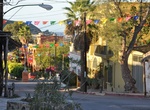
Visit Todos Santos, Baja California, Mexico
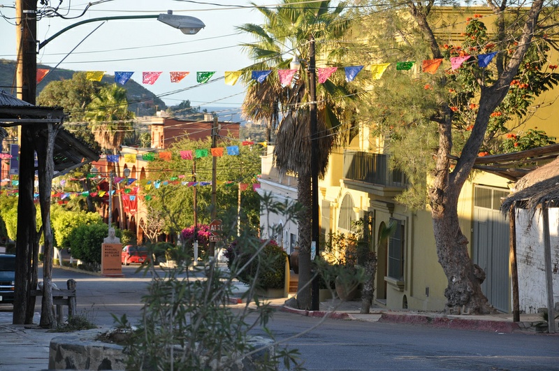 A quick word about the place...Flag as inappropriate ›Todos Santos is a very charming little town with many artists, boutique shops and spectacular views of the pacific. Explore the many beaches nearby where you can see whales playing just off the beach or wild horses taking a nap in the sand. Todos Santos is a small coastal town at the foothills of the Sierra de la Laguna Mountains, on the Pacific coast side of the Baja California Peninsula, about an hour's drive north of Cabo San Lucas on Highway 19 and an hour's drive southwest from La Paz. During the 19th century Todos Santos thrived as the Baja sugarcane capital, which is still evident by the ruins of sugar mills. Now the rich farmlands have been re-worked & the town prospers from an abundance of vegetable & chili farming, avocado, papaya & mango orchards, fishing & ranching. The mission Nuestra Señora del Pilar de La Paz was founded by father Jaime Bravo in 1723. It is located across the street to the...SHOW MORE
 -
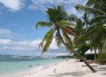
Relax on Palm Beach (Barbuda)
 A quick word about the place...Flag as inappropriate ›Named one of the World’s Most Romantic Islands by T+L, Barbuda is, above all, for solitude-seekers. Palm Beach is located along the west coast of the Codrington lagoon of Barbuda and therefore only really accessible by boat. Gently curving Palm Beach offers 22km of dazzling white sand interspersed with long stretches of pink, created by the tiny fragments of millions of seashells washed up over the years. It’s a great place to sunbathe, swim, and snorkel, though there’s little shade here - asks your boatman to drop you near one of the groves of Casuarina trees: and pick you up at an agreed time later in the day.
 -
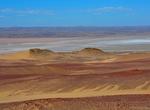
Relax on Bosluisbaii Beach, Namibia
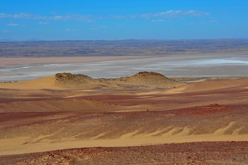 A quick word about the place...Flag as inappropriate ›Bosluisbaii beachis hidden in the north part of theSkeleton Coast in Namibia wherethe desert and the sea meet. The beach is near the mouth of theKunene River.Your will need special permission to visit this area and can obtained permission through the Schoeman family. Warning: Swimming is dangerous as the sea is cold with strong currents
 -
Visit Ibo Island, Mozambique
 A quick word about the place...Flag as inappropriate ›Ibo is one of the Quirimbas Islands in the Indian Ocean off northern Mozambique. Nominated for World Heritage status, and the head quarters of the Quirimbas National Park, Ibo has been described as one of the most unique and atmospheric islands in the world. Beach excursions, guided cultural and heritage experiences, snorkeling, sea kayaking, dhow sailing, birding, mangrove forests are some of the activities on the island. The island is known for its silversmiths. Ibo forms part of the Quirimbas National Park and is linked by dhows to the mainland at Tandanhangue.
 -
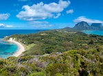
Visit Lord Howe Island, Australia (UNESCO site)
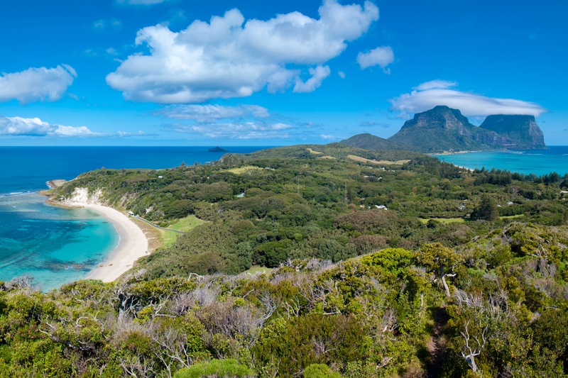 A quick word about the place...Flag as inappropriate ›Lord Howe Island is an irregularly crescent-shaped volcanic remnant in the southwest Pacific Ocean. Lying in the Tasman Sea between Australia and New Zealand the island is 600 kilometres (370 mi) directly east of mainland Port Macquarie, 702 kilometres (436 mi) northeast of Sydney, and about 900 kilometres (560 mi) from Norfolk Island to its northeast. As distances to sites of interest are short, cycling is the main means of transport on the island. Tourist activities include golf (9-hole), lawn bowls, tennis, fishing (including deep-sea game fishing), yachting, windsurfing, kite surfing, kayaking, and boat trips (including glass-bottom tours of the lagoon). Swimming, snorkelling and scuba diving are also popular in the lagoon, as well as off Tenth of June Island, a small rocky outcrop in the Admiralty group where an underwater plateau drops 36 metres to reveal extensive gorgonia and black corals growing on the vertical walls...SHOW MORE
Check out other Dreams from this list
-
1.
 Relax on Anse Source...
-
2.
 Relax on Polihale State...
-
3.
 Relax on Praia do Gunga...
-
4.
 Relax on Playon de...
-
5.
 Dive Rocktail Bay, South...
-
6.
 Relax on New Chums Beach...
-
7.
 Relax on Playa Carrillo...
-
8.
 Visit Panglao Island...
-
9.
 Relax on Praia de Salema...
-
10.
 Relax on Zlatni Rat Beach...
-
11.
 Surf La Pedrera, Uruguay
-
12.
 Relax on Agonda Beach...
-
13.
 Visit Ko Lanta Yai...
-
14.
 Visit Phú Quốc Island...
-
15.
 See The Great Dune of...
-
16.
 Visit Todos Santos, Baja...
-
17.
 Relax on Palm Beach...
-
18.
 Relax on Bosluisbaii...
-
19.
 Visit Ibo Island...
-
20.
 Visit Lord Howe Island...