Give us feedback!

Visit All 63 US National Parks
›Go to Dream PageDream out of
Stats for this Dream
On Your list: -
Your Check-offs: -
Friends with Dream: 0
Total Check-offs: -
Advertisement
-
Explore Grand Canyon National Park, Arizona (UNESCO site)
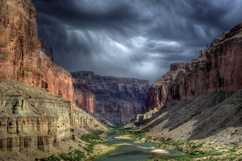 A quick word about the place...Flag as inappropriate ›The Grand Canyon, carved by the Colorado River over millions of years, is located in the USA’s desert Southwest. The gorge averaging 4,000 feet deep for its entire 277 miles. It is 6,000 feet deep at its deepest point and 18 miles at its widest. The Grand Canyon National Park is divided by the river into the North Rim and South Rim. Visitors viewing the magnificent gorge from either rim observe impressive waterfalls and buttes, spires and mesas that are in fact mountains viewed from above. The strata revealed by the cut made from the flowing river reveals over 2 Billion years of the earth’s geological development. The massive gorge and the relentless river that created it winds its way through a broad spectrum of climactic and habitat zones, from alpine to desert. Within the magnificent park are found over 1,000 plant species (11 of which are considered “threatened”), 76 mammal species, nearly 300...SHOW MORE
 -
Explore Yosemite National Park, California (UNESCO site)
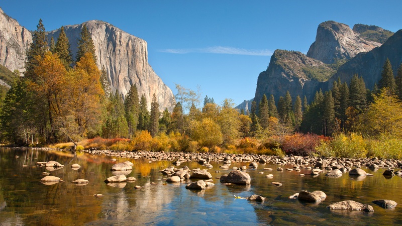 A quick word about the place...Flag as inappropriate ›Located in the western slopes of the Sierra Nevada Mountains in east central California, Yosemite National Park is a world treasure. It is not only a World Heritage Site, but is well known for its granite cliffs, amazing Sequoia groves, and epic waterfalls. While most people who visit Yosemite National Park spend the most time in Yosemite Valley, there’s much to explore beyond. Rock climbers from all over come to climb El Capitan, a granite rock formation that is larger than the tallest skyscraper stacked on top of itself. Regardless of the time of year that you visit Yosemite, there’s plenty to do. Going to the park in the winter months means plenty of snow and great for cross-country skiing. Also, during this time there are quite a few culinary adventures at the Park as well. Summer is the most popular time as most of the Park is accessible and there are plenty of wildflowers to see. There’s plenty of do...SHOW MORE
 -
Explore Yellowstone National Park, Wyoming, Montana & Idaho (UNESCO si...
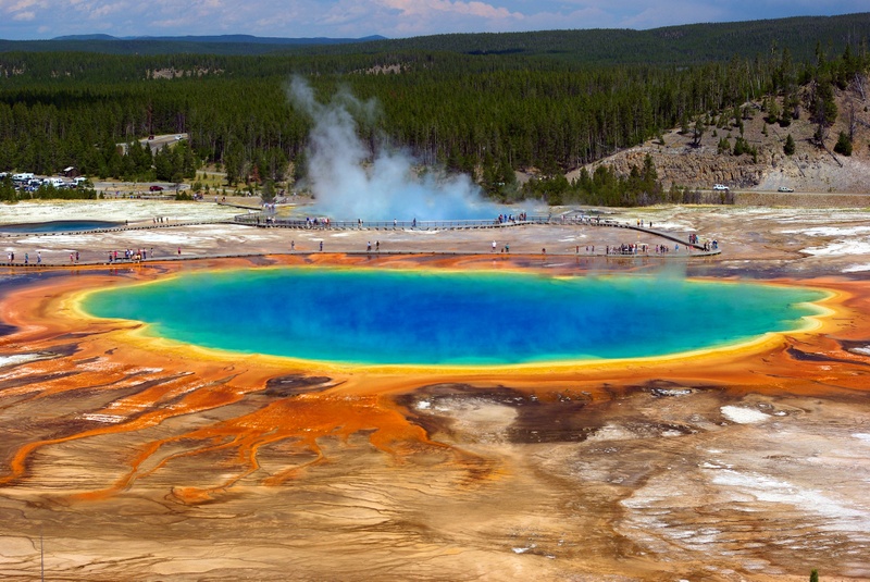 A quick word about the place...Flag as inappropriate ›Yellowstone National Park is located primarily in the U.S. state of Wyoming, although it also extends into Montana and Idaho. Yellowstone was the first national park in the world, and is known for its wildlife and its many geothermal features, especially Old Faithful Geyser, one of the most popular features in the park. It has many types of ecosystems, but the subalpine forest is dominant. Native Americans have lived in the Yellowstone region for at least 11,000 years. The region was bypassed during the Lewis and Clark Expedition in the early 19th century. Aside from visits by mountain men during the early-to-mid-19th century, organized exploration did not begin until the late 1860s. The U.S. Army was commissioned to oversee the park just after its establishment. In 1917, administration of the park was transferred to the National Park Service, which had been created the previous year. Hundreds of structures have been built and...SHOW MORE
 -
Explore Hawaii Volcanoes National Park, Hawaii (UNESCO site)
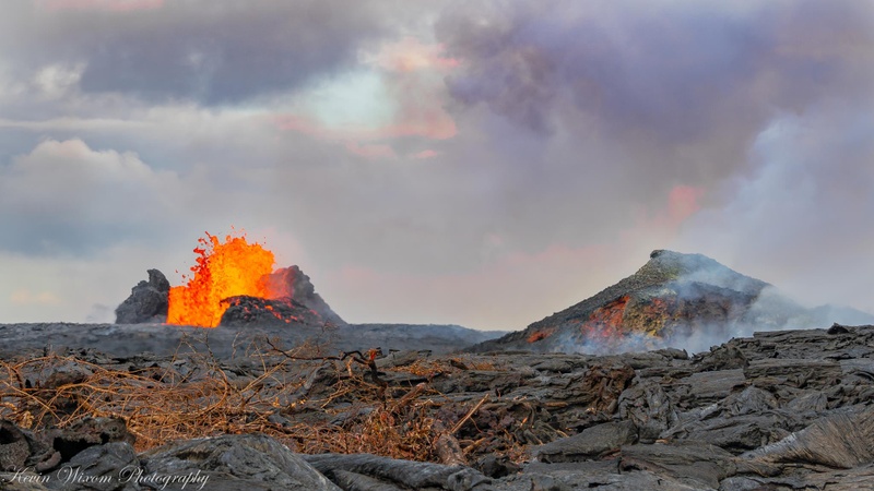 A quick word about the place...Flag as inappropriate ›Located 30 miles southwest of the city of Hilo on the Big Island of Hawaii, Volcanoes National Park contains a massive landscape that is home to one of the planet’s most active volcanoes, Kilauea. Kiluea has had more than 50 documented eruptions. The park is managed by the US National Parks Service (NPS) and is also a UNESCO World Heritage site. The park is one of the most popular visitor attractions in Hawaii and a hallowed place for Native Hawaiians. Besides the currently erupting Kilauea Volcano the park also contains the Mauna Loa Volcano which last erupted in 1984. Originally founded in 1916 as part of what was then known as Hawaii National Park, Hawaii Volcanoes National Park is what remains after the portion of the park that was located on Maui island was split off as Haleakala National Park in 1961. This 333,000 acre park stretches from the summit of Mauna Loa to the ocean, contains over 150 miles of hiking...SHOW MORE
 -
Explore Death Valley National Park, California
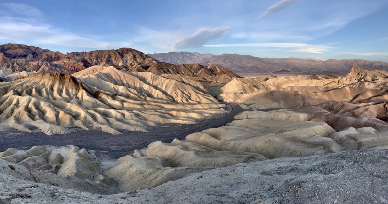 A quick word about the place...Flag as inappropriate ›Death Valley National Park is a national park located east of the Sierra Nevada in the arid Great Basin of the United States. Parts of the park are in southern Inyo County and northern San Bernardino County in Eastern California, with a small extension into southwestern Nye County and extreme southern Esmeralda County in Nevada. In addition, there is an exclave (Devil's Hole) in southern Nye County. The park covers 5,262 square miles, encompassing Saline Valley, a large part of Panamint Valley, almost all of Death Valley, and parts of several mountain ranges. Death Valley National Monument was declared a U.S. National Monument in 1933, placing the area under federal protection. In 1994, the monument was redesignated a national park, as well as being substantially expanded to include Saline and Eureka valleys. It is the hottest and driest of the national parks in the United States. The second-lowest point in the Western...SHOW MORE
 -
Explore Glacier Bay National Park, Alaska (UNESCO site)
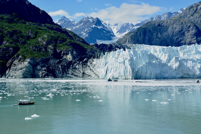 A quick word about the place...Flag as inappropriate ›Glacier Bay National Park is a national park in Alaska. The area around Glacier Bay in southeastern Alaska was first proclaimed a U.S. National Monument on February 25, 1925. It was changed to Glacier Bay National Park and Preserve on Dec. 2, 1980 by the Alaska National Interest Lands Conservation Act. Glacier Bay National Park and Preserve is a United States National Park in the southeastern part of Alaska west of Juneau. The park area was included in an International Biosphere Reserve in 1986 and is part of a UNESCO World Heritage Site. The park covers 5,130 mi² (13,287 km²). Most of the park is a designated wilderness area which covers 4,164 mi² (10,784 km²) of the park. No roads lead to the park and it is most easily reached by air travel. During some summers there are ferries to the small community of Gustavus or directly to the marina at Bartlett Cove. Despite the lack of roads, there are over 400,000...SHOW MORE
 -
Explore Everglades National Park, Florida (UNESCO site)
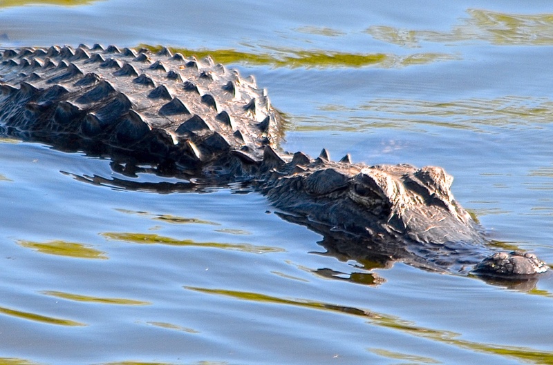 A quick word about the place...Flag as inappropriate ›Everglades National Park is a national park in the U.S. state of Florida that protects the southern 25 percent of the original Everglades. It is the largest subtropical wilderness in the United States, and is visited on average by one million people each year. It is the third-largest national park in the lower 48 states after Death Valley and Yellowstone. It has been declared an International Biosphere Reserve, a World Heritage Site, and a Wetland of International Importance, only one of three locations in the world to appear on all three lists. Unlike most U.S. national parks, Everglades National Park was created to protect a fragile ecosystem instead of safeguarding a unique geographic feature. The Everglades are wetlands created by a slow-moving river originating in Lake Okeechobee, fed by the Kissimmee River, and flowing southwest at about .25 miles (0.40 km) per day into Florida Bay. The park protects an interconnected...SHOW MORE
 -
Explore Acadia National Park, Maine
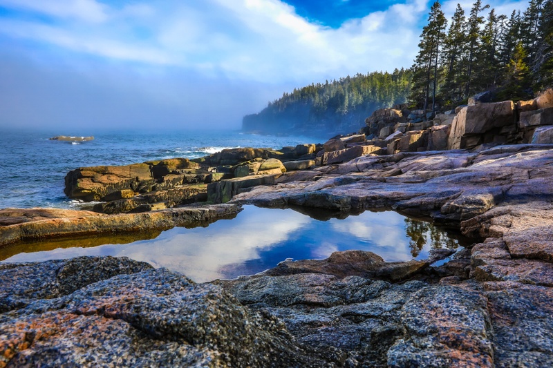 A quick word about the place...Flag as inappropriate ›Acadia National Park (ANP) is a National Park located in the U.S. state of Maine. It reserves much of Mount Desert Island, and associated smaller islands, off the Atlantic coast. Originally created as Lafayette National Park in 1919, the first National Park East of the Mississippi, it was renamed Acadia in 1929. The park includes mountains, an ocean shoreline, woodlands, and lakes. In addition to Mount Desert Island, the park comprises much of the Isle au Haut, parts of Baker Island, and a portion of the Schoodic Peninsula on the mainland. In total, Acadia National Park consists of more than 47,000 acres (73 square miles, 190 km2), including 30,300 acres (47 sq mi., 123 km2) on Mount Desert Island, 2,728 acres (4.6 sq mi., 11 km2) on Isle au Haut and 2,366 acres (3.5 sq mi., 9.2 km2) on the Schoodic Peninsula. Cadillac Mountain, named after the French Explorer of the same name, is on the eastern side of the island. Its green...SHOW MORE
 -
Explore Zion National Park, Utah
 A quick word about the place...Flag as inappropriate ›Zion National Park is located in the Southwestern United States, near Springdale, Utah. Notable geographical features of the park include: Virgin River Narrows, Emerald Pools, Hidden Canyon, Angels Landing, The Great White Throne, Checkerboard Mesa, The Three Patriarchs and Kolob Arch. Popular hiking trails include The Narrows, The Subway, Angels Landing, and Kolob Arch. Driving through the east side of Zion to U.S. Route 89 allows access to Bryce Canyon National Park in the north or to the north rim of the Grand Canyon in the south. Due to the narrowness of the Zion–Mount Carmel Tunnel, RVs and buses must obtain a special pass and can only drive through the tunnel during limited hours. The more primitive sections of Zion include the Kolob Terrace and the Kolob Canyons. The Grotto in Zion Canyon, the Visitor Center, and the viewpoint at the end of Kolob Canyons Road have the only designated picnic sites. Seven popular...SHOW MORE
 -
Explore Capitol Reef National Park, Utah
 A quick word about the place...Flag as inappropriate ›Capitol Reef National Park is located in south-central Utah. It is 100 miles (160 km) long but fairly narrow. The park, established in 1971, preserves 378 mi² (979 km²) and is open all year, although May through September are the most popular months. Called "Wayne Wonderland" in the 1920s by local boosters Ephraim P. Pectol and Joseph S. Hickman, Capitol Reef National Park protects colorful canyons, ridges, buttes, and monoliths. About 75 miles (120 km) of the long up-thrust called the Waterpocket Fold, a rugged spine extending from Thousand Lake Mountain to Lake Powell, is preserved within the park. "Capitol Reef" is the name of an especially rugged and spectacular segment of the Waterpocket Fold near the Fremont River. The area was named for a line of white domes and cliffs of Navajo Sandstone, each of which looks somewhat like the United States Capitol building, that run from the Fremont River to Pleasant Creek on...SHOW MORE
 -
Explore Canyonlands National Park, Utah
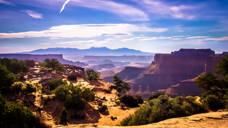 A quick word about the place...Flag as inappropriate ›Canyonlands National Park is a U.S. National Park located in southeastern Utah near the city of Moab and preserves a colorful landscape eroded into countless canyons, mesas and buttes by the Colorado River, the Green River, and their respective tributaries. The rivers divide the park into four districts: the Island in the Sky, the Needles, the Maze and the rivers themselves. While these areas share a primitive desert atmosphere, each retains its own character. The park covers 527.5 square miles (1,366 km2). Canyons are carved into the Colorado Plateau by the Colorado River and Green River. Author Edward Abbey, a frequent visitor, described the Canyonlands as "the most weird, wonderful, magical place on earth—there is nothing else like it anywhere." Canyonlands is a popular recreational destination. On average 440,039 people visited the park each year. The geography of the park is well suited to a number of different...SHOW MORE
 -
Explore Bryce Canyon National Park, Utah
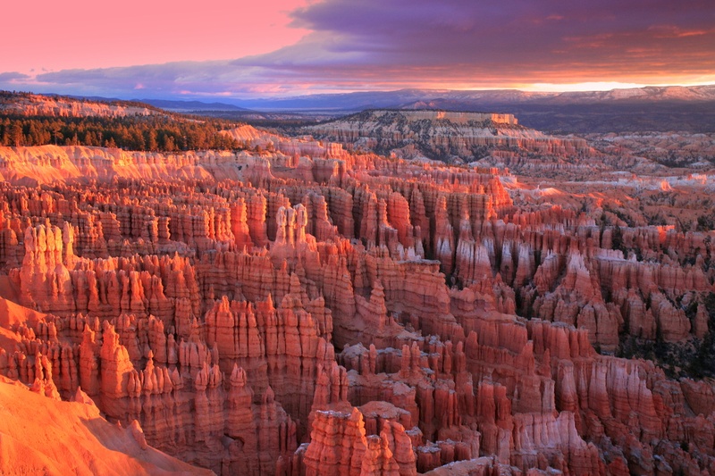 A quick word about the place...Flag as inappropriate ›Bryce Canyon National Park is located in southwestern Utah in the United States. The major feature of the park is Bryce Canyon which, despite its name, is not a canyon but a giant natural amphitheater created by erosion along the eastern side of the Paunsaugunt Plateau. Bryce is distinctive due to geological structures called hoodoos, formed by wind, water, and ice erosion of the river and lake bed sedimentary rocks. The red, orange, and white colors of the rocks provide spectacular views for park visitors. Bryce sits at a much higher elevation than nearby Zion National Park. The rim at Bryce varies from 8,000 to 9,000 feet (2,400 to 2,700 m). Most park visitors sightsee using the scenic drive, which provides access to 13 viewpoints over the amphitheaters. Bryce Canyon has eight marked and maintained hiking trails that can be hiked in less than a day (round trip time, trailhead): Mossy Cave (one hour, State Route 12 northwest...SHOW MORE
 -
Explore Arches National Park, Utah
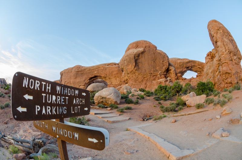 A quick word about the place...Flag as inappropriate ›Arches National Park is located in eastern Utah, USA. It is known for preserving over 2,000 natural sandstone arches, including the world-famous Delicate Arch, in addition to a variety of unique geological resources and formations. Among the notable features of the park are: Balanced Rock – a large balancing rock, the size of three school buses Courthouse Towers – a collection of tall stone columns Dark Angel – a free-standing 150-foot (46 m) tall sandstone pillar at the end of the Devil's Garden Trail Delicate Arch – a lone-standing arch which has become a symbol of Utah Devil's Garden – with many arches and columns scattered along a ridge Double Arch – two arches that share a common end Fiery Furnace – an area of maze-like narrow passages and tall rock columns (see biblical reference Fiery Furnace) Landscape Arch – a very thin and long arch with a span of 290 feet (88...SHOW MORE
 -
Explore Haleakalā National Park, Maui, Hawaii
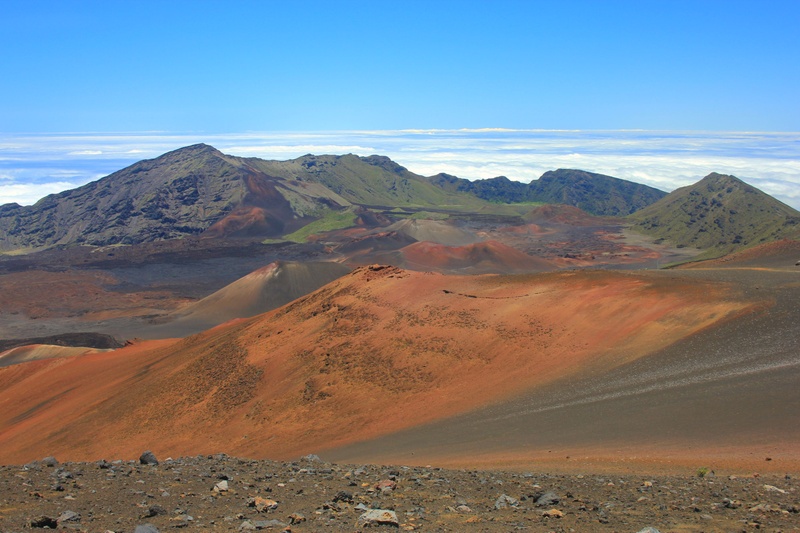 A quick word about the place...Flag as inappropriate ›Haleakala National Park, on Hawaii’s island of Maui, was established in 1916 as part of what was then known as Hawaii National Park. In 1960 the portion of the park that was located on the Big Island of Hawaii was split off from Haleakala with each section having its own identity in the National Parks System. Haleakala National Park stretches across Maui’s south and east coastlines and is home to its namesake and Maui’s tallest peak, Haleakala volcano. Haleakala rises 10,023 feet above sea level and is seen from virtually every spot on the island of Maui. Also named a United Nations International Biosphere Reserve, the park comprises starkly contrasting worlds of mountain and coast. The road to the summit of Haleakala is possibly the steepest grade for autos in the world. In the Hawaiian language, Haleakala means “House of the Sun” and is so named for an ancient legend that has the patron god of...SHOW MORE
 -
Explore Carlsbad Caverns National Park, New Mexico (UNESCO site)
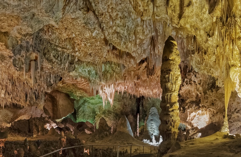 A quick word about the place...Flag as inappropriate ›Carlsbad Caverns National Park is a United States National Park in the Guadalupe Mountains in southeastern New Mexico. The primary attraction of the park for most visitors is the show cave, Carlsbad Caverns. Visitors to the cave can hike in on their own via the natural entrance, or take the elevator (the exit for everyone) directly to the Underground Lunchroom some 750 feet (230 m) below. The park has two entries on the National Register of Historic Places: The Caverns Historic District and the Rattlesnake Springs Historic District. Approximately two thirds of the park has been set aside as a wilderness area, helping to ensure no future changes will be made to the habitat. Carlsbad Caverns includes a large cave chamber, the Big Room, a natural limestone chamber which is almost 4,000 feet (about 1,219 m) long, 625 feet (190.5 m) wide, and 350 feet (about 107 m) high at the highest point. It is the third largest chamber in North...SHOW MORE
 -
Explore Redwood National and State Parks, California (UNESCO site)
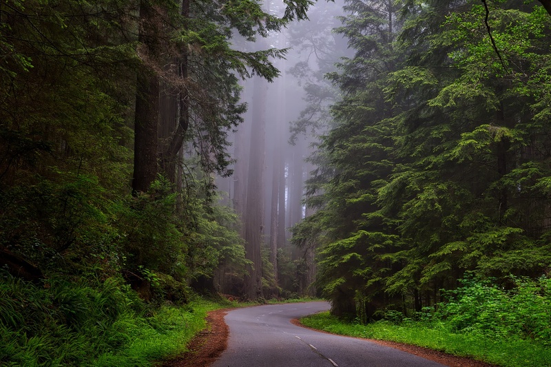 A quick word about the place...Flag as inappropriate ›The Redwood National and State Parks (RNSP) are located along the coast of northern California. The parks are protecting Coastal Redwood old-growth forests. These trees are the tallest and one of the most massive tree species on Earth. In addition to the redwood forests, the parks preserve other indigenous flora, fauna, grassland prairie, cultural resources, portions of rivers and other streams, and 37 miles (60 km) of pristine coastline. Comprising Redwood National Park (created 1968) and California's Del Norte Coast, Jedediah Smith, and Prairie Creek Redwoods State Parks (dating from the 1920s), the combined RNSP contain 133,000 acres (540 km2). Located entirely within Del Norte and Humboldt Counties, the four parks, together, protect 45% of all remaining Coastal Redwood (Sequoia sempervirens) old-growth forests. In 1850, old-growth redwood forest covered more than 2,000,000 acres (8,100 km2) of the California coast. The...SHOW MORE
 -
Visit Gateway Arch National Park, St. Louis, Missouri
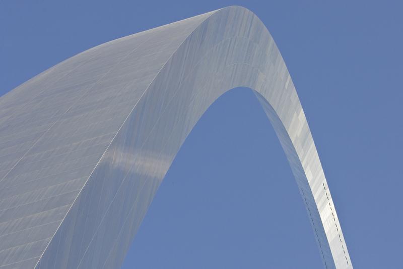 A quick word about the place...Flag as inappropriate ›Gateway Arch National Park, formerly known as the Jefferson National Expansion Memorial until 2018, is an American national park located in St. Louis, Missouri, near the starting point of the Lewis and Clark Expedition. The Gateway Arch and its immediate surroundings were initially designated as a national memorial by executive order on December 21, 1935, and redesignated as a national park in 2018. The park is maintained by the National Park Service (NPS). The memorial was established to commemorate: The memorial was established to commemorate: the Louisiana Purchase, and the subsequent westward movement of American explorers and pioneers; the first civil government west of the Mississippi River; and the debate over slavery raised by the Dred Scott case. The national park consists of the Gateway Arch, a steel catenary arch that has become the definitive icon of St. Louis; a 91-acre (36.8 ha) park along the Mississippi River...SHOW MORE
 -
Explore White Sands National Park, New Mexico
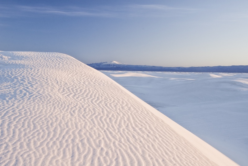 A quick word about the place...Flag as inappropriate ›White Sands National Park is a United States national park located in the state of New Mexico on Route 70 approximately 54 miles (87 km) northeast of Las Cruces and 16 miles (26 km) southwest of Alamogordo in western Otero County and northeastern Doña Ana County. The park is situated at an elevation of 4,235 feet (1,291 m) in the mountain-ringed Tularosa Basin and comprises the southern part of a 275 sq mi (710 km2) field of white sand dunes composed of gypsum crystals. The gypsum dune field is the largest of its kind on Earth. A fossil trackway of footprints of humans and ground sloths dating from the last ice age shows that ground sloths lived at White Sands, and were hunted by humans at least 11,700 years ago. The first Euro-American exploration was led by a party of US Army officers in 1849. :6 :5 The Antelope Band of the Mescalero Apache were already living in the area at the time. Hispanic families started farming...SHOW MORE
 -
Explore Joshua Tree National Park, California
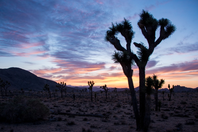 A quick word about the place...Flag as inappropriate ›Joshua Tree National Park is located in southeastern California. Straddling the San Bernardino County/Riverside County border, the park includes parts of two deserts, each an ecosystem whose characteristics are determined primarily by elevation: the higher Mojave Desert and lower Colorado Desert. The Little San Bernardino Mountains run through the southwest edge of the park. Nine established campgrounds exist in the park, three of which (Black Rock Campground, Indian Cove Campground, and Cottonwood Campground) provide water and flush toilets. A fee is charged per night for each camping spot.Reservations are accepted at Black Rock Campground, Indian Cove Campground, and Cottonwood Campground, while the six other campgrounds are first-come first-serve. Backcountry camping, for those who wish to backpack, is permitted with a few regulations. There are several hiking trails within the park, many of which can be accessed from a...SHOW MORE
 -
Explore Virgin Islands National Park, USVI
 A quick word about the place...Flag as inappropriate ›Among the attractions that makes St. John a worthy destination is the Virgin Islands National Park. This US National Park is renowned throughout the world for its breathtaking beauty while covering two-thirds of the island. The park claims some of the most beautiful coral reefs, plant life and brilliantly decorated tropical fish in the Caribbean. More than a third of the area that makes up the national park is underwater presenting unique opportunities for diving and snorkeling that may be unmatched for accessibility and dependability. Thanks to the US Park Service, St. John has sustained its vast stretches of verdant hillsides and oft-photographed, pristine white-sand beaches. Virgin Islands National Park is home to hundreds of historic structures that include plantations, factories, fortifications, schools and numerous home sites that were inhabited by workers previously enslaved on the island. The waters of Virgin Islands...SHOW MORE
 -
Explore Sequoia National Park, California
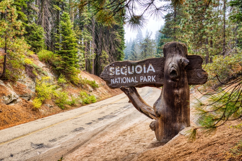 A quick word about the place...Flag as inappropriate ›Sequoia National Park is home to the General Sherman Tree, the largest tree on Earth, surrounded by serene trails and ancient forests. Sequoia National Park is a national park in the southern Sierra Nevada, east of Visalia, California, in the United States of America. It was established on September 25, 1890. The park spans 404,051 acres (1,635 km2). Encompassing a vertical relief of nearly 13,000 feet (4,000 m), the park contains among its natural resources the highest point in the contiguous 48 United States, Mount Whitney, at 14,505 feet (4,421 m) above sea level. The park is south of and contiguous with Kings Canyon National Park; the two are administered by the National Park Service together. The park is famous for its Giant Sequoia trees, including the General Sherman tree, the largest tree on Earth. The General Sherman tree grows in the Giant Forest, which contains five out of the ten largest trees in the world, in...SHOW MORE
 -
Explore Petrified Forest National Park, Arizona
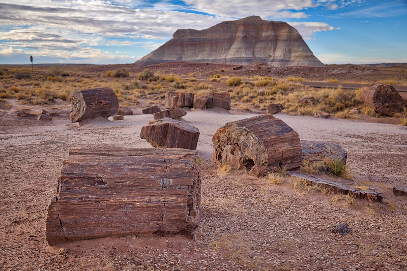 A quick word about the place...Flag as inappropriate ›Petrified Forest National Park is a United States national park in Navajo and Apache counties in northeastern Arizona. Named for its large deposits of petrified wood, the park covers about 146 square miles (380 km2), encompassing semi-desert shrub steppe as well as highly eroded and colorful badlands. The Painted Desert Visitor Center, designed by modernist architect Richard Neutra, is part of the Painted Desert Community Complex Historic District and is on the National Register of Historic Places. Eight other sites within the park are also on the National Register, including the Painted Desert Inn and associated cabins, the Agate House Pueblo, the Painted Desert Petroglyphs and Ruins Archeological District, Newspaper Rock Petroglyphs Archeological District, Puerco Ruins and Petroglyphs, the Flattops Site (an archeological site), the Twin Buttes Archeological District, and the 35th Parallel Route (also known as the Beale Camel...SHOW MORE
 -
Explore Guadalupe Mountains National Park, Texas
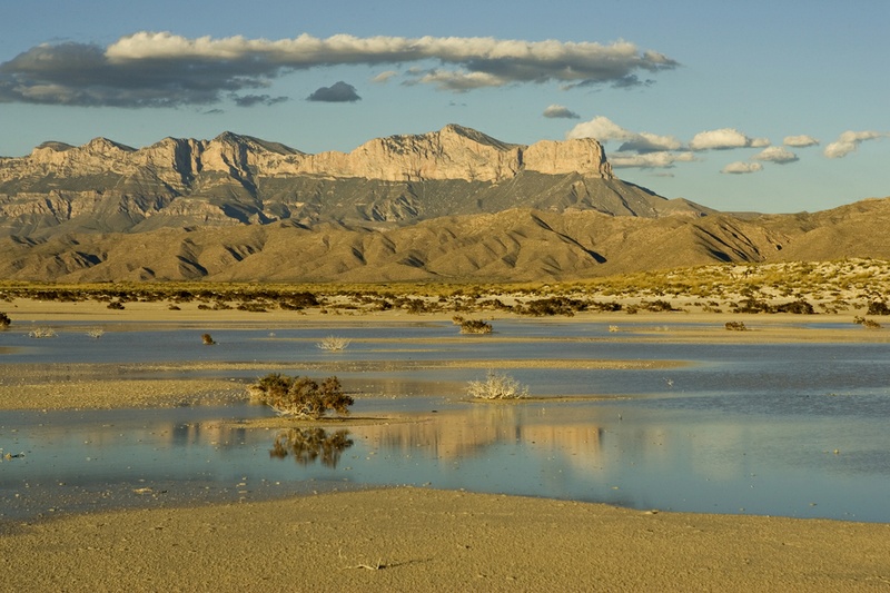 A quick word about the place...Flag as inappropriate ›Guadalupe Mountains National Park is located in the Guadalupe Mountains of West Texas and contains Guadalupe Peak, the highest point in Texas at 8,749 feet (2,667 m) in elevation. It also contains El Capitan, long used as a landmark by people traveling along the old route later followed by the Butterfield Overland Mail stagecoach line. Visitors can see the ruins of an old stagecoach station near the Pine Springs Visitor Center. Camping is available nearby at the Pine Springs Campground. The restored Frijole Ranch House is now a small museum of local ranching history and is the trailhead for Smith Spring. The park covers 135 square miles (350 km2) and is in the same mountain range as Carlsbad Caverns National Park which is located about 25 miles (40 km) to the north in New Mexico. Numerous well-established trails exist in the park for hiking and horse-riding. The Guadalupe Peak Trail offers perhaps the most outstanding views in...SHOW MORE
 -
Explore Great Sand Dunes National Park, Colorado
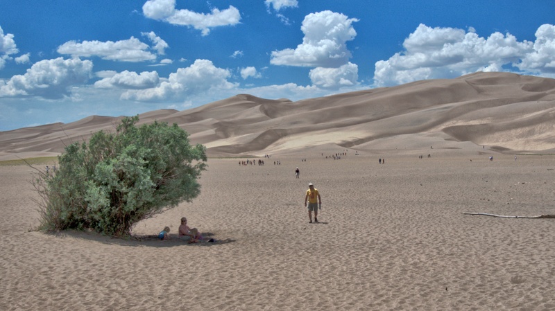 A quick word about the place...Flag as inappropriate ›Great Sand Dunes National Park and Preserve is a United States National Park located in the easternmost parts of Alamosa County and Saguache County, Colorado, United States. The large, main dunefield covers approximately 30 square miles, but there are many more square miles of smaller dunes in the sand sheet surrounding the main dunefield. At the widest point, the main dunefield runs six miles and at the greatest length, eight miles. Great Sand Dunes has the tallest dunes in North America. Star Dune rises 750 feet from its base to its crest. High Dune rises 650 feet from its base, but because it starts on higher ground, its crest is higher above sea level that of Star Dune. The park also contains alpine lakes and tundra, six peaks over 13,000 feet (3,940 m) in elevation, ancient spruce and pine forests, large stands of aspen and cottonwood, grasslands, and wetlands — all habitat for diverse wildlife and plant...SHOW MORE
 -
Explore Dry Tortugas National Park, Florida
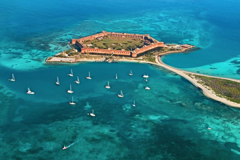 A quick word about the place...Flag as inappropriate ›Dry Tortugas National Park preserves Fort Jefferson and the Dry Tortugas section of the Florida Keys. The park covers 101 mi² , mostly water, about 68 statute miles west of Key West in the Gulf of Mexico. It is famous for abundant sea life, colorful coral reefs and legends of shipwrecks and sunken treasures. The park's centerpiece is Fort Jefferson, a massive but unfinished coastal fortress. It is the largest masonry structure in the Western Hemisphere, and is composed of over 16 million bricks. The park has almost 80,000 visitors each year. The park is accessible only by seaplane or boat. Ferries leave from Key West. Activities include snorkeling, picnicking, camping, scuba diving, saltwater fishing and birdwatching. Fort Jefferson is an unincorporated community and ghost town in Monroe County, Florida, United States. It is located on Garden Key in the lower Florida Keys within the Dry Tortugas National Park, about 70...SHOW MORE
 -
Explore Crater Lake National Park, Oregon
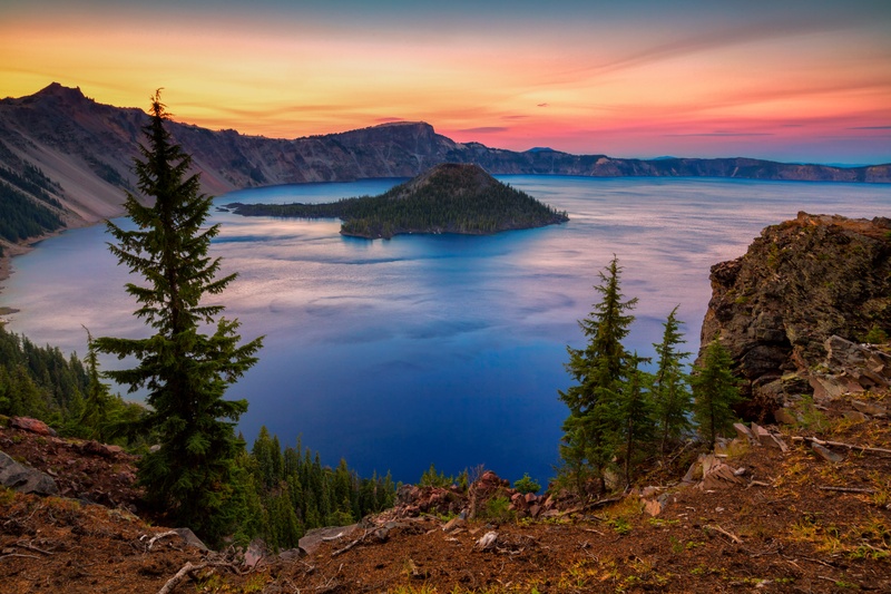 A quick word about the place...Flag as inappropriate ›Crater Lake National Park is a United States National Park located in southern Oregon, whose primary feature is Crater Lake. This National Park was established on May 22, 1902, and it is the sixth oldest National Park in the U.S. This park encompasses the Crater Lake caldera, which rests in the remains of a destroyed volcano (eventually named Mount Mazama) and the surrounding forestland and hills. This is the only National Park in Oregon. The lake is 1,949 feet deep at its deepest point, which makes it the deepest lake in the United States, the second deepest in North America and the ninth deepest in the world. However, when comparing its average depth of 1,148 feet (350 m) to the average depth of other deep lakes, Crater Lake becomes the deepest in the Western Hemisphere and the third deepest in the world. The impressive average depth of this volcanic lake is due to the nearly symmetrical 4,000-foot deep caldera formed 7,700...SHOW MORE
 -
Explore Glacier National Park, Montana (UNESCO site)
 A quick word about the place...Flag as inappropriate ›Glacier National Park is located in the U.S. state of Montana, bordering the Canadian provinces of Alberta and British Columbia. The park encompasses over 1,000,000 acres (4,000 km2) and includes parts of two mountain ranges (sub-ranges of the Rocky Mountains), over 130 named lakes, more than 1,000 different species of plants and hundreds of species of animals. This vast pristine ecosystem is the centerpiece of what has been referred to as the "Crown of the Continent Ecosystem", a region of protected land encompassing 16,000 square miles (41,000 km2). The region that became Glacier National Park was first inhabited by Native Americans and upon the arrival of European explorers, was dominated by the Blackfeet in the east and the Flathead in the western regions. Soon after the establishment of the park on May 11, 1910, a number of hotels and chalets were constructed by the Great Northern Railway. These historic hotels and...SHOW MORE
 -
Explore Wrangell–St. Elias National Park, Alaska (UNESCO site)
 A quick word about the place...Flag as inappropriate ›Wrangell–St. Elias National Park and Preserve is a United States National Park in southeastern Alaska. It was established in 1980 by the Alaska National Interest Lands Conservation Act. The park area is included in an International Biosphere Reserve and is part of a UNESCO World Heritage Site. It is the largest national park in the United States by area, covering an area of 20,587 mi² (53,321 km²), or over 13 million acres (53,000 km²). In fact, it is larger than nine U.S. States, and its size is comparable to the Canadian province of Nova Scotia. The Edgerton Highway runs along the valley of the Copper River on the western margin of the park. The headquarters and visitor center are at mile 106.8 near Copper Center. Road access to the park's interior is along the Nabesna Road and the McCarthy Road. The abandoned mining town of Kennecott can be accessed by footbridge from a continuation of the McCarthy...SHOW MORE
 -
Explore Great Smoky Mountains National Park, Tennessee & North Carolin...
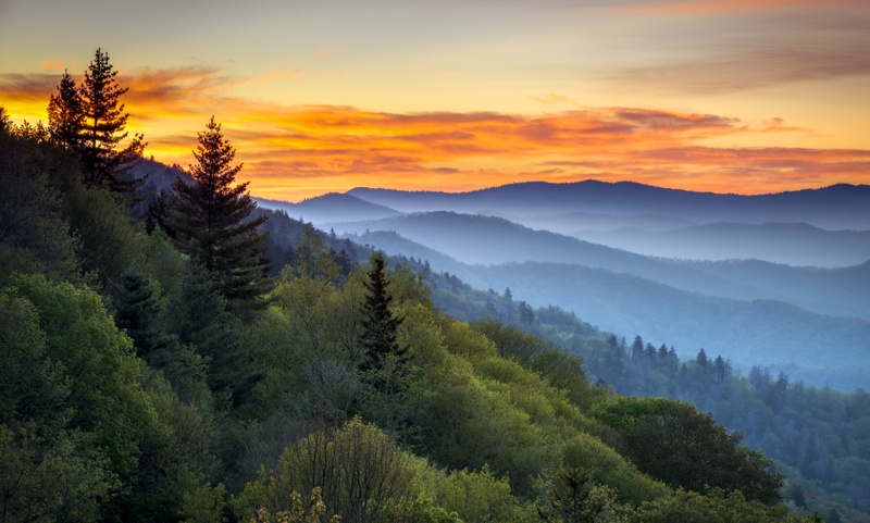 A quick word about the place...Flag as inappropriate ›Great Smoky Mountains National Park is the most important natural area in the eastern United States, the most visited National Park in the USA, a UNESCO World Heritage Site and an International Biosphere Reserve. The park is frequently cited as a shining example of a temperate deciduous hardwood forest. With 130 species of tree found in the park, it has almost as many tree species as all of Europe. It harbors many endangered species of animals and has what has been called the greatest diversity of salamanders in the world. The Great Smoky Mountains presents 16 peaks over 6,000 feet, the tallest mountains in the Appalachian chain. The topography of the park is comprised of crested, steep-sided ridges separated by V-shaped valleys. Many of those ridges branch and subdivide creating a natural drainage system with a number of rapidly flowing clear mountain streams. Wildlife, in addition to the Black Bears, includes more than 50...SHOW MORE
 -
Explore Olympic National Park, Washington (UNESCO site)
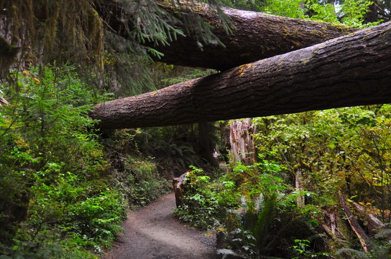 A quick word about the place...Flag as inappropriate ›Olympic National Park is located on the Olympic Peninsula in the state of Washington. The park can be divided into three basic regions: the Pacific coastline, the Olympic Mountains, and the temperate rainforest. U.S. President Theodore Roosevelt originally created Mount Olympus National Monument in 1909 and after Congress voted to authorize a re-designation to National Park status, President Franklin Roosevelt signed the legislation in 1938. In 1976, Olympic National Park became an International Biosphere Reserve, and in 1981 it was designated a World Heritage Site. In 1988, Congress designated 95 percent of the park as the Olympic Wilderness. The coastal portion of the park is a rugged, sandy beach along with a strip of adjacent forest. It is 73 miles (117 km) long but just a few miles wide, with native communities at the mouths of two rivers. The Hoh River has the Hoh people and at the town of La Push at the mouth of the...SHOW MORE
 -
Explore Mammoth Cave National Park, Kentucky (UNESCO site)
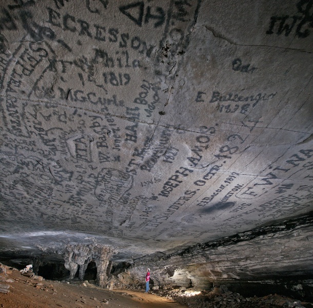 A quick word about the place...Flag as inappropriate ›Mammoth Cave National Park is a U.S. National Park in central Kentucky, encompassing portions of Mammoth Cave, the longest cave system known in the world. The official name of the system is the Mammoth-Flint Ridge Cave System for the ridge under which the cave has formed. The park was established as a national park on July 1, 1941. It became a World Heritage Site on October 27, 1981, and an international Biosphere Reserve on September 26, 1990. The park's 52,835 acres (21,382 ha) are located primarily in Edmonson County, Kentucky, with small areas extending eastward into Hart County and Barren County. It is centered around the Green River, with a tributary, the Nolin River, feeding into the Green just inside the park. With over 390 miles (630 km) of passageways it is by far the world's longest known cave system, being well over twice as long as the second longest cave system, which is South Dakota's Jewel Cave with just over...SHOW MORE
 -
Explore Mesa Verde National Park, Colorado (UNESCO site)
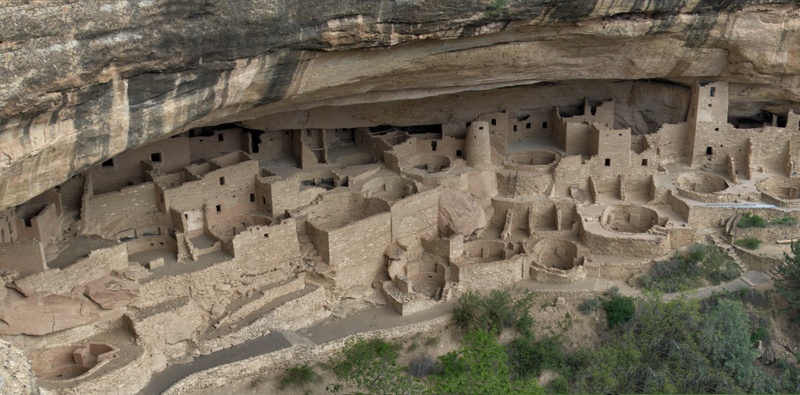 A quick word about the place...Flag as inappropriate ›Mesa Verde National Park is a U.S. National Park and UNESCO World Heritage Site located in Montezuma County, Colorado, United States. It was created in 1906 to protect some of the best preserved cliff dwellings in the world. The park occupies 81.4 square miles (211 km2) (211 square kilometers) near the Four Corners and features numerous ruins of homes and villages built by the Ancestral Puebloan people, sometimes called the Anasazi. The park protects over 4,000 archaeological sites, including 600 separate cliff dwellings. The Anasazi inhabited Mesa Verde anywhere between 550 to 1300 AD. These people were mainly subsistence farmers; they grew crops on nearby mesas. Their primary crop was Corn, which was also was the major part of their diet. Men were also hunters which further increased their food supply. The women of the Anasazi were famous for the elegant basket weaving. Anasazi pottery is just as famous as their baskets...SHOW MORE
 -
Explore Black Canyon of the Gunnison National Park, Colorado
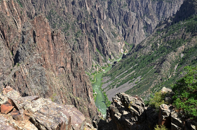 A quick word about the place...Flag as inappropriate ›Black Canyon of the Gunnison National Park, near the towns of Montrose and Crawford, Colorado. The park was literally carved out of multiple rock layers over the last couple of million years by the Gunnison River harboring a variety of life zones in its dramatically plunging gorges and chasms. It’s big enough to be awe-inspiring while welcoming enough to allow visitors to feel the pulse of time on a more personal level. Black Canyon of the Gunnison presents some of the steepest cliffs, oldest rock formations and craggiest spires in North America. Having those two million years to work its wonder, the Gunnison River has sculpted this vertical wilderness of rock, water and sky, assisted by the forces of nature. According to Wallace Hansen, considered to be the unequivocal expert on the geology of this region, “no other canyon in North America combines the depth, narrowness, sheerness, and somber countenance of the...SHOW MORE
 -
Explore Shenandoah National Park, Virginia
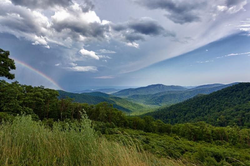 A quick word about the place...Flag as inappropriate ›Shenandoah National Park encompasses part of the Blue Ridge Mountains in the U.S. state of Virginia. This national park is long and narrow, with the broad Shenandoah River and valley on the west side, and the rolling hills of the Virginia Piedmont on the east. Although likely the most prominent feature of the Park is the scenic Skyline Drive, almost 40% of the land area 79,579 acres (322.04 km2) has been designated as wilderness and is protected as part of the National Wilderness Preservation System. The highest peak is Hawksbill Mountain at 4,051 feet (1,235 m). The park is best known for Skyline Drive, a 105 mile (169 km) road that runs the entire length of the park along the ridge of the mountains. The drive is particularly popular in the fall when the leaves are changing colors. 101 miles (162 km) of the Appalachian Trail are also in the park. In total, there are over 500 miles (800 km) of trails within the park. Of the...SHOW MORE
 -
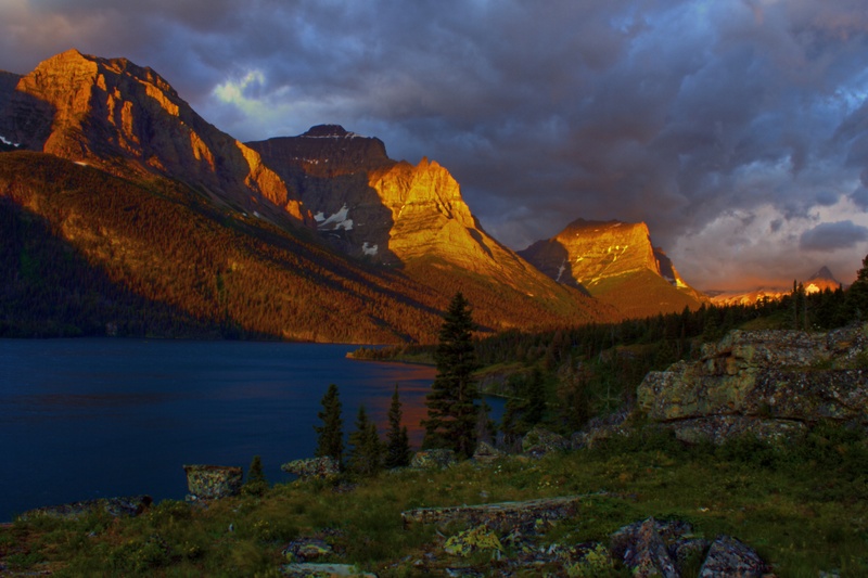
Explore Grand Teton National Park, Wyoming
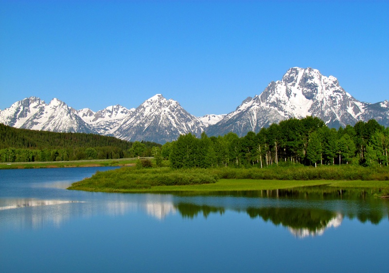 A quick word about the place...Flag as inappropriate ›Grand Teton National Park is located in northwestern Wyoming. The park consists of approximately 310,000 acres (130,000 ha) and includes the major peaks of the 40 miles (64 km) long Teton Range as well as most of the northern sections of the valley known as Jackson Hole. Only 10 miles (16 km) south of Yellowstone National Park, the two parks are connected by the National Park Service managed John D. Rockefeller, Jr. Memorial Parkway. These three protected areas in conjunction with surrounding National Forests constitute the Greater Yellowstone Ecosystem, which at almost 18,000,000 acres (7,300,000 ha), is one of the largest intact ecosystems in the United States. Grand Teton National Park is named for Grand Teton which is the tallest mountain in the Teton Range. At 13,775 feet (4,199 m), Grand Teton rises abruptly more than 7,000 feet (2,100 m) above Jackson Hole and is almost 850 feet (260 m) higher than Mount Owen, the...SHOW MORE
 -
Explore Rocky Mountain National Park, Colorado
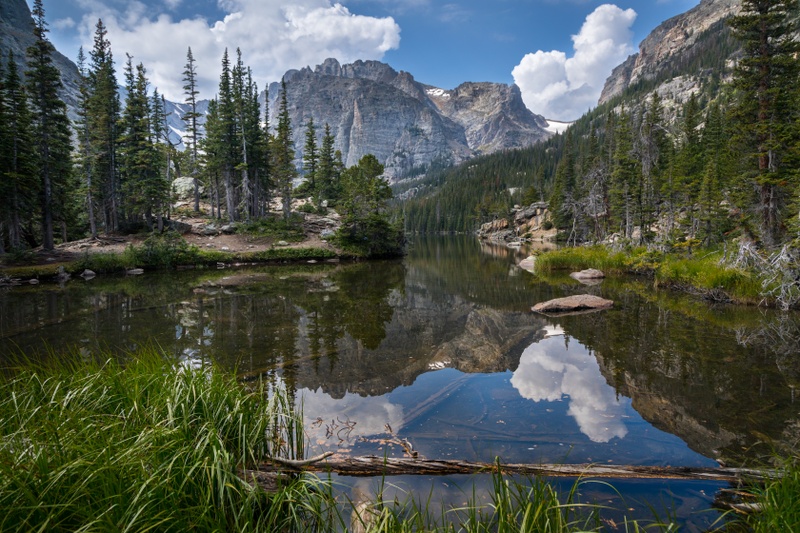 A quick word about the place...Flag as inappropriate ›Rocky Mountain National Park is a national park located in the north-central region of the U.S. state of Colorado. It features majestic mountain views, a variety of wildlife, varied climates and environments—from wooded forests to mountain tundra—and easy access to back-country trails and campsites. The park is located northwest of Boulder, Colorado, in the Rockies, and includes the Continental Divide and the headwaters of the Colorado River. Planning a trip to Rocky Mountain National Park from May 24 through mid-October? Rocky Mountain National Park is implementing a timed entry reservation system during certain hours of the day. There are two different options available to choose from: Timed Entry or Timed Entry + Bear Lake Road. Timed entry reservations apply to all areas of the park. The park has five visitor centers. The park headquarters, Beaver Meadows Visitor Center, is a National Historic Landmark...SHOW MORE
 -
Explore Denali National Park, Alaska
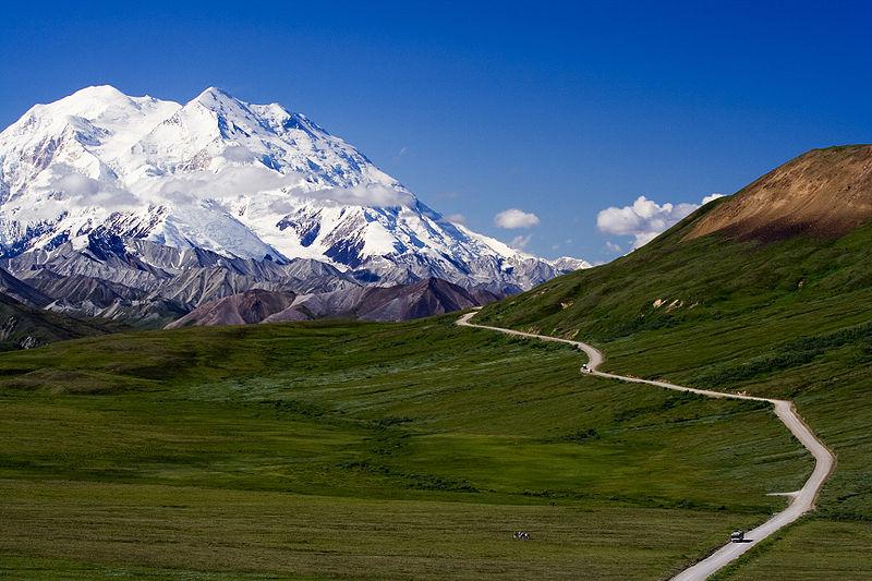 A quick word about the place...Flag as inappropriate ›Denali National Park and Preserve is located in Interior Alaska and contains Denali (Mount McKinley), the highest mountain in North America. The park and preserve together cover 9,492 mi² (24,585 km²). Denali is home to a variety of Alaskan birds and mammals, including a healthy population of grizzly bears and black bears. Herds of caribou roam throughout the park. Dall sheep are often seen on mountainsides, and moose feed on the aquatic plants of the small lakes and swamps. Despite human impact on the area, Denali accommodates gray wolf dens, both historic and active. Smaller animals, such as hoary marmots, arctic ground squirrels, beavers, pikas, and snowshoe hares are seen in abundance. Foxes, martens, lynx, wolverines also inhabit the park, but are more rarely seen due to their elusive natures. The park is also well known for its bird population. Many migratory species reside in the park during late spring and...SHOW MORE
 -
Explore Channel Islands National Park, California
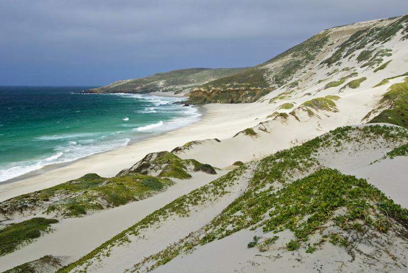 A quick word about the place...Flag as inappropriate ›Channel Islands National Park consists of five of the eight Channel Islands off the coast of California. Although the islands are close to the shore of densely-populated Southern California, their isolation has left them relatively undeveloped. Channel Islands National Park offers a wide variety of recreation activities, kayaking through the Sea Caves being one of the most popular. Backpacking, camping, day hiking, scuba diving, and spearfishing are among the activities available to visitors. The Channel Islands National Park is renowned for its large number of complex, beautiful Sea Caves. Based on ocean conditions and ferry availability, Scorpion Anchorage on Santa Cruz Island is the most visited area in the park for day and camping visitors. It is recommended that inexperienced visitors use caution when visiting the national park due to changing ocean conditions in this unique ecosystem. Guide and outfitter services are...SHOW MORE
 -
Explore Saguaro National Park, Arizona
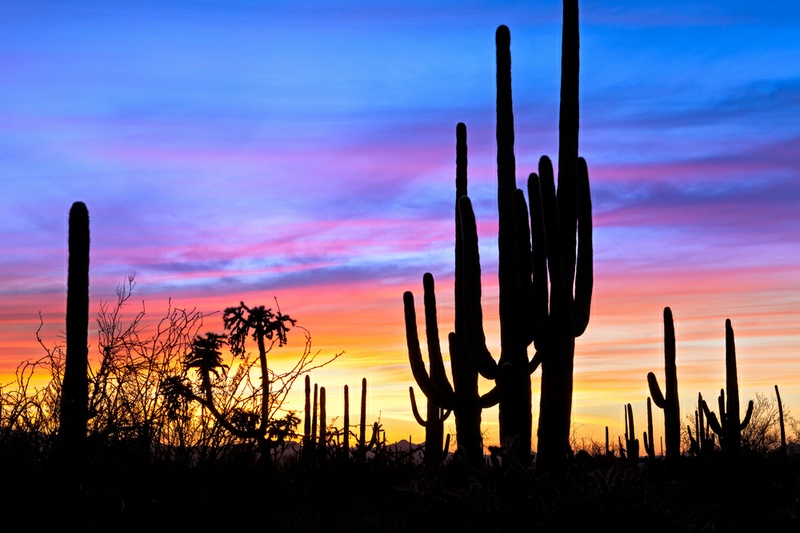 A quick word about the place...Flag as inappropriate ›Saguaro National Park, located in the state of Arizona, is part of the United States national park system. Saguaro National Park is divided into two sections, lying approximately 20 miles (32 km) east and 15 miles (24 km) west of the center of the city of Tucson, Arizona. There is a visitor center in each section. Both are easily reached by car from Tucson, but there is no public transport into either section. Both sections conserve fine tracts of the Sonoran Desert, including ranges of significant hills, the Tucson Mountains in the west and the Rincon Mountains in the east. The park gets its name from the saguaro cactus which is native to the region. Many other kinds of cactus, including barrel cactus, chollacactus, and prickly pear, are also abundant in the park. One endangered animal, the Lesser Long-nosed Bat, lives in the park part of the year during its migration, together with one threatened species, the Mexican Spotted...SHOW MORE
 -
Explore North Cascades National Park, Washington
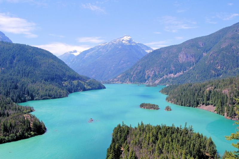 A quick word about the place...Flag as inappropriate ›North Cascades National Park is a U.S. National Park located in the state of Washington. The park is the largest of the three National Park Service units that comprise the North Cascades National Park Service Complex. Several national wilderness areas and British Columbia parkland adjoin the National Park. The park features rugged mountain peaks. In 1971, the park had 318 glaciers with an area of 117 km2 (Post et al., 1971), the most of any US park outside Alaska. All the glaciers in the park have retreated significantly from 1980–2005 and the rate is increasing. The recent warmer climate has led to more summer melting and more winter melting events, reducing winter snowpack. Several glaciers in the range have melted away in the last decade. Boston Glacier, on the north slope of Boston Peak, is the largest glacier in the park with an area of 7 km2. The other large glaciers (with areas greater than 2.5 km2) are: Redoubt...SHOW MORE
 -
Explore Kobuk Valley National Park, Alaska
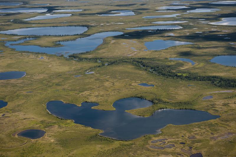 A quick word about the place...Flag as inappropriate ›Kobuk Valley National Park is in northwestern Alaska 25 miles (40 km) north of the Arctic Circle. It is noted for the Great Kobuk Sand Dunes and caribou migration routes. The park offers backcountry camping, hiking, backpacking, and dog sledding. There are no designated trails or roads in the park, which at 1,669,813 acres (6,757.49 km2), is approximately the size of the state of Delaware. Bounded by the Waring Mountains in the South and the Baird Mountains in the North, it is the center of a vast ecosystem between Selawik National Wildlife Refuge and the Noatak National Preserve. It is over 75 miles (121 km) by river to the Chukchi Sea. The Gates of the Arctic National Park and Preserve lie 32 miles (51 km) to the east. The most visible animals are the 400,000 caribou of the Western Arctic herd. The herd migrates annually between their winter breeding grounds, south of the Waring Mountains, and their summer calving grounds...SHOW MORE
 -
Explore Biscayne National Park, Florida
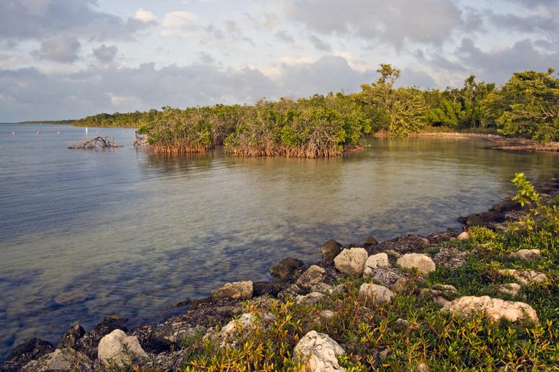 A quick word about the place...Flag as inappropriate ›Biscayne National Park is a U.S. National Park located in southern Florida. The park preserves Biscayne Bay, one of the top scuba diving areas in the United States. Ninety-five percent of the park is water. In addition, the shore of the bay is the location of an extensive mangrove forest. The park covers 207 mi² (700 km²). Elliott Key, the park's largest island, is considered the first of the true Florida Keys being formed from fossilized coral reef, i.e. Key Largo limestone. The islands farther north in the park are transitional islands of coral and sand. The major attraction of the park is fishing the inshore and offshore waters. Scuba diving or snorkeling on the coral reef ecosystems that are found east of the barrier islands is also a very popular attraction. Other attractions include: canoeing, kayaking, sailing, or cruising the expanse of open waters within the park and camping on Elliot Key or Boca Chita...SHOW MORE
 -
Explore Mount Rainier National Park, Washington
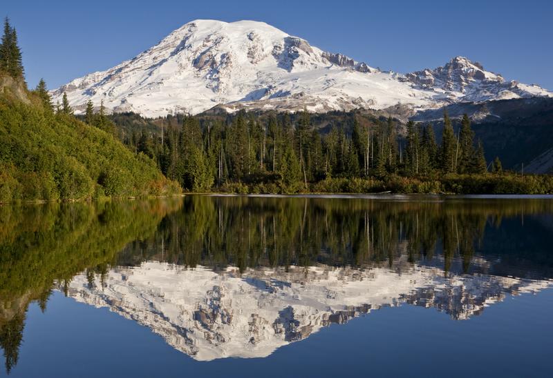 A quick word about the place...Flag as inappropriate ›Mount Rainier National Park is a United States National Park located in southeast Pierce County and northeast Lewis County in Washington state. It was one of the US's earliest National Parks, having been established on March 2, 1899 as the fifth national park in the United States. The park contains 368 square miles (950 km2) including all of Mount Rainier, a 14,411-foot (4,392 m) stratovolcano. The mountain rises abruptly from the surrounding land with elevations in the park ranging from 1,600 feet (490 m) to over 14,000 feet (4,300 m). The highest point in the Cascade Range, around it are valleys, waterfalls, subalpine wildflower meadows, old growth forest and more than 26 glaciers. The volcano is often shrouded in clouds that dump enormous amounts of rain and snow on the peak every year and hide it from the crowds that head to the park on weekends. Mount Rainier is circled by the Wonderland Trail and is covered by several...SHOW MORE
 -
Explore Hot Springs National Park, Arkansas
 A quick word about the place...Flag as inappropriate ›Established from Hot Springs Reservation, Hot Springs National Park is a United States National Park in central Arkansas adjacent to the city of Hot Springs. Hot Springs Reservation was initially created by an act of the United States Congress on April 20, 1832, and the area was made a national park on March 4, 1921. It is the smallest national park by area in the United States. Since Hot Springs National Park is the oldest federal reserve, it was the first to receive its own US quarter in April 2010 as part of the America the Beautiful Quarters. The hot springs flow from the western slope of Hot Springs Mountain, part of the Ouachita Mountain range. In the park, the hot springs have not been preserved in their unaltered state as natural surface phenomena. They have instead been managed to conserve the production of uncontaminated hot water for public use. The mountains within the park are also managed within this conservation...SHOW MORE
 -
Explore Cuyahoga Valley National Park, Ohio
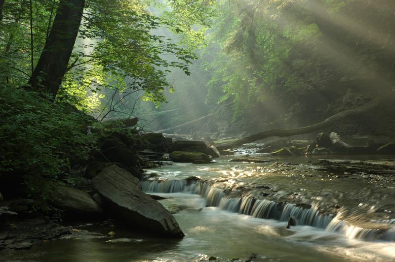 A quick word about the place...Flag as inappropriate ›Cuyahoga Valley National Park preserves and reclaims the rural landscape along the Cuyahoga River between Akron and Cleveland in Northeast Ohio. The 51-square-mile (130 km2) park is the only national park in Ohio. Cuyahoga means "crooked river" in Mohawk. Many visitors spend their time hiking or bicycling the parks' many trails which visit its numerous attractions, including the crushed limestone along portions of the 20 miles (32.2 km) Towpath Trail, following a former stretch of the 308 miles (495.7 km) Ohio and Erie Canal. Waterfalls, rolling hills, caves, winding river scenery attract many park visitors. Steep narrow ravines, a rolling floodplain, and lush farmland contrast one another throughout the park. Animal life is also plentiful. The Ledges provides a boulder-strewn cliff to relax and watch the sunset over the wooded scenery below. Sled-riding is popular during the winter at Happy Days Park. The national park has...SHOW MORE
 -
Explore Gates of the Arctic National Park, Alaska
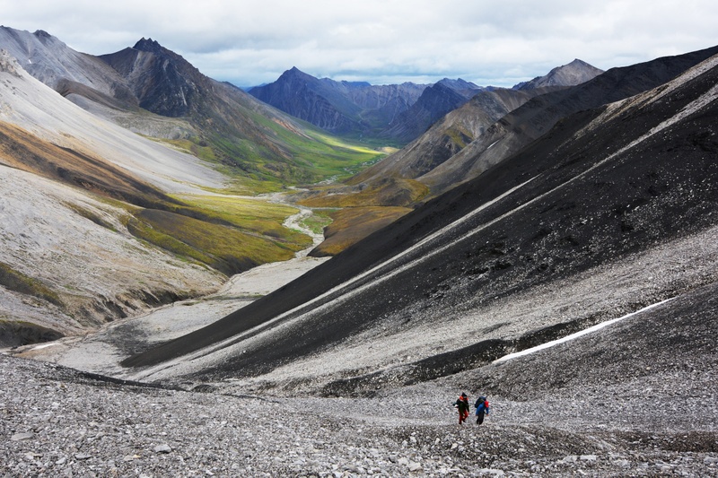 A quick word about the place...Flag as inappropriate ›Gates of the Arctic National Park and Preserve is a U.S. National Park in Alaska. It is the northernmost national park in the U.S. (the entirety of the park lies north of the Arctic Circle) and the second largest at 13,238 mi² , about the same size as Switzerland. The park consists primarily of portions of the Brooks Range of mountains. It was first protected as a U.S. National Monument on December 1, 1978, before becoming a national park and preserve two years later in 1980 upon passage of the Alaska National Interest Lands Conservation Act. A large part of the park is preserved as a wilderness area; some 11,321 mi² of wilderness which with the adjoining Noatak Wilderness Area forms the largest contiguous wilderness in the United States. The park's name dates to 1929, when wilderness activist Bob Marshall, exploring the North Fork of the Koyukuk River, encountered a pair of mountains (Frigid Crags and Boreal...SHOW MORE
 -
Explore Wind Cave National Park, South Dakota
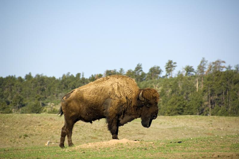 A quick word about the place...Flag as inappropriate ›Wind Cave National Park is a United States national park 10 miles (16 km) north of the town of Hot Springs in western South Dakota. Established in 1903 by President Theodore Roosevelt, it was the seventh U.S. National Park and the first cave to be designated a national park anywhere in the world. The cave is notable for its displays of the calcite formation known as boxwork. Approximately 95 percent of the world's discovered boxwork formations are found in Wind Cave. Wind Cave is also known for its frostwork. The cave is also considered a three-dimensional maze cave, recognized as the densest (most passage volume per mi3) cave system in the world. The cave passed Hölloch cave in Switzerland on February 11, 2006 to become fourth-longest in the world with 119.58 miles (192.45 km) of explored cave passageways. The cave's current length is 131.04 miles (210.89 km), with an average of four new miles of cave being discovered...SHOW MORE
 -
Explore Katmai National Park, Alaska
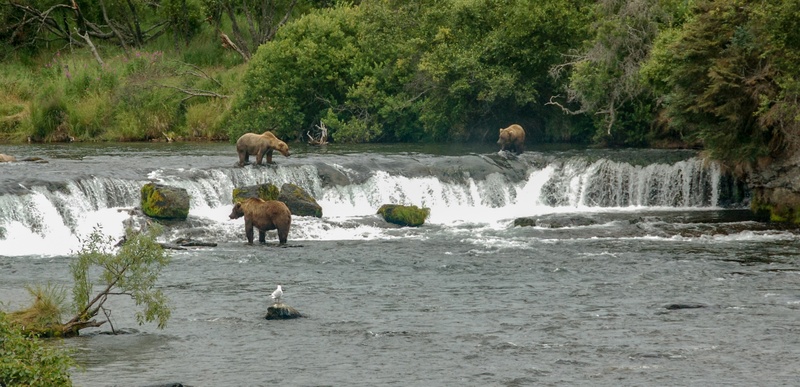 A quick word about the place...Flag as inappropriate ›Katmai National Park and Preserve is a United States National Park in southern Alaska, notable for the Valley of Ten Thousand Smokes and for its brown bears. The park covers 7,383 square miles (19,120 km2), being roughly the size of Wales. Most of this is a designated wilderness area, including 5,288 square miles (13,700 km2) of the park. The park is named after Mount Katmai, its centerpiece stratovolcano. Activities at Katmai include hiking, backpacking, camping, backcountry skiing, fishing, kayaking, boat tours, and interpretive programs. There are at least fourteen active volcanoes within the national park, most recently Fourpeaked Volcano, which became active September 17, 2006 after more than 10,000 years of dormancy. This park contains numerous archaeological sites which indicate a long history of prehistoric occupations from the Paleoarctic tradition up to the Thule tradition. Katmai is also well known for brown bears...SHOW MORE
 -
Explore Badlands National Park, South Dakota
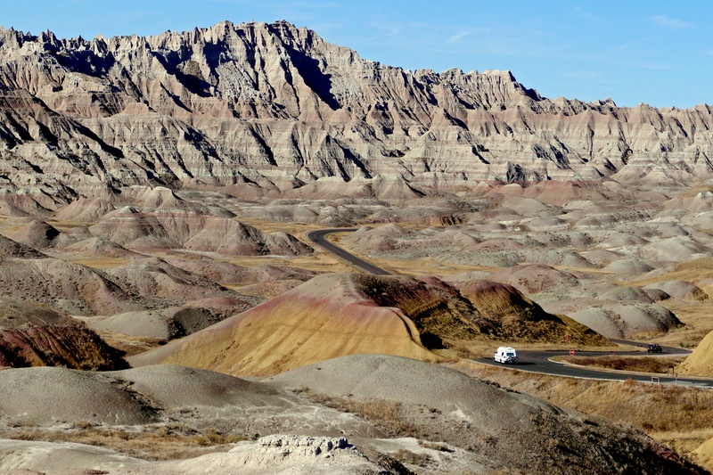 A quick word about the place...Flag as inappropriate ›Badlands National Park, in southwest South Dakota, United States preserves 244,000 acres (98,740 ha) of sharply eroded buttes, pinnacles, and spires blended with the largest protected mixed grass prairie in the United States. Bison, bighorn sheep, prairie dogs, and black-footed ferrets can be seen at the park. These striking geologic deposits contain one of the world’s richest fossil beds. Ancient mammals such as the rhino, horse, and saber-toothed cat once roamed here. The yellow and red layers in the badlands formations are fossilized soils, called paleosols. Fossil root traces, burrows, and animal bones found within the soils provide scientists with evidence of environmental and climatic changes that occurred in the badlands over time. The Badlands Wilderness protects 64,144 acres (25,958 ha) of the park as a designated wilderness area and is the site of the reintroduction of the black-footed ferret, the most...SHOW MORE
 -
Explore Theodore Roosevelt National Park, North Dakota
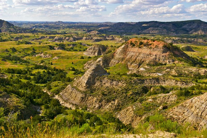 A quick word about the place...Flag as inappropriate ›Theodore Roosevelt National Park in the US comprising three geographically separated areas of badlands in western North Dakota. Both main units of the park have scenic drives, approximately 100 miles of foot and horse trails, wildlife viewing, and opportunities for back country hiking and camping. There are three developed campgrounds: Juniper Campground in the North Unit, Cottonwood Campground in the South Unit, and the Roundup Group Horse Campground in the South Unit. One of the most popular attractions is wildlife viewing. The park is home to a wide variety of Great Plains wildlife including bison, feral horses, elk, bighorn sheep, white-tailed deer and mule deer, prairie dogs, and at least 186 species of birds including golden eagles, sharp-tailed grouse, and wild turkeys. Bison may be dangerous and visitors are advised to view them from a distance. Bison, elk, and bighorn sheep have been successfully reintroduced to the...SHOW MORE
 -
Explore Great Basin National Park, Nevada
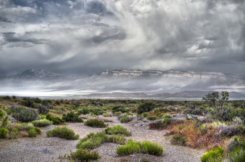 A quick word about the place...Flag as inappropriate ›Great Basin National Park is a United States National Park established in 1986, located in east-central Nevada near the Utah border. The park derives its name from the Great Basin, the dry and mountainous region between the Sierra Nevada and the Wasatch Mountains. Topographically, this area is known as the Basin and Range Province. The park is notable for its groves of ancient bristlecone pines, the oldest known non-clonal organisms; and for the Lehman Caves at the base of 13,063 ft (3,982 m) Wheeler Peak. The caves were originally designated as the Lehman Caves National Monument on January 24, 1922, and they were later incorporated into the national park. The park has 12 trails ranging from 0.3 to 13.1 miles (0.48 to 21.1 km). Trails range from short nature trails at 6,825 feet (2,080 m) (Mountain View Nature Trail), to the Wheeler summit trail starting at 10,160 feet (3,097 m). The Wheeler Summit trail is quite strenuous...SHOW MORE
 -
Explore Voyageurs National Park, Minnesota
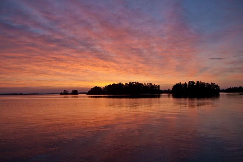 A quick word about the place...Flag as inappropriate ›Voyageurs National Park is a United States National Park in northern Minnesota near the town of International Falls. It was established in 1975. The park's name commemorates the voyageurs, French-Canadian fur traders who were the first European settlers to frequently travel through the area. The park is notable for its outstanding water resources and is popular with canoeists, kayakers, other boaters and fishermen. The Kabetogama Peninsula, which lies entirely within the park and makes up most of its land area, is accessible only by boat. To the east of the National Park lies the Boundary Waters Canoe Area Wilderness. The park has several boat ramps and visitor centers around its periphery, though the main body of the park is only accessible by boat or, in the winter, by snowmobile, ski, or snowshoe. The park hosts about 235,000 visitors per year. 114,000 acres (461 km2) of the park are intended to be wilderness by September...SHOW MORE
 -
Explore Lassen Volcanic National Park, California
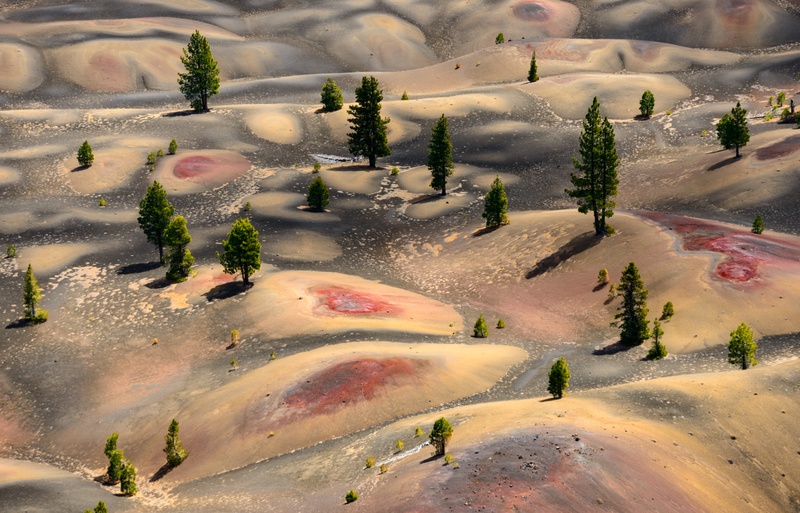 A quick word about the place...Flag as inappropriate ›Lassen Volcanic National Park is located in northeastern California and is known for Lassen Peak; the largest plug dome volcano in the world and the southern-most volcano in the Cascade Range. Lassen Volcanic National Park started as two separate national monuments designated by President Theodore Roosevelt in 1907: Cinder Cone National Monument and Lassen Peak National Monument. The source of heat for volcanism in the Lassen area is subduction off the Northern California coast of the Gorda Plate diving below the North American Plate. The area surrounding Lassen Peak is still active with boiling mud pots, stinking fumaroles, and churning hot springs. Lassen Volcanic National Park is one of the few areas in the world where all four types of volcano can be found (plug dome, shield, cinder cone, and strato). The park is accessible via State Routes SR 89 and SR 44. SR 89 passes north-south through the park, beginning at SR 36 to...SHOW MORE
 -
Explore Lake Clark National Park, Alaska
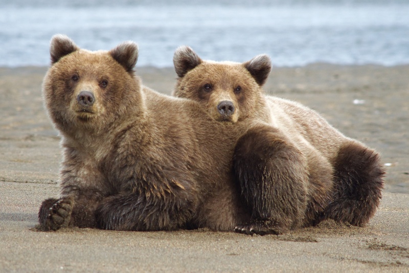 A quick word about the place...Flag as inappropriate ›Established in 1980 by the Alaska National Interest Lands Conservation Act, Lake Clark National Park and Preserve is a United States National Park in southwestern Alaska. The park includes many streams and lakes vital to the Bristol Bay salmon fishery. The park allows a wide variety of recreational activities year-round. Lake Clark has been called "the essence of Alaska", for it concentrates in a relatively small area of the Alaska Peninsula, Southwest of Anchorage, a variety of features not found together in any of the other Alaska Parks: the junction of three mountain ranges, (the Alaska Range from the North, the Aleutian Range from the South, and the park's own rugged Chigmit Mountains), two active volcanoes (Iliamna and Redoubt), a coastline with rainforests on the East (similar to South East Alaska), a plateau with tundra on the West (similar to Arctic Alaska), and turquoise lakes. No roads lead to the park and it can...SHOW MORE
 -
Explore Kings Canyon National Park, California
 A quick word about the place...Flag as inappropriate ›Kings Canyon National Park is a U.S. National Park in the southern Sierra Nevada, east of Fresno, California. The park was established in 1940 and covers 462,901 acres (187,329 ha). It incorporated General Grant National Park, established in 1890 to protect the General Grant Grove of Giant Sequoias. The park is north of and contiguous with Sequoia National Park; the two are administered by the National Park Service together. Kings Canyon National Park consists of two sections. The small, detached General Grant Grove section preserves several groves of giant sequoias, including the General Grant Grove, with the famous General Grant Tree, and the Redwood Mountain Grove, which is the largest remaining natural grove of giant sequoias in the world (covering 3,100 acres (1,300 ha) and with 15,800 sequoia trees over one foot 1 foot (30 cm) in diameter at their bases). The park's Giant Sequoia forests are part of 202,430 acres (81,920...SHOW MORE
 -
Explore Pinnacles National Park, California
 A quick word about the place...Flag as inappropriate ›Pinnacles National Park is a protected mountainous area located east of central California's Salinas Valley, about 5 miles (8.0 km) east of Soledad and about 80 miles (130 km) southeast of San Francisco. The park's namesakes are the eroded leftovers of half of an extinct volcano. The national park is divided by the rock formations into East and West Divisions, connected by foot trails; there is no through road that connects the east and west entrances to the park. The east side has shade and water, the west has high walls. The rock formations provide for spectacular pinnacles that attract rock climbers. It is popular with advanced rock climbers due to the many difficult and challenging climbs. The park is most often visited in spring or fall because of the intense heat during the summer months. There are several trails for day hikers, some of which are strenuous. The trails provide views of the surrounding hills and valleys on...SHOW MORE
 -
Explore Kenai Fjords National Park, Alaska
 A quick word about the place...Flag as inappropriate ›Kenai Fjords National Park is a United States National Park established in 1980 by the Alaska National Interest Lands Conservation Act. The park covers an area of approximately 1,760 sq mi (4,600 km2) on the Kenai Peninsula in southcentral Alaska, near the town of Seward. The park contains the Harding Icefield, one of the largest ice fields in the United States. The park is named for the numerous fjords carved by glaciers moving down the mountains from the ice field. The field is the source of at least 38 glaciers, the largest of which is Bear Glacier. Seward is a departure point and destination for large cruise ships from Celebrity Cruises, Holland America Line, Royal Caribbean International and others. Passenger traffic through Seward is projected at 68,000 for 2013. Cruise tours originating from Seward provide access to the park via Resurrection Bay. Various companies offer tours, many guided by National Park Rangers. The...SHOW MORE
 -
Explore Congaree National Park, South Carolina
 A quick word about the place...Flag as inappropriate ›Congaree National Park preserves in South Carolina is the largest tract of old growth bottomland hardwood forest left in the United States. The lush trees growing in this floodplain forest are some of the tallest in the Eastern U.S., forming one of the highest natural canopies remaining in the world. The Congaree River flows through the park. In addition to being a designated Wilderness Area, an International Biosphere Reserve, a Globally Important Bird Area and a National Natural Landmark, Congaree National Park features primitive campsites and offers hiking, canoeing, kayaking, and bird watching. Bald cypress is a common tree in the park. Large animals possibly seen in the park include bobcats, deer, feral pigs, feral dogs, coyotes, armadillos andturkeys. Its waters contain interesting creatures like amphibians, turtles, snakes, alligators, and many types of fish, including bowfin, largemouth bass, panfish, and catfish...SHOW MORE
 -
Explore Indiana Dunes National Park, Indiana
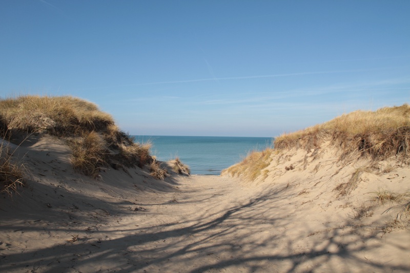 A quick word about the place...Flag as inappropriate ›Indiana Dunes National Park is a unit of the National Park System designated as a U.S. National Park located in northwest Indiana and managed by the National Park Service. It was authorized by Congress in 1966 as the Indiana Dunes National Lakeshore, the name by which it was known until 2019. The national park runs for nearly 25 miles (40 km) along the southern shore of Lake Michigan, in Chesterton, Indiana, and contains approximately 15,000 acres (6,100 ha). The National Park has acquired about 95% of the property within the authorized boundaries. Its holdings are non-contiguous and include the 2,182-acre (883 ha) Indiana Dunes State Park (1925), which is owned and managed by the state of Indiana. The park is physically divided into 15 disconnected pieces. Along the lakefront, the eastern area is roughly the lake shore south to U.S. 12 or U.S. 20 between Michigan City, Indiana, on the east and the ArcelorMittal steel plant on...SHOW MORE
 -
Explore National Park of American Samoa
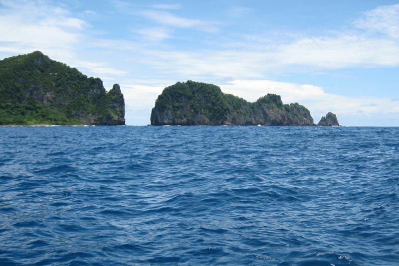 A quick word about the place...Flag as inappropriate ›The National Park of American Samoa is a national park on the American territory of American Samoa, distributed across three separate islands: Tutuila, Ofu-Olosega, and Ta‘ū. The Tutuila unit of the park is on the north end of the island near Pago Pago. It is separated by Mount Alava (1,610 feet (490 m)) and the Maugaloa Ridge and includes the Amalau Valley, Craggy Point, Tafeu Cove, and the islands of Pola and Manofa. It is the only part of the park accessible by car and attracts the vast majority of people. The park lands include a trail to the top of Mount Alava and historic World War II gun emplacement sites at Breakers Point and Blunt's Point. The trail runs along the ridge in dense forest, north of which the land slopes steeply away to the ocean. Ofu and Olosega can be accessed by small plane from the airport on Tutuila to Ofu. Accommodations are available on Ofu at the airport and at Asaga. Ta‘ū can be...SHOW MORE
 -
Explore Isle Royale National Park, Michigan
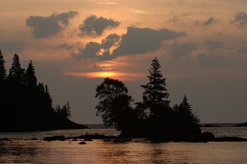 A quick word about the place...Flag as inappropriate ›Isle Royale National Park is a U.S. National Park in the state of Michigan. Isle Royale, the largest island in Lake Superior, is over 45 miles (72 km) in length and 9 miles (14 km) wide at its widest point. The park is made of Isle Royale itself and approximately 400 smaller islands, along with any submerged lands within 4.5 miles (7.24 km) of the surrounding islands. Isle Royale National Park was established on April 3, 1940, was designated as a Wilderness Area in 1976, and was made an International Biosphere Reserve in 1980. It is a relatively small national park at 894 square miles (2,314 km²), with only 209 square miles (542 km²) above water. At the U.S.-Canada border, it will meet the borders of the future Canadian Lake Superior National Marine Conservation Area. The Greenstone Ridge is a high ridge in the center of the island and carries the longest trail in the park, the Greenstone Ridge Trail, which runs 40...SHOW MORE
 -
Explore Big Bend National Park, Texas
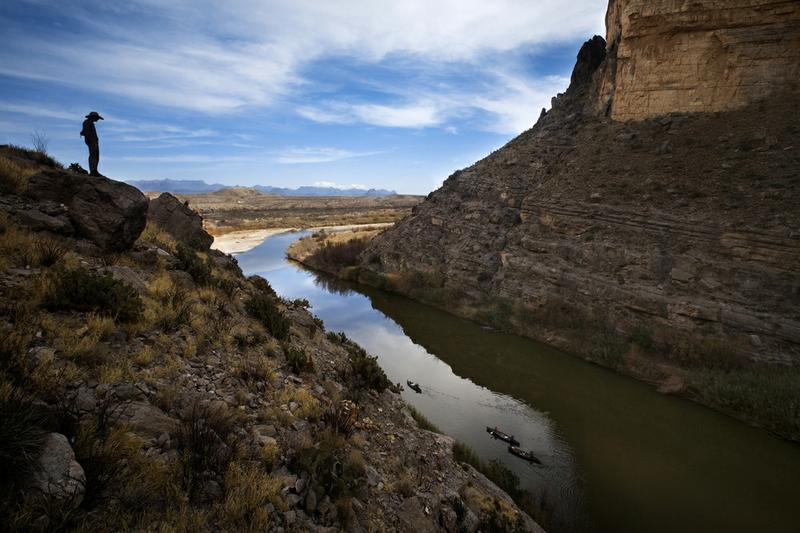 A quick word about the place...Flag as inappropriate ›Big Bend National Park is a national park located in the U.S. state of Texas. For more than 1,000 miles (1,600 km), the Rio Grande/Río Bravo forms the international boundary between Mexico and the United States, and Big Bend National Park administers approximately 244 miles (393 km) along that boundary. The park was named after the area, which is bounded by a large bend in the Texas-Mexico border (see map at right below). Big Bend National Park has national significance as the largest protected area of Chihuahuan Desert topography and ecology in the United States, which includes more than 1,200 species of plants, more than 450 species of birds, 56 species of reptiles, and 75 species of mammals. The park covers 801,163 acres (1,252 sq mi; 3,242 km2). Few areas exceed the park's value for the protection and study of geologic and paleontologic resources. Cretaceous and Tertiary fossil organisms exist in variety and...SHOW MORE
 -
Explore New River Gorge National Park and Preserve, West Virginia
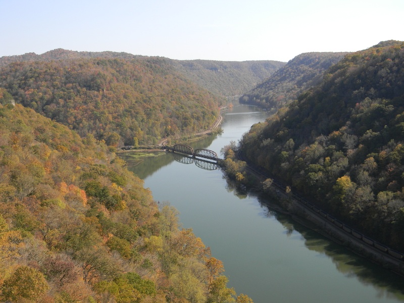 A quick word about the place...Flag as inappropriate ›The New River Gorge National Park and Preserve is a unit of the United States National Park Service designed to protect and maintain the New River Gorge in southern West Virginia in the Appalachian Mountains. Established in 1978 as a national river, the NPS-protected area stretches for 53 miles (85 km) from just downstream of Hinton to Hawks Nest State Park near Ansted. The park is rich in cultural and natural history and offers an abundance of scenic and recreational opportunities. New River Gorge is also home to some of the country's best whitewater rafting, mainly from the Cunard put-in to the Fayette Station take-out. New River Gorge is also one of the most popular climbing areas on the east coast with over 1,400 established rock climbs. The cliffs at "The New" are located just below the rim of the gorge and are made up of a very hard Nuttall sandstone. The rock is very featured, and an abundance of crack and face routes...SHOW MORE
Check out other Dreams from this list
-
1.
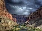 Explore Grand Canyon...
-
2.
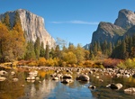 Explore Yosemite National...
-
3.
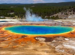 Explore Yellowstone...
-
4.
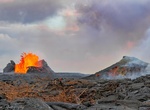 Explore Hawaii Volcanoes...
-
5.
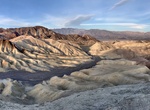 Explore Death Valley...
-
6.
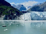 Explore Glacier Bay...
-
7.
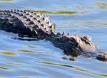 Explore Everglades...
-
8.
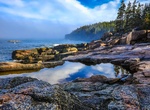 Explore Acadia National...
-
9.
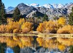 Explore Zion National...
-
10.
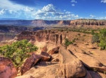 Explore Capitol Reef...
-
11.
 Explore Canyonlands...
-
12.
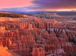 Explore Bryce Canyon...
-
13.
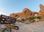 Explore Arches National...
-
14.
 Explore Haleakalā...
-
15.
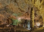 Explore Carlsbad Caverns...
-
16.
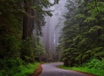 Explore Redwood National...
-
17.
 Visit Gateway Arch...
-
18.
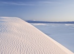 Explore White Sands...
-
19.
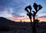 Explore Joshua Tree...
-
20.
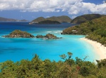 Explore Virgin Islands...
-
21.
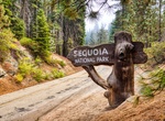 Explore Sequoia National...
-
22.
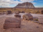 Explore Petrified Forest...
-
23.
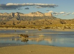 Explore Guadalupe...
-
24.
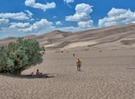 Explore Great Sand Dunes...
-
25.
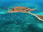 Explore Dry Tortugas...
-
26.
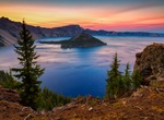 Explore Crater Lake...
-
27.
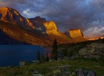 Explore Glacier National...
-
28.
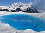 Explore Wrangell–St...
-
29.
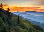 Explore Great Smoky...
-
30.
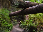 Explore Olympic National...
-
31.
 Explore Mammoth Cave...
-
32.
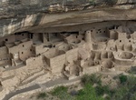 Explore Mesa Verde...
-
33.
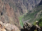 Explore Black Canyon of...
-
34.
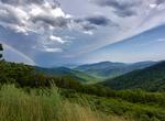 Explore Shenandoah...
-
35.
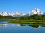 Explore Grand Teton...
-
36.
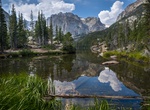 Explore Rocky Mountain...
-
37.
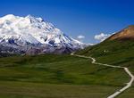 Explore Denali National...
-
38.
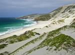 Explore Channel Islands...
-
39.
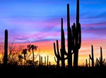 Explore Saguaro National...
-
40.
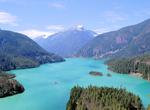 Explore North Cascades...
-
41.
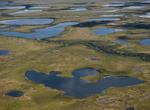 Explore Kobuk Valley...
-
42.
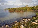 Explore Biscayne National...
-
43.
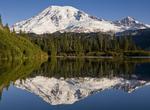 Explore Mount Rainier...
-
44.
 Explore Hot Springs...
-
45.
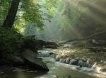 Explore Cuyahoga Valley...
-
46.
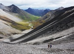 Explore Gates of the...
-
47.
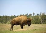 Explore Wind Cave...
-
48.
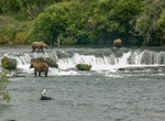 Explore Katmai National...
-
49.
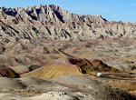 Explore Badlands National...
-
50.
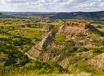 Explore Theodore...
-
51.
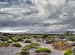 Explore Great Basin...
-
52.
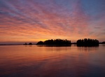 Explore Voyageurs...
-
53.
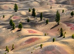 Explore Lassen Volcanic...
-
54.
 Explore Lake Clark...
-
55.
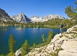 Explore Kings Canyon...
-
56.
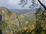 Explore Pinnacles...
-
57.
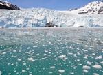 Explore Kenai Fjords...
-
58.
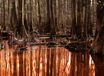 Explore Congaree National...
-
59.
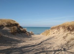 Explore Indiana Dunes...
-
60.
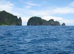 Explore National Park of...
-
61.
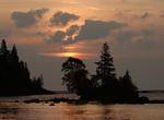 Explore Isle Royale...
-
62.
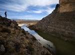 Explore Big Bend National...
-
63.
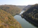 Explore New River Gorge...