Give us feedback!

Visit Top 10 Lowest Points in the World
›Go to Dream PageDream out of
Stats for this Dream
On Your list: -
Your Check-offs: -
Friends with Dream: 0
Total Check-offs: -
Advertisement
-
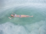
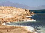
Float in the Dead Sea
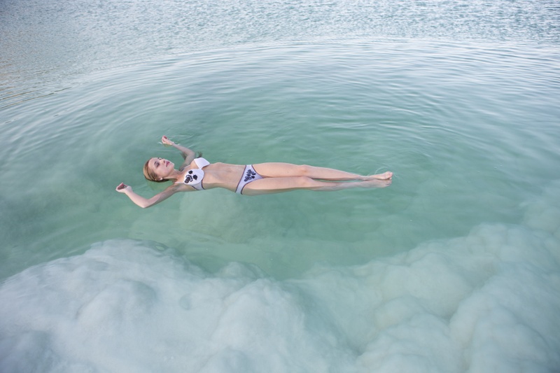 A quick word about the place...Flag as inappropriate ›The Dead Sea is not a sea at all but a lake made up of 30 percent salt, which turns even the skinniest figures into bouyant blobs on the surface. It's better to just sit there and enjoy it. This salty water is meant to be good for the skin and can help with respiration. Make sure to wear shoes, the salt crystals on the bottom are sharp enough to cut your feet. The Dead Sea, also called the Salt Sea, is a salt lake bordering Jordan to the east and Israel and the West Bank to the west. Its surface and shores are 423 metres (1,388 ft) below sea level, the lowest elevation on the Earth's surface on dry land. The Dead Sea is 377 m (1,237 ft) deep, the deepest hypersaline lake in the world. With 33.7% salinity, it is also one of the world's saltiest bodies of water, though Lake Assal (Djibouti), Garabogazköl and some hypersaline lakes of the McMurdo Dry Valleys in Antarctica (such as Don Juan Pond) have reported higher...SHOW MORE
 -
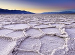
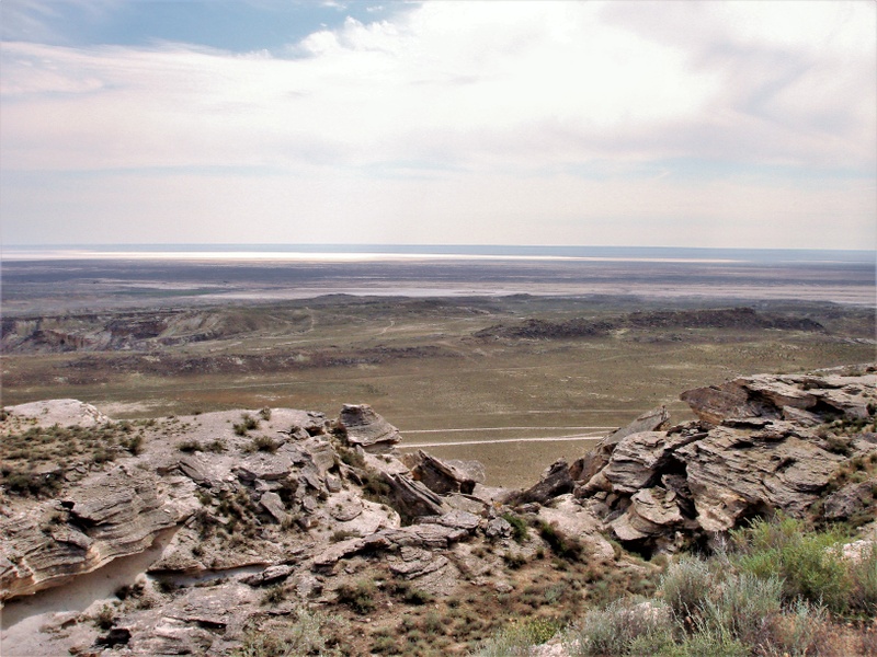
Visit Badwater Basin, Death Valley National Park, California
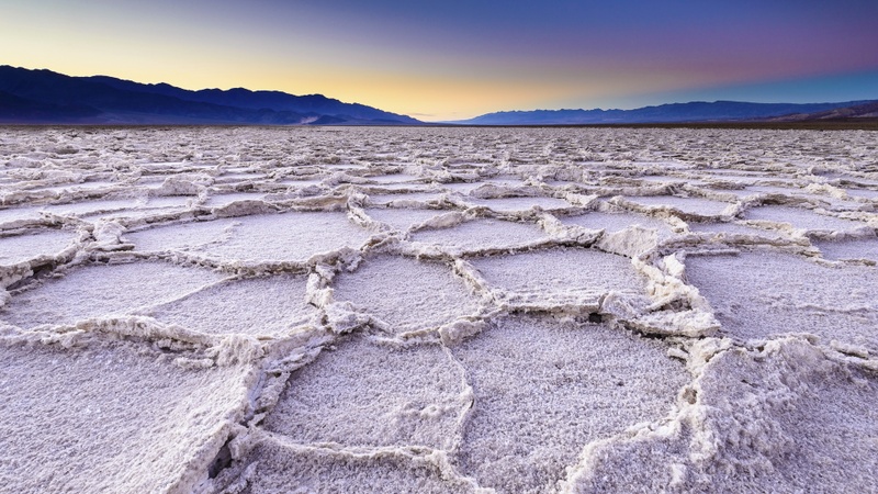 A quick word about the place...Flag as inappropriate ›Badwater Basin is an endorheic basin in Death Valley National Park, Death Valley, Inyo County, California, noted as the lowest point in North America, with an elevation of 282 ft (86 m) below sea level. Mount Whitney, the highest point in the contiguous 48 states, is only 84.6 miles (136 km) to the WNW. The site itself consists of a small spring-fed pool of "bad water" next to the road in a sink; the accumulated salts of the surrounding basin make it undrinkable, thus giving it the name. The pool does have animal and plant life, including pickleweed, aquatic insects, and the Badwater snail. Adjacent to the pool, where water is not always present at the surface, repeated freeze–thaw and evaporation cycles gradually push the thin salt crust into hexagonal honeycomb shapes. The pool itself is not actually the lowest point of the basin: the lowest point (which is only slightly lower) is several miles to the west and varies...SHOW MORE
 -
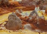
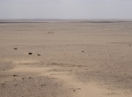
Explore Danakil Desert "Cruelest Place on Earth", Ethiopia
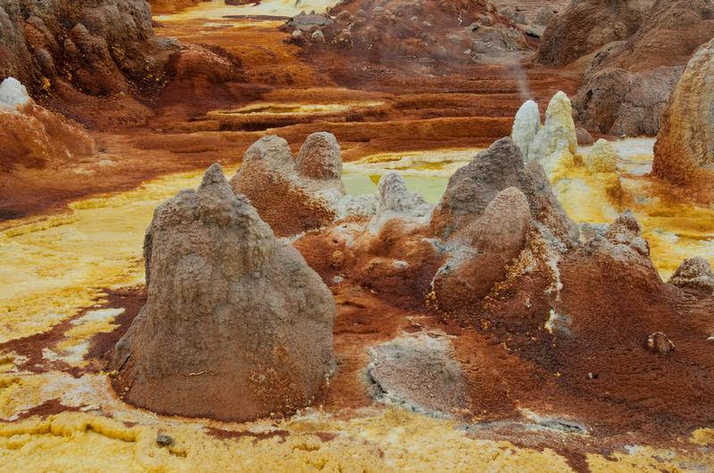 A quick word about the place...Flag as inappropriate ›The Danakil Desert lies in the Afar Triangle. It extends into the north-east of Ethiopia, the south of Eritrea and into much of Djibouti. It is known for its extreme heat and inhospitability. The deepest point in the desert lies up to 100 m below sea level in the Danakil Depression. The Danakil Desert's main industry is salt mining that is still cut by hand and loaded onto camels for transport and it is not uncommon to see caravans of camels making the slow journey through the desert. It is also home to wildlife, including African Wild Asses. Many volcanoes exist in the region, including Erta Ale and the Dabbahu Volcano. It was named by National Geographic as the "Cruelest Place on Earth". The area was subject to a BBC documentary by a BBC correspondent Kate Humble It is the homeland of the Afar people who are known for their ability to withstand the extremes and survive as they have done for hundreds of years.SHOW MORE
 -
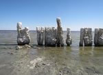
Explore Salton Sea, California
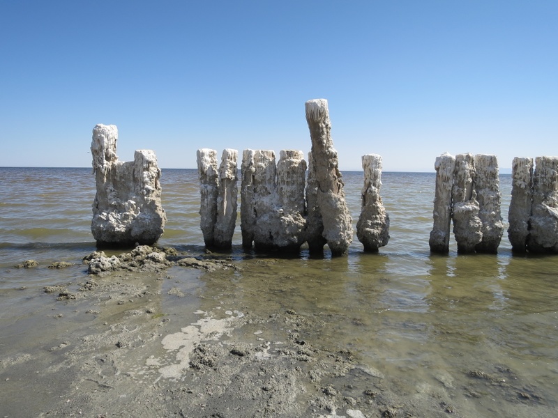 A quick word about the place...Flag as inappropriate ›The Salton Sea is a shallow, saline, endorheic rift lake located directly on the San Andreas Fault, predominantly in California's Imperial and Coachella Valleys. The lake occupies the lowest elevations of the Salton Sink in the Colorado Desert of Imperial and Riverside Counties in Southern California. Its surface is 234.0 ft (71.3 m) below sea level. The deepest point of the sea is 5 ft (1.5 m) higher than the lowest point of Death Valley. The sea is fed by the New, Whitewater, and Alamo Rivers, as well as agricultural runoff, drainage systems, and creeks. Over millions of years, the Colorado River has flowed into the Imperial Valley and deposited soil (creating fertile farmland), building up the terrain and constantly changing the course of the river. For the last thousands of years, the river has flowed into and out of the valley alternately, creating a freshwater lake, an increasingly saline lake, and a dry desert basin...SHOW MORE
 -
Visit Ayding Lake, China
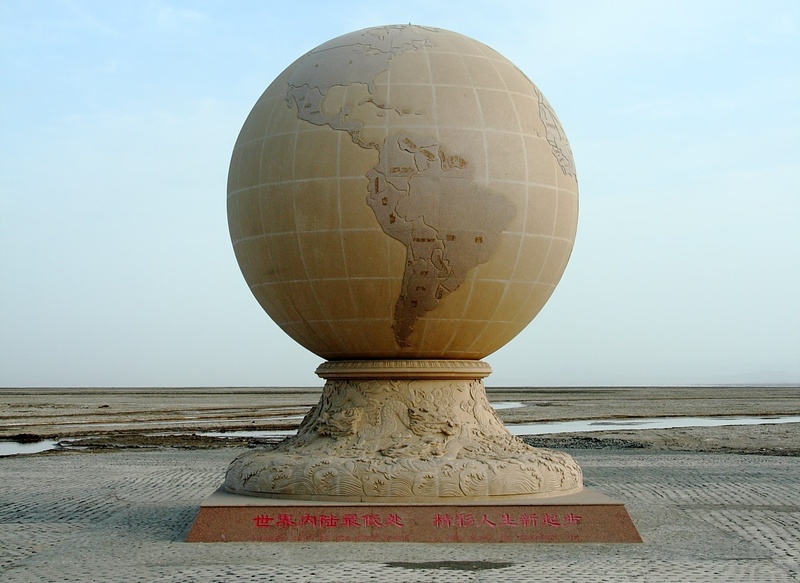 A quick word about the place...Flag as inappropriate ›Aydingkol is a lake in the Turpan Depression, Xinjiang Uyghur Autonomous Region, PR China. At 154 m below sea level, it is the lowest point in China. This lake is now totally dried, and very muddy and salty. In ancient times, Ayding Lake was known asjuéluòwǎn. The Uyghur derived nameAydingkölmeans "moon lake", due to the lake having a layer of white salt along its edge, giving the appearance of a shining moon. The lake is located in the south hinterland of the Turpan Depression, approximately 35 kilometres away from the city of Turpan. From east to west, the lake spans 40 kilometres; the north-south span is 8 kilometres; and the total area of the lake is 200 square kilometres. The lake was formed from the formation of an orogeny of the Himalayas 249 million years ago, and once held approximately 5 million square kilometres of inland sea, which at one time surged up and became vastly extended. During the...SHOW MORE
 -
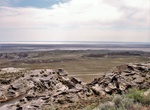
Visit Qattara Depression, Egypt
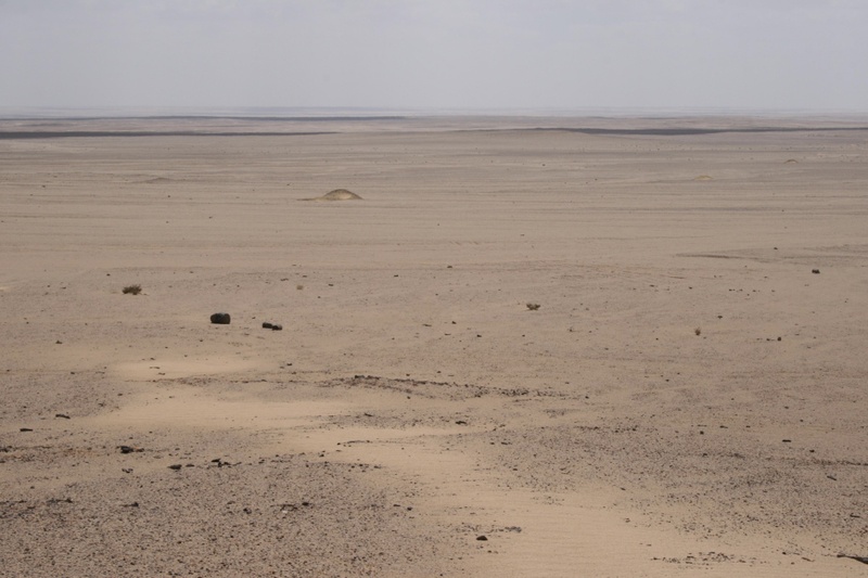 A quick word about the place...Flag as inappropriate ›The Qattara Depression is a depression in northwestern Egypt, specifically in the Matruh Governorate. The depression is part of the Western Desert of Egypt. The Qattara Depression lies below sea level, and its bottom is covered with salt pans, sand dunes, and salt marshes. The depression extends between the latitudes of 28°35' and 30°25' north and the longitudes of 26°20' and 29°02' east. The Qattara Depression was created by the interplay of salt weathering and wind erosion. Some 20 kilometres (10 mi) west of the depression lie the oases of Siwa in Egypt and Jaghbub in Libya in smaller but similar depressions. The Qattara Depression contains the second lowest point in Africa at an elevation of 133 metres (436 ft) below sea level, the lowest point being Lake Assal in Djibouti. The depression covers about 19,605 square kilometres (7,570 sq mi), a size comparable with Lake Ontario or twice as large as Lebanon...SHOW MORE
 -
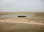
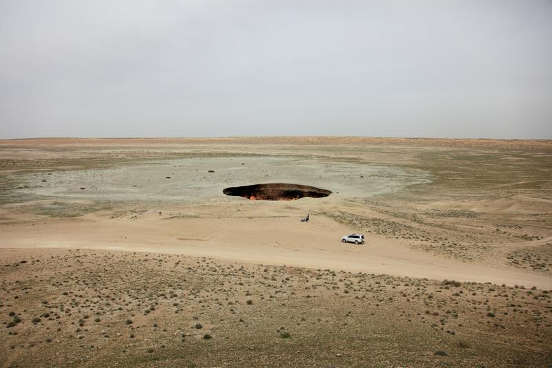
Visit Vpadina Kaundy (Karagiye), Kazakhstan
 A quick word about the place...Flag as inappropriate ›Karagiye is a 40 kilometres (25 mi) long karst trench close to the Caspian Sea. At its lowest point at Vpadina Kaundy, it is approximately 134 metres (440 ft) below sea level. It is the lowest point in Central Asia, Kazakhstan, and the former Soviet Union. It is also known as the Karagiye Depression and Karagiye Mountain Trench. The trench was formed as soluble limestone, dolomite and gypsum dissolved forming potholes, funnels and caves that eventually collapsed. Today the trench features many scarps and offsets and generates long rain clouds caused by the air rising above it. There is a vernal lake in the south-west of the trench and a stream rising from a drilled well that disappears back into the ground within the trench. The trench is inhabited by mouflon, corsac, snakes, hares and vultures. It is the only place within the Mangyshlak Peninsula where mushrooms grow and these are collected by locals.SHOW MORE
 -
Visit Akjagaýa Depression, Turkmenistan
 A quick word about the place...Flag as inappropriate ›Akjagaýa is a depression in the northwest Karakum Desert. It is located to the south of Sarykamyska Valley. It is about 50 km long and 6 km wide. The lowest point is 81 m below sea level, making it the lowest point in Turkmenistan.
 -
Explore Lake Assal (Lac Assal), Djibouti
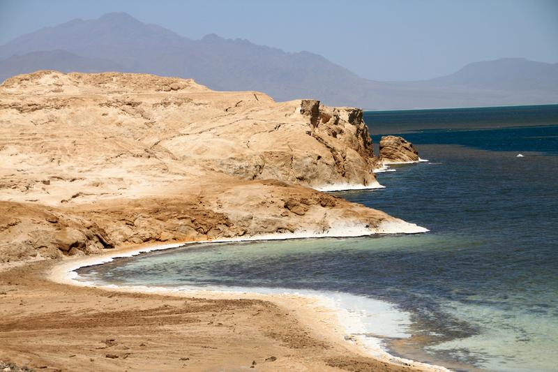 A quick word about the place...Flag as inappropriate ›Lac Assal. 150m below seal level, Lake Assal is the third lowest point on Earth. You'll need to hire a car or ask someone who lives in Djibouti to drive you there. Expect a rough ride: the roads outside the capital are destroyed by the truck traffic between Djibouti and Ethiopia. The road passes within sight of the Devil's Island, and some impressive views. Expect to be awestruck.
 -
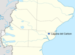
Explore Laguna del Carbón, Patagonia, Argentina
 A quick word about the place...Flag as inappropriate ›Laguna del Carbón (Coal Lagoon) is an endorheic salt lake in the Gran Bajo de San Julián (Great San Julián Depression) of Santa Cruz Province, Argentina, 54 km from Puerto San Julián. At 105 metres (344 ft) below sea level, it is the lowest point of both the Western and Southern Hemispheres, and the seventh lowest point on Earth. As in several other locations in Patagonia, dinosaur fossils have been found in the area.
Check out other Dreams from this list