Give us feedback!

Hike All 46 Adirondack High Peaks (Adirondack Forty-Sixers)
›Go to Dream PageDream out of
Stats for this Dream
On Your list: -
Your Check-offs: -
Friends with Dream: 0
Total Check-offs: -
Advertisement
-
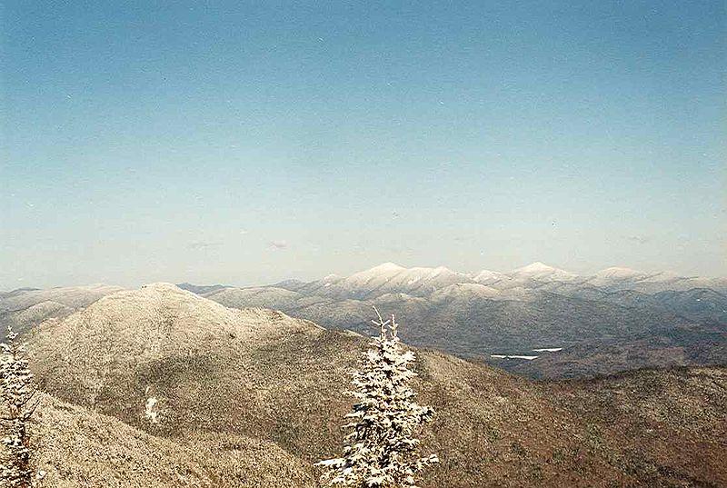
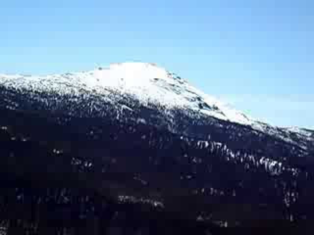
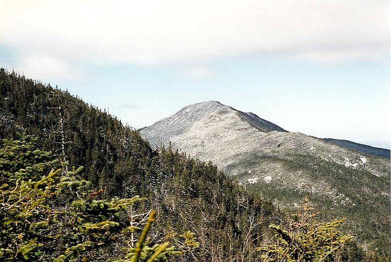
Summit Couchsachraga Peak, New York
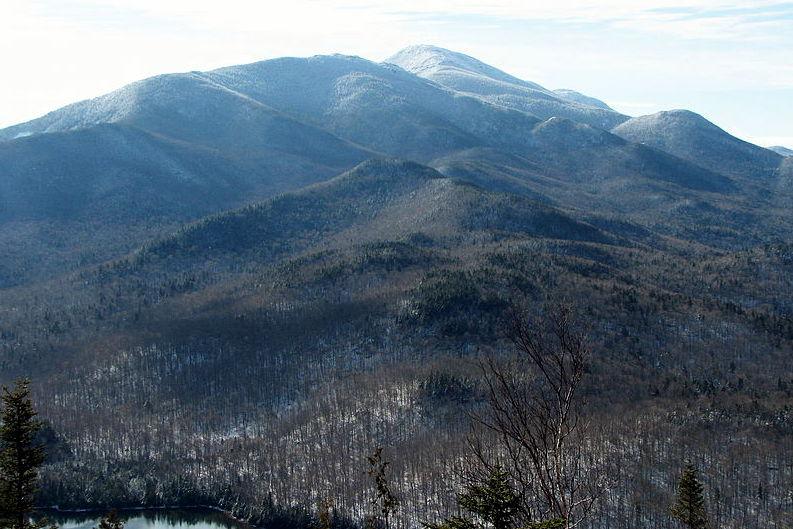
 A quick word about the place...Flag as inappropriate ›Couchsachraga Peak is a mountain located in Essex County, New York. "Couchsachraga" is based on an Algonquin or Huron name for the area, meaning "dismal wilderness". The mountain is part of the Santanoni Mountains of the Adirondacks. Couchsachraga Peak is flanked to the east by Panther Peak. There is no marked trail to the summit, which, being fully forested, has no views. Couchsachraga Peak stands within the watershed of the Cold River, which drains into the Raquette River, the Saint Lawrence River in Canada, and into the Gulf of Saint Lawrence. The southern sides of Couchsachraga drains into Calahan Brook, thence into Moose Creek and the Cold River. The northeast and northern sides of Couchsachraga drains via several brooks into the Cold River. According to the 1897 survey of the Adirondacks, the height of Couchsachraga Peak was over 4,000 feet (1,219 m), so it was included in the 46 High Peaks; the 1953 USGS survey found it...SHOW MORE
 -
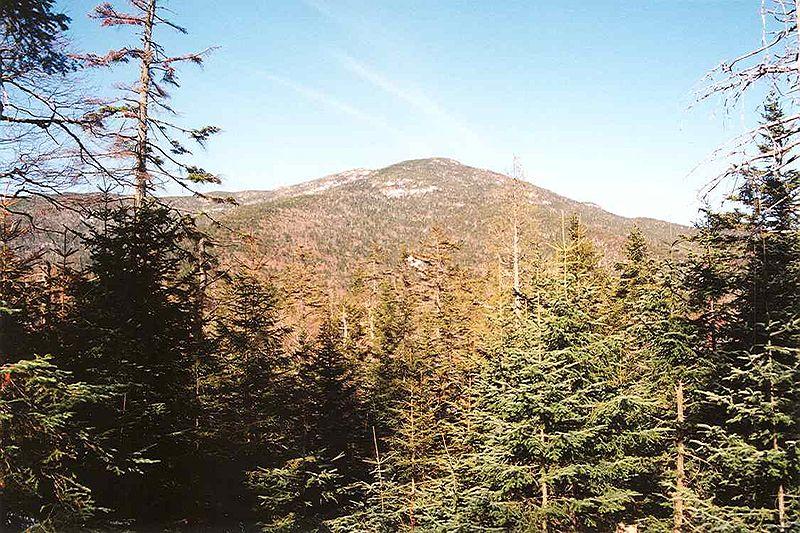
Summit Nye Mountain, New York
 A quick word about the place...Flag as inappropriate ›Nye Mountain is a mountain located in Essex County, New York, named after William B. Nye (c.1815–1893), an Adirondack mountain guide. Nye Mountain is part of the Street Range of the Adirondack Mountains; it is flanked to the southwest by Street Mountain. Nye Mountain stands within the watershed of the West Branch of the Ausable River, which drains into Lake Champlain, thence into Canada's Richelieu River, the Saint Lawrence River, and into the Gulf of Saint Lawrence. The west side of Nye Mtn. drains into the headwaters of the Chubb River, thence into the West Branch. The north end of Nye Mtn. drains into the Chubb River. The east side of Nye Mtn. drains into the northern Indian Pass Brook, thence into the Ausable's West Branch. Nye Mountain is within New York's Adirondack Park. According to the 1901 USGS survey, Nye Mountain's elevation was 4,170 ft (1,271 m), and its peak was 540 ft (165 m) above the col separating it...SHOW MORE
 -
Summit Cliff Mountain, New York
 A quick word about the place...Flag as inappropriate ›Cliff Mountain is a mountain located in Essex County, New York. The mountain is part of the Marcy Group of the Great Range of the Adirondack Mountains. Cliff is flanked to the southeast by Mount Redfield. Cliff Mountain stands within the watershed of the Opalescent River, a tributary of the Hudson River, which in turn drains into New York Bay. The north and west sides of Cliff Mtn. drain directly into the Opalescent River. The southeast side drains into Upper Twin Brook, thence into the Opalescent River. According to the 1897 survey of the Adirondacks, the height of Cliff Mountain was over 4,000 feet (1,219 m), so it was included in the 46 High Peaks; the 1953 USGS survey found it and three other peaks to be lower, but the list has not been changed. Cliff Mtn. is within the High Peaks Wilderness Area of Adirondack State Park. No marked trail leads to its summit.SHOW MORE
 -
Summit Blake Peak, New York
 A quick word about the place...Flag as inappropriate ›Blake Peak (or Blake Mountain) is a mountain located in Essex County, New York. It is one of the 46 Adirondack High Peaks and is located in the Adirondack Park. The mountain is named after Mills Blake (died 1930), Verplanck Colvin’s chief assistant during the Adirondack Survey. It is part of the Colvin Range. Blake Peak is flanked to the northeast by Mount Colvin, and to the southwest by Pinnacle. The northwest side of Blake Peak drains into the East Branch of the Ausable River, between Upper and Lower Ausable Lakes. The Ausable River drains into Lake Champlain, which in turn drains into Canada's Richelieu River, the Saint Lawrence River, and into the Gulf of Saint Lawrence. The southeast side of Blake Peak drains into the West Inlet of Elk Lake, thence into The Branch of the Schroon River, the Hudson River, and into New York Bay. Blake Peak was formerly thought to have an elevation of at least 4,000 ft (1,219 m), so it...SHOW MORE
 -
Summit East Dix, New York
 A quick word about the place...Flag as inappropriate ›East Dix is a mountain located in Essex County, New York. It is one of the 46 Adirondack High Peaks and is located in the Adirondack Park. The northwest side of East Dix drains into the headwaters of the South Fork of the Boquet River, thence into Lake Champlain, which drains into Canada's Richelieu River, the Saint Lawrence River, and into the Gulf of Saint Lawrence. The east side of East Dix drains into Lindsay Brook, thence into the Schroon River, the Hudson River, and into New York Bay. The south side of East Dix drains into West Mill Brook, thence into the Schroon River. East Dix is within the High Peaks Wilderness Area of Adirondack State Park.
 -
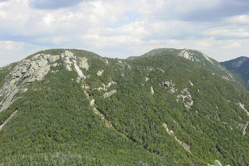
Summit Dial Mountain, New York
 A quick word about the place...Flag as inappropriate ›Dial Mountain is a mountain located in Essex County, New York. The mountain is part of the Colvin Range. Dial Mountain is flanked to the southwest by Nippletop. It is one of the 46 Adirondack High Peaks and is located in the Adirondack Park. Dial Mountain stands within the watershed of Lake Champlain, which drains into Canada's Richelieu River, the Saint Lawrence River, and into the Gulf of Saint Lawrence. The west side of Dial Mountain drains into Gill Brook, thence into the East Branch of Ausable River, and into Lake Champlain. The southeast side of Dial Mountain drains into the headwaters of the North Fork of the Boquet River, thence into Lake Champlain. The northeast side of Dial Mountain drains into Gravestone Brook, thence into the North Fork of the Boquet River.SHOW MORE
 -
Summit Mount Emmons, New York
 A quick word about the place...Flag as inappropriate ›Mount Emmons is a mountain located in Franklin County, New York. The mountain is named after Ebenezer Emmons (1799–1863), a geologist who named the Adirondack Mountains and led the first recorded ascent of Mount Marcy in 1837. The mountain is part of the Seward Mountains of the Adirondacks. Mount Emmons is flanked to the north by Donaldson Mountain. Emmons is the westernmost of the 46 High Peaks. Mount Emmons stands within the watershed of the Cold River, which drains into the Raquette River, the Saint Lawrence River in Canada, and into the Gulf of Saint Lawrence. The east side of Mt. Emmons drains into Seward Brook, thence into the Cold River. The west side of Emmons drains into Boulder Brook, thence into the Cold River. Mount Emmons is within the High Peaks Wilderness Area of Adirondack State Park.SHOW MORE
 -
Summit Mount Colvin, New York
 A quick word about the place...Flag as inappropriate ›Mount Colvin is the 39th highest peak in the High Peaks Region of the Adirondack Mountains, in the state of New York, USA. It is one of the 46 Adirondack High Peaks and is located in the Adirondack Park. Mount Colvin offers excellent views of a number of other Adirondack High Peaks, most notably the peaks that comprise the Great Range. High Peaks that are readily visible from Colvin include Giant, Rocky Peak Ridge, Upper Wolfjaw, Lower Wolfjaw, Armstrong, Sawteeth, Gothics, Saddleback, Basin, Tabletop, Marcy, Haystack, Redfield, Allen, Nippletop, Dial, and Blake. The mountain is named after Verplanck Colvin, an explorer of the Adirondacks and the director of the survey which mapped the region. After naming many other peaks and geographic features, he chose this less-prominent mountain to name after himself.SHOW MORE
 -
Summit Porter Mountain, New York
 A quick word about the place...Flag as inappropriate ›Porter Mountain is in Essex County of New York. It is one of the 46 Adirondack High Peaks and is located in the Adirondack Park. Its name comes from Noah Porter, later president of Yale University and one of the first to climb it. Somewhat overshadowed by its higher and more popular neighbor, Cascade Mountain, with which it is often climbed, Porter is nevertheless rewarding. While it lacks the pseudo-alpine open summit of Cascade, there are nevertheless wide views available from the summit, particularly of the Johns Brook Valley to the east (which Porter blocks from Cascade); it is often less crowded than Cascade. A yellow-blazed trail leaves the trail to Cascade about 0.5 mile (approximately 1 km) short of that mountain's summit, and leads down into the col between the two peaks about 1 mile (1.6 km) to Porter’s summit. It is also possible to follow this trail from its other terminus, over neighboring Blueberry Mountain...SHOW MORE
 -
Summit South Dix, New York
 A quick word about the place...Flag as inappropriate ›South Dix is a mountain located in Essex County, New York. The mountain is part of the Dix Range, named after John A. Dix (1798–1879), New York Secretary of State in 1837, and later Governor. The name is being changed to Carson Peak, after Russell M.L. Carson (1884–1961), author of Peaks and People of the Adirondacks. South Dix is flanked to the northeast by East Dix, to the northwest by Hough Peak, and to the southwest by Macomb Mountain. The north side of South Dix drains into the headwaters of the South Fork of the Boquet River, thence into Lake Champlain, which drains into Canada's Richelieu River, the Saint Lawrence River, and into the Gulf of Saint Lawrence. The southeast side of South Dix drains into West Mill Brook, thence into the Schroon River, the Hudson River, and into New York Bay. The west side of South Dix drains into Lillian Brook, thence into the East Inlet of Elk Lake, and into The Branch of the...SHOW MORE
 -
Summit Cascade Mountain, New York
 A quick word about the place...Flag as inappropriate ›Cascade Mountain is in Essex County of New York. It is one of the 46 Adirondack High Peaks and is located in the Adirondack Park. Its name comes from a series of waterfalls on a brook near the mountain's base. The lake it flows into and the pass between Cascade and Pitchoff mountains are also named Cascade. Cascade Mountain towers over the Van Hoevenberg ski center, the venue for bobsledding at the 1980 Winter Olympics. Of the 46 Adirondack High Peaks, Cascade is the most accessible and the most frequently climbed. The main trailhead is on Route 73, 6 miles (10 km) east of Lake Placid, at Cascade Pass, overlooking Cascade Lake. The summit is visible from the trailhead, a rare occurrence in the High Peaks. The well-used trail follows red plastic markers and takes the hiker up 2.2 miles (4.6 km) and almost 2,000 vertical feet (600 vertical m) to the mountain's bare-rock summit, which, while it resembles the alpine summits found...SHOW MORE
 -
Summit Sawteeth, New York
 A quick word about the place...Flag as inappropriate ›Sawteeth (sometimes Resagonia Mountain or Sawtooth) is a mountain located in Essex County, New York. The mountain is part of the Great Range of the Adirondack Mountains. The mountain's name comes from the serrated appearance of its summit ridge. Sawteeth is on a spur ridge of the Great Range, which branches off to the southeast from Gothics. Sawteeth stands within the watershed of the East Branch of the Ausable River, which drains into Lake Champlain, thence into Canada's Richelieu River, the Saint Lawrence River, and into the Gulf of Saint Lawrence. The west side and south end of Sawteeth drain into Shanty Brook, thence into the East Branch of the Ausable River between Upper and Lower Ausable Lake. The east side and north end of Sawteeth drain into Cascade Brook, thence into the East Branch below Lower Ausable Lake. Sawteeth is within the High Peaks Wilderness Area of Adirondack Park.SHOW MORE
 -
Summit Seymour Mountain, New York
 A quick word about the place...Flag as inappropriate ›Seymour Mountain is a mountain located in Franklin County, New York, named after Horatio Seymour (1810–1886), Governor of New York (1853–1854, 1863–1864). The mountain is part of the Seward Mountains of the Adirondacks. Seymour Mountain faces Seward Mountain to the west across Ouluska Pass. Seymour Mountain stands within the watershed of the Raquette River, which drains into the Saint Lawrence River in Canada, and into the Gulf of Saint Lawrence. The east and southeast slopes of Seymour Mtn. drain via various brooks into the Cold River, a tributary of the Raquette River. The west side of Seymour Mtn. drains into Seward Brook, thence into the Cold River. The northern slopes of Seymour drain into Ward Brook, thence into Ampersand Lake, Ampersand Brook, Stony Creek, and the Raquette River. Seymour Mountain is within the High Peaks Wilderness Area of New York's Adirondack Park.SHOW MORE
 -
Summit Donaldson Mountain, New York
 A quick word about the place...Flag as inappropriate ›Donaldson Mountain is a mountain located in Franklin County, New York, named in 1924 after Alfred Lee Donaldson (1866–1923), author ofA History of the Adirondacks. The mountain is part of the Seward Mountains of the Adirondacks. Donaldson Mtn. is flanked to the northeast by Seward Mountain, and to the south by Mount Emmons. Donaldson Mountain stands within the watershed of the Raquette River, which drains into the Saint Lawrence River in Canada, and into the Gulf of Saint Lawrence. The southeast side of Donaldson Mt. drains into Seward Brook, thence into the Cold River, a tributary of the Raquette River. The southwest end of Donaldson Mt. drains into Boulder Brook, thence into the Cold River. The northwest side of Donaldson drains into Calkins Brook, thence into the Raquette River. Donaldson Mountain is within the High Peaks Wilderness Area of Adirondack State Park.SHOW MORE
 -
Summit Phelps Mountain, New York
 A quick word about the place...Flag as inappropriate ›Phelps Mountain is a mountain located in Essex County, New York. The mountain is named after Orson Schofield "Old Mountain" Phelps (1817–1905), who cut the first trail up Mount Marcy and named several of the Adirondack peaks. Phelps Mountain is flanked to the southeast by Tabletop Mountain. Phelps Mountain stands within the watershed of the West Branch of the Ausable River, which drains into Lake Champlain, thence into Canada's Richelieu River, the Saint Lawrence River, and into the Gulf of Saint Lawrence. The south side of Phelps Mtn. drains into Phelps Brook, thence into Marcy Brook, and the Ausable's West Branch. The northwest side of Phelps Mtn. drains into Pelkey Brook, thence into Marcy Brook. The northeast side of Phelps drains into Klondike Brook, thence into Marcy Brook. Phelps is climbed regularly, and has a well marked trail. The trail is rocky and is very steep in some parts of the final approach to the...SHOW MORE
 -
Summit Big Slide Mountain, New York
 A quick word about the place...Flag as inappropriate ›Big Slide is the twenty-seventh highest peak of the High Peaks Region of the Adirondack Park in New York. The peak was named for the prominent steep cliff that rises to its summit. It is located in the High Peaks Wilderness Area. Because it is relatively close to trail heads and because it offers a close view of the nearby Great Range, Big Slide is a popular day hiking destination. The most popular approach is via theBrothers, a set of rocky crags which offer several views on the way to the summit. It can also be climbed via the Slide Mountain Brook Trail from the Phelps trail in Johns Brook Valley, or combined with Yard Mountain via the Klondike Notch trail (Yard's elevation is 4018 feet, but it is not one of the High Peaks as it is too close to Big Slide).
 -
Summit Allen Mountain, New York
 A quick word about the place...Flag as inappropriate ›Allen Mountain is a mountain located in Essex County, New York. It is part of the Marcy Group of the Great Range of the Adirondack Mountains, and is flanked to the north by Mount Skylight. The south side of Allen Mountain drains into White Lily Brook, thence into the Boreas Ponds, the Boreas River, the Hudson River, and into New York Bay. The southwest side drains into Dudley Brook, thence into the Opalescent River, and the Hudson River. The northwest side drains into Allen Brook, thence into Skylight Brook, and Dudley Brook. The northeast side drains into Marcy Brook, thence into Stillwater Inlet, Upper Ausable Lake, and the Ausable River, which drains into Lake Champlain, and ultimately into Canada's Gulf of Saint Lawrence. The east side drains into Sand Brook, and thence into Stillwater Inlet. Allen Mountain is in the High Peaks Wilderness Area of Adirondack State Park and was named for Frederick B. Allen (1840–1925)...SHOW MORE
 -
Summit Mount Marshall, New York
 A quick word about the place...Flag as inappropriate ›Mount Marshall is a mountain located in Essex County, New York. Originally named for Governor DeWitt Clinton, and then for Herbert Clark, it was renamed for wilderness activist Bob Marshall (1901–1939) after his death. Marshall is part of the MacIntyre Mountains. Mount Marshall is flanked to the northeast by Iroquois Peak, and faces Wallface Mountain to the northwest across Indian Pass. The northeast end of Mount Marshall drains into Cold Brook, thence into Lake Colden, the Flowed Lands, the Opalescent River, the Hudson River, and into New York Bay. The east side of Mt. Marshall drains into Herbert Brook, thence into the Flowed Lands. The southwest end of Mt. Marshall drains into Calamity Brook, thence into the Hudson River. The west side of Marshall drains into the southern Indian Pass Brook, thence into Henderson Lake, the source of the Hudson River. The north side of Marshall drains into the northern Indian Pass...SHOW MORE
 -
Summit Armstrong Mountain, New York
 A quick word about the place...Flag as inappropriate ›Armstrong Mountain is a mountain located in Essex County, New York, named after Thomas Armstrong, a local pioneer. The mountain is part of the Great Range of the Adirondack Mountains. Armstrong Mtn. is flanked to the southwest by Gothics, and to the northeast by Upper Wolfjaw Mountain. Armstrong Mountain stands within the watershed of the East Branch of the Ausable River, which drains into Lake Champlain, thence into Canada's Richelieu River, the Saint Lawrence River, and into the Gulf of Saint Lawrence. The east side of Armstrong Mtn. drains into the East Branch of the Ausable River. The west side of Armstrong Mtn. drains into Ore Bed Brook, thence into Johns Brook and the East Branch. Armstrong Mountain is within the High Peaks Wilderness Area of Adirondack State Park.SHOW MORE
 -
Summit Rocky Peak Ridge, New York
 A quick word about the place...Flag as inappropriate ›Rocky Peak Ridge is the twentieth highest peak in the High Peaks Region of the Adirondack Park of New York, USA. The name of the mountain is due to its geology, a rocky ridge to the east of the better known Giant Mountain. The long, bare ridge is unusual in the Adirondacks; it resulted from the last great forest fire in the region, in 1913. Ascents There are two trails leading to the top of the peak. One trail, leaving from the town of New Russia is about a ten mile round trip with few step rock scrambles along the way. The more commonly used trail splits from the giant mountain trail from about .1 miles below Giant's summit. The trail goes very steeply down for about .4 miles and hen goes gently uphill for .8 miles. Views Rocky Ridge Peaks view is commonly underestimated. Although the mountain lies in the shadow of Giant Mountain's cone-like summit, Rocky Peak Ridge gives completely unobstructed 360 degree views. The views of...SHOW MORE
 -
Summit Table Top Mountain, New York
 A quick word about the place...Flag as inappropriate ›Table Top Mountain is a mountain located in Essex County, New York. Table Top Mtn. is flanked to the north by Phelps Mountain, and to the south by Mount Marcy. Table Top has three summits; the southernmost is the highest, followed by the middle peak (1,312 m) and the north peak (1,285 m). Table Top Mountain stands within the watershed of the Ausable River, which drains into Lake Champlain, thence into Canada's Richelieu River, the Saint Lawrence River, and into the Gulf of Saint Lawrence. The southwest end of Table Top Mtn. drains into Marcy Brook, and the West Branch of the Ausable River. The northwest side of Table Top Mtn. drains into Phelps Brook, thence into Marcy Brook. The north end of Table Top drains into Klondike Brook, thence into the Ausable's West Branch. The southeast side of Table Top drains into Johns Brook, thence into the East Branch of the Ausable River. Table Top Mountain is within the High Peaks Wilderness...SHOW MORE
 -
Summit Panther Peak, New York
 A quick word about the place...Flag as inappropriate ›Panther Peak is a mountain located in Essex County, New York. The mountain is part of the Santanoni Mountains of the Adirondacks. Panther Peak is flanked to the west by Couchsachraga Peak, and to the south by Santanoni Peak. The northeast slopes of Panther Peak drain into Duck Hole pond, the source of the Cold River, which drains into the Raquette River, the Saint Lawrence River in Canada, and into the Gulf of Saint Lawrence. The northwest slopes of Panther Peak drain into the Cold River. The southwest slopes of Panther drain into Calahan Brook, thence into Moose Creek and the Cold River. The southeast slopes of Panther drain into Santanoni Brook, Henderson Lake, the source of the Hudson River, and into New York Bay. Panther Peak is within the High Peaks Wilderness Area of New York's Adirondack Park.SHOW MORE
 -
Summit Saddleback Mountain, New York
 A quick word about the place...Flag as inappropriate ›Saddleback Mountain is a mountain located in Essex County, New York. The mountain is part of the Great Range of the Adirondack Mountains. The 0.2 mi (0.32 km) long summit ridge has peaks at each end with a pronounced dip between, giving it the profile of a saddle. Saddleback Mtn. is flanked to the southwest by Basin Mountain, and to the east by Gothics. Saddleback Mountain stands within the watershed of the East Branch of the Ausable River, which drains into Lake Champlain, thence into Canada's Richelieu River, the Saint Lawrence River, and into the Gulf of Saint Lawrence. The southeast end and southwest side of Saddleback Mtn. drain into Shanty Brook, thence into the East Branch of the Ausable River between Upper and Lower Ausable Lake. The northwest end of Saddleback Mtn. drains into Chicken Coop Brook, thence into Johns Brook and the East Branch. The northeast side of Saddleback Mtn. drains into Ore Bed Brook, thence into...SHOW MORE
 -
Summit Nippletop, New York
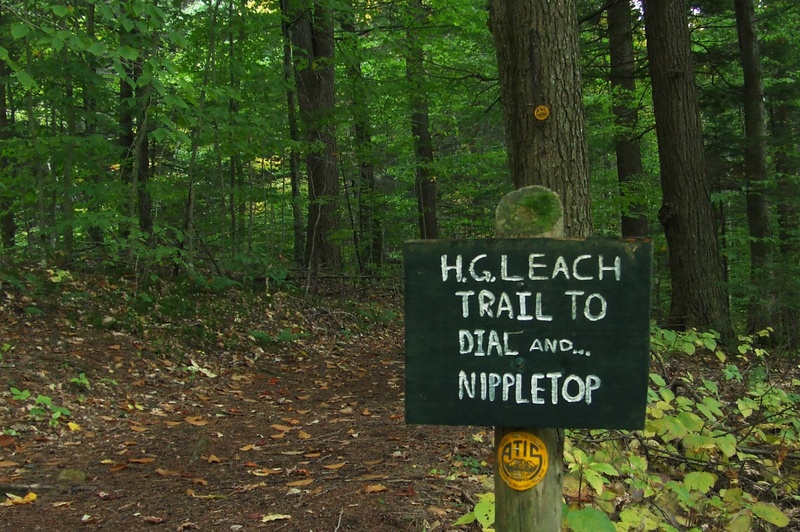 A quick word about the place...Flag as inappropriate ›Nippletop is a mountain located in Essex County, New York. The mountain is part of the Colvin Range. Nippletop is flanked to the northeast by Dial Mountain. To the east, it faces Dix Mountain across Hunters Pass, and to the west it faces Mount Colvin across Elk Pass. The west side of Nippletop drains into the West Inlet of Elk Lake, thence into The Branch of the Schroon River, the Hudson River, and into New York Bay. The south and east sides of Nippletop drain into the East Inlet of Elk Lake. The northeast side of Nippletop drains into the headwaters of the North Fork of the Boquet River, thence into Lake Champlain, which drains into Canada's Richelieu River, the Saint Lawrence River, and into the Gulf of Saint Lawrence. The northwest side of Nippletop drains into Gill Brook, thence into the East Branch of Ausable River, and into Lake Champlain. Nippletop Mountain, 3,018 ft (920 m) high is a different nearby mountain.SHOW MORE
 -
Summit Giant Mountain, New York
 A quick word about the place...Flag as inappropriate ›Giant Mountain is the twelfth highest peak in the High Peaks Region of the Adirondack Park, in New York, USA. The peak is also known as "Giant of the Valley," due to its stature looking over Keene Valley and St. Huberts to the west. The prominent rock slides on the mountain's steep western face and its location away from most other large peaks make it quite an imposing figure, leading to its name. There are three main trails up Giant, one from the east, and two from the west. The two most popular routes begin on trailheads along New York State Route 73, one near St. Huberts ("Roaring Brook Trail") and the other near Chapel Pond ("Zander Scott Trail"). The two trails climb the southern ridge of the mountain, meeting up about a mile south of the summit. The Zander Scott Trail is shorter than the Roaring Brook Trail but steeper. The third trail begins from the east, near the town of New Russia, and is not as commonly climbed due...SHOW MORE
 -
Summit Gothics, New York
 A quick word about the place...Flag as inappropriate ›Gothics is the tenth highest of the High Peaks of the Adirondack Park in New York, USA. Much of the mountain is covered in bare rock slides, which give the mountain its name due to their resemblance to Gothic architecture. The summit has near 360 degree views, which combined with its location in the High Peaks Region, gives splendid views of the Adirondacks.
 -
Summit Basin Mountain, New York
 A quick word about the place...Flag as inappropriate ›Basin is the ninth-highest peak of the High Peaks Region in the Adirondack Park in New York, USA. The peak was named by Verplanck Colvin for several basins formed between knobs on its slopes. It is located in the High Peaks Wilderness Area. A basin is an area of land enclosed by higher land. Basin Mountain is one of the highest peaks in the Great Range. Basin Mountain can be climbed from many trailheads in the Adirondacks. The shortest route would be using the garden trailhead. An excellent hike would be starting at the Roostercomb Trailhead in Keene Valley and climbing the entire Great Range. There are very steep sections of open rock in the Great Range which makes this very challenging. Also the mileage and vertical rise is very considerable which would make this best be done as an overnight trip or a day trip with very light packs. The trail climbs up to a junction below the summit of Roostercomb. That is a four way...SHOW MORE
 -
Summit Dix Mountain, New York
 A quick word about the place...Flag as inappropriate ›Dix Mountain is the sixth highest peak in the High Peaks Region of the Adirondack Park, and is located roughly on the boundary between the towns of North Hudson and Keene in Essex County, New York. The peak was named in 1837 after John Dix (1798–1879), who was the Secretary of State of New York at the time, and later became the state's governor. While it stands somewhat south of the main High Peaks region (and in fact is at the center of its own Dix Mountain Wilderness Area) and is more difficult to reach and steep and challenging to climb, the mountain enjoys great popularity with serious hikers not only due to its status as a required peak for Adirondack Forty-Sixers but for open views of the region from its summit, almost as good as those to be found at nearby Mount Marcy with far less crowds. Dix is also the gateway to four other High Peaks in the Dix Range, all of them, unlike Dix itself, officially trailless...SHOW MORE
 -
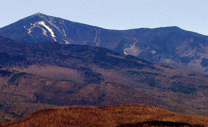
Summit Whiteface Mountain, New York
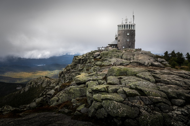 A quick word about the place...Flag as inappropriate ›Whiteface Mountain is the fifth-highest mountain in New York State, and one of the High Peaks of the Adirondack Mountains. Set apart from most of the other High Peaks, the summit offers a 360-degree view featuring the Adirondacks and perhaps on a clear day glimpses of Vermont and even Canada. The skyscrapers of Montreal, 80 miles (130 km) away, can be seen on a very clear day. Located in the town of Wilmington (about 13 miles / 21 kilometers from Lake Placid) the mountain is home to a ski area with the highest vertical drop in the eastern United States (3,430 ft/1,050 m). Part of the post World War II growth in recreational skiing attributed to the efforts of returning veterans of the Army's 10th Mountain Division, Whiteface also hosted the alpine skiing competition of the 1980 Winter Olympics. Unique among the High Peaks, Whiteface features a developed summit and seasonal accessibility by motor vehicle. Whiteface Memorial...SHOW MORE
 -
Summit Mount Skylight, New York
 A quick word about the place...Flag as inappropriate ›Mount Skylight is a mountain in the Great Range of the Adirondack High Peaks in the Adirondack Mountains of New York. It gets its name from its open, bare and relatively flat summit, unusual in the Adirondack High Peaks. A remote summit by any approach, it is nonetheless a favorite of hikers. It is famously distinguished by two large cairns that have grown on either end of the summit over the years, as 46er lore has it that carrying a rock up and placing it on them will ensure good weather. A single trail goes up to the mountain's summit from theFour Cornersjunction between Skylight and Mount Marcy, its northern neighbor; as the name suggests, however, there are three ways to get there. Most commonly, hikers come up from the west, via theFeldspar Brook Trailfrom the campsites at theFlowed Landsand climb the peak in conjunction with a visit to Lake Tear-of-the-Clouds, the source of the Hudson River, and a climb up neighboring...SHOW MORE
 -
Summit Mount Haystack, New York
 A quick word about the place...Flag as inappropriate ›Mount Haystack is a mountain in the Great Range of the Adirondack High Peaks in the Adirondack Mountains of New York. It is the third highest peak in the state, after Algonquin Peak and Mount Marcy. It gets its name from the resemblance of its rounded, conical peak to a haystack. It is north of Mount Redfield. Despite this and the views offered from its bare, alpine summit, it is not visited by as many hikers outside of aspiring members of the Adirondack Forty-Sixers; it is rather remote from the nearest trailhead and the approach from either direction is steep and challenging. The most frequent approach if Haystack is the main goal is to follow theJohns Brook Trailfrom the popular Garden parking area in Keene Valley to thePhelps Trailand then useShorey's Short Cutto get over to theRange Trail. It is possible to combine this with an attempt on Marcy itself, but that makes for a long day and the approach from Panther Gorge is...SHOW MORE
 -
Summit Algonquin Peak, New York
 A quick word about the place...Flag as inappropriate ›Algonquin Peak is in the MacIntyre Range in the town of North Elba, in Essex County, New York. It is the second highest mountain in New York, and one of the 46 Adirondack High Peaks in Adirondack Park. Its name comes from its reputedly being on the Algonquian side of a nearby informal boundary between the Algonquian and their Iroquois neighbors. Algonquin is popular with hikers, accessible from the popular Adirondak Loj trailhead near Heart Lake outside of Lake Placid for a day trip. While shorter than nearby Mount Marcy, it is steeper; requiring almost as much vertical ascent in a considerably shorter distance. The usual route is via the blue-blazed Van Hoevenberg Trail 0.9 miles (1.4 km) to its junction with the yellow-blazed MacIntyre Range Trail and follow that the remaining 3.1 miles (5 km) to the summit, during which the route gets progressively steeper and rockier, going over many steep rock chutes called "slides". The...SHOW MORE
 -
Summit Mount Marcy, New York
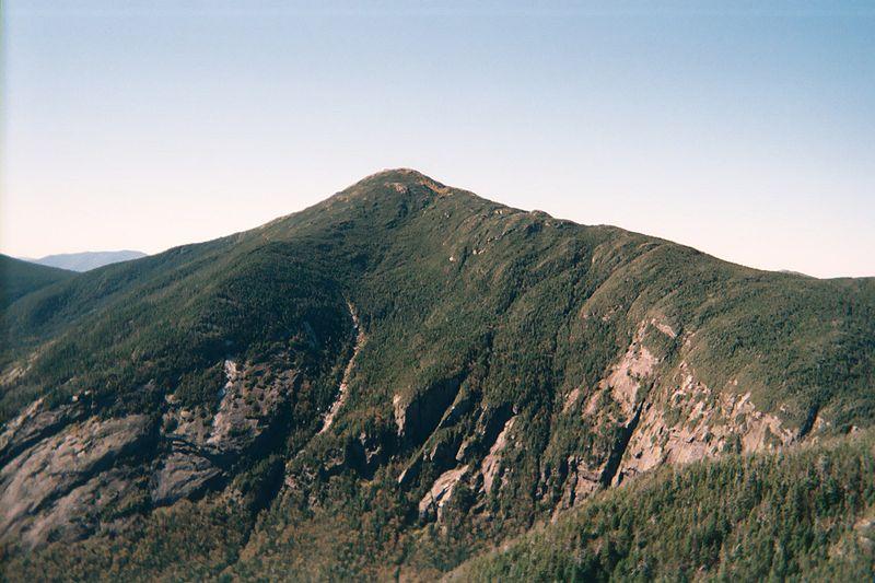 A quick word about the place...Flag as inappropriate ›Mount Marcy is the highest point in New York State, with an elevation of 5,344 feet (1,629 m). It is a popular destination for hikers due to its stature and great views, and the peak can get very crowded in the summer months. Located in Essex County, the mountain is in the heart of the Adirondack High Peaks Region of the High Peaks Wilderness Area. Mount Marcy is one of the High Peaks of the Adirondack Mountains. The majority of the mountain is forested, although the final few hundred feet is above tree line. The peak is dominated by rocky outcrops, lichens, and alpine shrubs. There are two plaques at the top commemorating the centennial of the climb as well as the mountain summit itself. The shortest and most frequently used route up the mountain is from the northwest, the Van Hoevenberg Trail, which starts at the Adirondak Loj near Heart Lake. From there it is 7.4 miles (11.2 km) to the summit, a lengthy roundtrip which can...SHOW MORE
 -
Summit Street Mountain, New York
 A quick word about the place...Flag as inappropriate ›Street Mountain is a mountain located in Essex County, New York, named after Alfred Billings Street (1811–1881), a poet and New York State Librarian. The mountain is the high point of the Street Range of the Adirondack Mountains. Street's northeast ridge is Nye Mountain. Street Mountain stands within the watershed of the Saint Lawrence River, which drains into the Gulf of Saint Lawrence. The southeast, east, and northeast slopes of Street Mtn. drain into the northern Indian Pass Brook, thence into the West Branch of the Ausable River, and Lake Champlain, thence into Canada's Richelieu River, and the Saint Lawrence River. The north and northwest slopes of Street Mtn. drain into the headwaters of the Chubb River, thence into the Ausable's West Branch. The west end of Street Mtn. drains into the northern Moose Creek, and thence into the Cold River, the Raquette River, and the Saint Lawrence River in Canada. The southwest...SHOW MORE
 -
Summit Lower Wolfjaw Mountain, New York
 A quick word about the place...Flag as inappropriate ›Lower Wolfjaw Mountain is located in Essex County, New York. Landscape artist Alexander Helwig Wyant (1836–1892) named Lower Wolfjaw, together with neighboring Upper Wolfjaw Mountain, about 1870 for their appearance in profile. The mountain is the northeasternmost of the Adirondack High Peaks in the Great Range of the Adirondack Mountains. Lower Wolfjaw Mountain is flanked to the southwest by Upper Wolfjaw Mountain, and to the northeast by Hedgehog Mountain. Lower Wolfjaw Mountain stands within the watershed of the East Branch of the Ausable River, which drains into Lake Champlain, thence into Canada's Richelieu River, the Saint Lawrence River, and into the Gulf of Saint Lawrence. The east and southeast sides of Lower Wolfjaw Mtn. drain into Wedge Brook, thence into the East Branch of the Ausable River. The west side of Lower Wolfjaw Mountain drains into Wolfjaw Brook, thence into Johns Brook and the East Branch. The...SHOW MORE
 -
Summit Upper Wolfjaw Mountain, New York
 A quick word about the place...Flag as inappropriate ›Upper Wolfjaw Mountain is a mountain located in Essex County, New York. Landscape artist Alexander Helwig Wyant (1836–1892) named the mountain, in combination with neighboring Lower Wolfjaw Mountain, circa 1870 for their appearance in profile. The mountain is part of the Great Range of the Adirondack Mountains. Upper Wolfjaw Mtn. is flanked to the southwest by Armstrong Mountain, and to the northeast by Lower Wolfjaw Mtn. Upper Wolfjaw Mountain stands within the watershed of the East Branch of the Ausable River, which drains into Lake Champlain, thence into Canada's Richelieu River, the Saint Lawrence River, and into the Gulf of Saint Lawrence. The east and southeast sides of Upper Wolfjaw Mtn. drain into the East Branch of the Ausable River. The west side of Upper Wolfjaw drains into Ore Body Brook, thence into Johns Brook and the East Branch. The north side of Upper Wolfjaw drains into Wolfjaw Brook, thence into Johns...SHOW MORE
 -
Summit Esther Mountain, New York
 A quick word about the place...Flag as inappropriate ›Esther Mountain is a mountain located in Essex County, New York. The mountain is the northernmost of the High Peaks of the Adirondack Mountains and its 28th highest peak. It is the only High Peak named for a woman, in honor of Esther McComb, who made the first recorded climb to the summit in 1839, at age 15; at the time she was attempting to climb Whiteface Mountain from the north (Whiteface is a higher mountain which flanks Esther to the south). Esther Mountain stands within the watershed of Lake Champlain, which drains into Canada's Richelieu River, the Saint Lawrence River, and into the Gulf of Saint Lawrence. The southeast side of Esther Mtn. drains into White Brook, thence into the West Branch of the Ausable River, which drains into Lake Champlain. The southwest and north sides of Esther Mountain drain into Frenchs Brook, thence into the Saranac River, and into Champlain. The Whiteface Mountain Memorial Highway, which was...SHOW MORE
 -
Summit Seward Mountain, New York
 A quick word about the place...Flag as inappropriate ›Seward Mountain is a mountain located in Franklin County, New York, of which it is the highest point. Seward Mtn. is named after William H. Seward (1801–1872), Governor of New York (1839–1842), and United States Secretary of State (1861–1869). The mountain is part of the Seward Mountains of the Adirondacks. Seward Mountain is flanked to the southwest by Donaldson Mountain, and to the east faces Seymour Mountain across Ouluska Pass. Seward Mountain stands within the watershed of the Raquette River, which drains into the Saint Lawrence River in Canada, and into the Gulf of Saint Lawrence. The southeast slopes of Seward Mtn. drain into Seward Brook, thence into the Cold River, a tributary of the Raquette River. The west end of Seward Mtn. drains into Calkins Brook, thence into the Raquette River. The northern slopes of Seward drain into Ward Brook, thence into Ampersand Lake, Ampersand Brook, Stony Creek, and...SHOW MORE
 -
Summit Hough Peak, New York
 A quick word about the place...Flag as inappropriate ›Hough Peak (pronounced "huff") is a mountain located in Essex County, New York. The mountain, part of the Dix Range, is named after Franklin B. Hough (1822–1885), the first chief of the United States Division of Forestry, and sometimes called the "father of American forestry". Hough Peak is flanked to the north by Dix Mountain, and to the south by South Dix. The east side of Hough Peak drains into the headwaters of the South Fork of the Boquet River, thence into Lake Champlain, which drains into Canada's Richelieu River, the Saint Lawrence River, and into the Gulf of Saint Lawrence. The west side of Hough Peak drains into Lillian Brook, thence into the East Inlet of Elk Lake, and into The Branch of the Schroon River, the Hudson River, and into New York Bay. Hough Peak is within the High Peaks Wilderness Area of Adirondack State Park.SHOW MORE
 -
Summit Macomb Mountain, New York
 A quick word about the place...Flag as inappropriate ›Macomb Mountain is a mountain located in Essex County, New York. The mountain is named after Maj.Gen. Alexander Macomb (1782–1841), who won acclaim during the War of 1812 at the Battle of Plattsburgh, and served as Commanding General of the United States Army (1828–1841). Macomb Mountain is part of the Dix Range, and is the southernmost of the High Peaks of the Adirondack Mountains. Macomb is flanked to the northeast by South Dix. Macomb Mountain stands within the watershed of the Schroon River, which drains into the Hudson River, and into New York Bay. The east and northeast sides of Macomb Mtn. drain into West Mill Brook, thence into the Schroon River. The northwest sides of Macomb Mtn. drain into Lillian Brook, thence into the East Inlet of Elk Lake, source of The Branch of the Schroon River. The southwest side of Macomb drains into Slide Brook, thence into the East Inlet of Elk Lake. The southeast slopes of...SHOW MORE
 -
Summit Wright Peak, New York
 A quick word about the place...Flag as inappropriate ›Wright Peak is the 16th highest peak in the High Peaks of the Adirondack Park, and is located in the MacIntyre Range in the town of North Hudson, in Essex County, New York. Named for N.Y. Governor Silas Wright (1795–1847), Wright is the northern-most peak in the MacIntyre Range, and is known to be one of the windiest peaks in the park. There are long slides from the summit that lead to Marcy Dam which are often skied in the winter. The usual approach to Wright Peak is from the Adirondak Loj, heading 1.3 miles (2.1 km) up the Van Hovenberg trail, then ascending the steep MacIntyre Range Trail to the junction for Algonquin Peak; a left turn takes the climber up the last few hundred feet of elevation through the alpine zone. Wright is often hiked in conjunction with Algonquin and sometimes Iroquois Peak by peakbaggers.SHOW MORE
 -
Summit Mount Redfield, New York
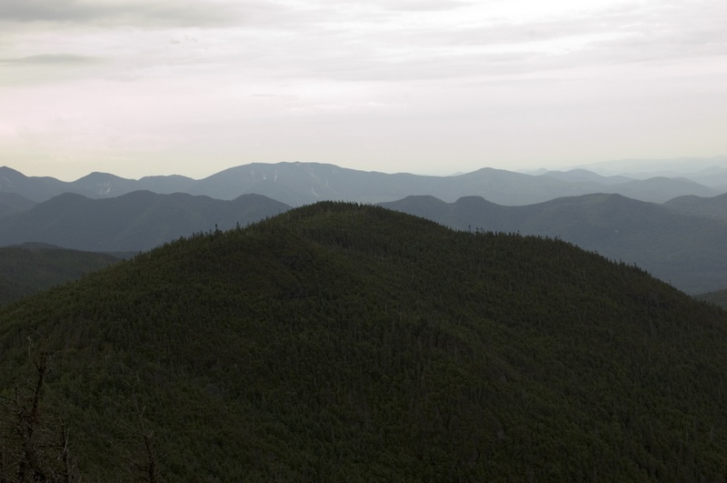 A quick word about the place...Flag as inappropriate ›Mount Redfield is a mountain located in Essex County, New York. The mountain is part of the Marcy Group of the Great Range of the Adirondack Mountains. Mount Redfield is flanked to the northwest by Cliff Mountain, and to the northeast by Mount Skylight. Verplanck Colvin (1847–1920) named Mount Redfield for William C. Redfield (1789–1857), organizer and member of the first expedition to Mount Marcy in 1837, and the first to guess that Marcy was the highest peak in the Adirondacks, and therefore in New York. Mount Redfield stands within the watershed of the Opalescent River, a tributary of the Hudson River, which in turn drains into New York Bay. The northeast and north sides of Mt. Redfield drain into Uphill Brook, thence into the Opalescent River. The west end of Redfield drains into Upper Twin Brook, thence into the Opalescent River. The south side of Redfield drains into Skylight Brook, thence into Dudley Brook...SHOW MORE
 -
Summit Santanoni Peak, New York
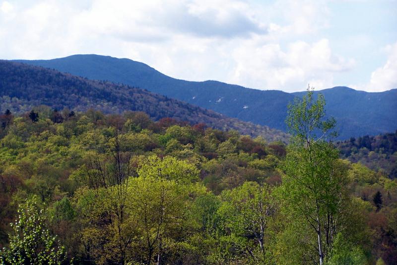 A quick word about the place...Flag as inappropriate ›Santanoni Peak is a mountain located in Essex County, New York. The mountain is part of the Santanoni Mountains of the Adirondacks. The mountain's name is believed to be an Abenaki derivative of "Saint Anthony"; the first French fur traders and missionaries having named the area for Saint Anthony of Padua. Santanoni Peak is flanked to the north by Panther Peak, and to the southwest by Little Santanoni Mountain. The east slopes of Santanoni Peak drain into the eastern Santanoni Brook, thence into Henderson Lake, the source of the Hudson River, and into New York Bay. The south end of Santanoni Peak drains into the southern Santanoni Brook, thence into Newcomb Lake, the Newcomb River, and the Hudson River. The southwest side of Santanoni drains into Ermine Brook, thence into Moose Creek, the Cold River, the Raquette River, the Saint Lawrence River in Canada, and into the Gulf of Saint Lawrence. The west slopes of Santanoni drain...SHOW MORE
 -
Summit Mount Colden, New York
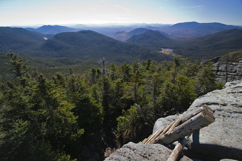 A quick word about the place...Flag as inappropriate ›Mount Colden is the eleventh highest peak in the High Peaks of the Adirondack Mountains, New York, USA. The peak is named after David S. Colden, an investor in the McIntyre Iron Works, in 1836. The peak was briefly renamed "Mount McMartin" the next year, but the older name persisted. The mountain is known for its distinctive Trap Dyke, a large crevice running up the center of the mountain, which can clearly be seen from Avalanche Lake. There are two maintained trails up Mount Colden. The first, which approaches from the northeast, passes by Lake Arnold before ascending the summit after crossing over several false peaks. The second trail, which is steeper, approaches from the southwest, starting from Lake Colden. Both approaches can reached from the popular Adirondak Loj trailhead. After hiking from the Loj to the Avalanche Lean-Tos, climbers can head southwest through Avalanche Pass and past Avalanche Lake to reach Lake Colden...SHOW MORE
 -
Summit Iroquois Peak, New York
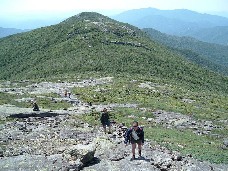 A quick word about the place...Flag as inappropriate ›Iroquois Peak is 8th highest peak in the Adirondack Mountains in New York State, and is part of the MacIntyre Range, which also includes Wright Peak, Mount Marshall, and Algonquin Peak. Although the mountain does not have an officially maintained trail, a well maintained "herd path" leads to the summit from the northeast.
 -
Summit Gray Peak, New York
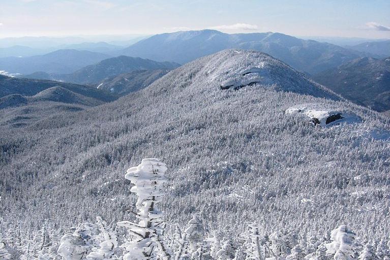 A quick word about the place...Flag as inappropriate ›Gray Peak is the seventh highest peak in the High Peaks Region of the Adirondack Park, in New York, USA, and is located in close proximity to Mount Marcy, the highest peak in New York state. Gray Peak is flanked to the east of Mount Colden. It was named for Asa Gray by Verplanck Colvin. Gray Peak is most frequently climbed from Lake Tear of the Clouds, with approaches via Elk Lake or Upper Works. Gray is the highest peak in the Adirondacks without a maintained and marked trail. This fact, combined with the somewhat limited view from Gray's summit, means that it is less frequently climbed than many shorter peaks. Gray Peak is one of the Adirondack Forty-Sixers. In winter the easiest way to get there is to descend the West side of Marcy and up and along the ridgeline to the summit. Depending on snow conditions this can be an easy ski or a dangerous ice ridge walk through iced-over bush and cliffs. In summer this route is easy...SHOW MORE
Check out other Dreams from this list
-
1.
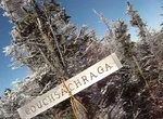 Summit Couchsachraga...
-
2.
 Summit Nye Mountain, New...
-
3.
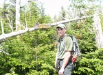 Summit Cliff Mountain...
-
4.
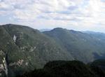 Summit Blake Peak, New...
-
5.
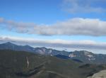 Summit East Dix, New York
-
6.
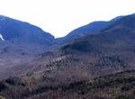 Summit Dial Mountain, New...
-
7.
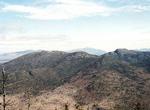 Summit Mount Emmons, New...
-
8.
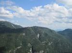 Summit Mount Colvin, New...
-
9.
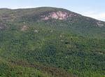 Summit Porter Mountain...
-
10.
 Summit South Dix, New...
-
11.
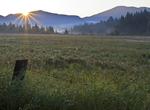 Summit Cascade Mountain...
-
12.
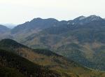 Summit Sawteeth, New York
-
13.
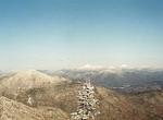 Summit Seymour Mountain...
-
14.
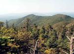 Summit Donaldson...
-
15.
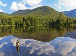 Summit Phelps Mountain...
-
16.
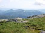 Summit Big Slide...
-
17.
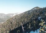 Summit Allen Mountain...
-
18.
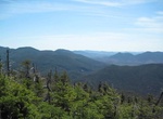 Summit Mount Marshall...
-
19.
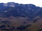 Summit Armstrong...
-
20.
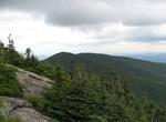 Summit Rocky Peak Ridge...
-
21.
 Summit Table Top...
-
22.
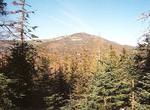 Summit Panther Peak, New...
-
23.
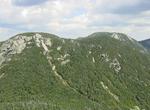 Summit Saddleback...
-
24.
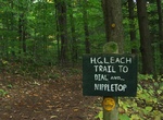 Summit Nippletop, New...
-
25.
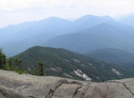 Summit Giant Mountain...
-
26.
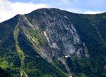 Summit Gothics, New York
-
27.
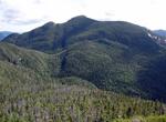 Summit Basin Mountain...
-
28.
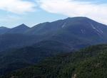 Summit Dix Mountain, New...
-
29.
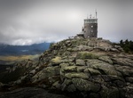 Summit Whiteface...
-
30.
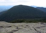 Summit Mount Skylight...
-
31.
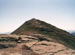 Summit Mount Haystack...
-
32.
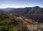 Summit Algonquin Peak...
-
33.
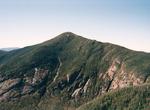 Summit Mount Marcy, New...
-
34.
 Summit Street Mountain...
-
35.
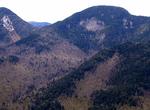 Summit Lower Wolfjaw...
-
36.
 Summit Upper Wolfjaw...
-
37.
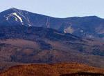 Summit Esther Mountain...
-
38.
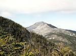 Summit Seward Mountain...
-
39.
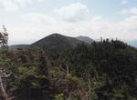 Summit Hough Peak, New...
-
40.
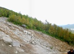 Summit Macomb Mountain...
-
41.
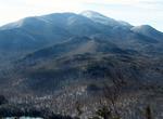 Summit Wright Peak, New...
-
42.
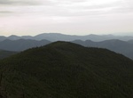 Summit Mount Redfield...
-
43.
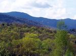 Summit Santanoni Peak...
-
44.
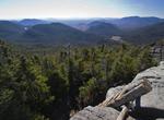 Summit Mount Colden, New...
-
45.
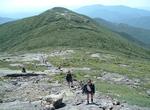 Summit Iroquois Peak, New...
-
46.
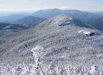 Summit Gray Peak, New...