Give us feedback!


 See all

Our philosophy is simple. We want to encourage you to dream. BIG! Then we help you plan your trip, get the most out of it while you're traveling and help you share your experience with friends.
Join Now It's FREE
Dream Packages
Duration: 8 hours
Price: $214.32
Price: $214.32
Duration: 2 days
Price: $469.00
Price: $469.00
Duration: 4 hours
Price: $129.99
Price: $129.99
Duration: 2 days
Price: $779.00
Price: $779.00
Related Categories
- Australian National Parks & Reserves
- Canadian National Parks
- Canyoneering
- Day Hikes
- Guided Hikes
- In the Mountains
- Mountaineering
- Mountains
- New Zealand Great Walks
- New Zealand National Parks
- Parks & Reserves
- Rock Climbing
- South African National Parks
- UK National Parks
- UNESCO Parks & Preserves
- US Historical Parks (NHP)
Dreams Still To Do
Checked-Off Dreams
Dreams Still To Do
Checked-Off Dreams
Advertisement
Explore Hikes & Treks
-
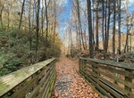
Visit Cunard River Access, New River, West Virginia
Take Cunard River Access Road to the public put in spot on the New River. -
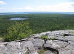
Hike Cup and Saucer Trail, Manitoulin Island, Lake Huron, Canada
With its dramatic 70 metre cliffs and breathtaking views, this loop trail to the top of the Niagara Escarpment, offering views over West Bay & Lake Manitou. -
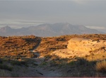
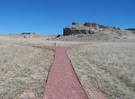
Hike Curtis Bench Trail, Goblin Valley State Park, Utah
The Curtis Bench Trail is accessed alongside the Entrada Canyon Trail and runs parallel to it, but at a higher elevation. It is named for the grey-green Curtis layer of sand and silt stone that covers many of the upland regions of the park. From this vantage point, hikers are awarded sweeping vistas of the Henry Mountains to the south, as well as the Valley of Goblins... -
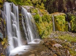
Hike Curtis Falls Track, Egmont National Park, New Zealand
Walk to Curtis Falls and enjoy a dip in the shallow pool beneath the falls. Follow the Curtis Falls Track from the car park at Ngāti Ruanui Stratford Mountain House, turning right down steps into the valley of the Te Popo Stream. Steps and ladders up the other side lead steeply uphill before dropping sharply to the gorge of the Manganui River. Follow the river bed, ro... -
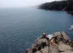
Hike and Camp Cutler Coast Trail, Maine
Cutler coast is a public reserve land with hiking trail & primitive camping on the coast of down east Maine. Those seeking a taste of wilderness along Maine's coast will enjoy exploring the Cutler Coast Public Lands, a 12,234-acre expanse of blueberry barrens, woodlands and peatlands with 4.5 miles of headlands (interspersed by pocket coves and cobble beaches) ove... -
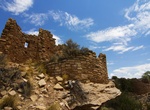
Off-road and Hike to Cutthroat Castle Group, Hovenweep National Monument, Colorado
Trailheads are down an unimproved dirt road that is 8.5 miles from the visitor center. Stop by the visitor center for directions and road conditions. From the upper trailhead, the trail to Cutthroat Castle winds through a hip-height slot in boulders, then opens up to regular primitive trail. The trail descends through open country, down part of a sandy wash, and along... -
Hike Cuyamaca Peak Trail, Cuyamaca Rancho State Park, California
Cuyamaca Peak is a mountain peak of the Cuyamaca Mountains range, in San Diego County, Southern California. At 6,512 feet (1,985 m), its summit is the second highest point in San Diego County. A popular 3.5-mile (5.6 km) year round hike to the summit of Cuyamaca leads from the Paso Picacho Campground, starting at about 5,000 feet (1,500 m). Cuyamaca Peak is located ro... -
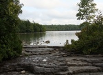
Hike Cyprus Lake Trail, Bruce Peninsula National Park, Ontario, Canada
For the less rugged experience, follow this trail around Cyprus Lake. A watchful eye will note the charred stumps from forest fires of the early 1900s. There are many access trails from the Cyprus campground and campers are encouraged to use this trail as their path to the Head-of-Trails. -
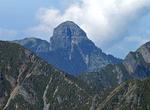
Rock Climb or Hike around Dabajian Mountain, Taiwan
Dabajian Mountain is located in the northern section of the Shei-Pa National Park in Taiwan. It is surrounded by numerous other peaks, the most predominant including Mount Nanhuda, Mount Yize, Mt. Zhongyangjian, Mt. Pintian, and Mt. Mutule. It is also near the Madala River. Dabajian Mountain is known for its steep grade, beautiful surroundings, and rugged terrain, mak... -
Hike Daemonelix Trail, Agate Fossil Beds National Monument, Nebraska
The 1 mile Daemonelix Trail features in situ fossil exhibits of the spiral corkscrew fossil of the Paleocastor, an ancient land beaver that lived here in the Miocene. The trail is open year-round from sunrise to sunset. -
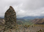
Hike Dale Head, Lake District, England
Dale Head is a fell in the north-western sector of the Lake District, in northern England. It is 753 metres (2,470 feet) above sea level and stands immediately north of Honister Pass, the road between Borrowdale and Buttermere. The North-Western Fells occupy the area between the rivers Derwent and Cocker, a broadly oval swathe of hilly country, elongated on a north-s... -
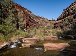
Hike Dales Gorge, Karijini National Park, Western Australia
Dales Gorge hike is a 4-kilometre loop trail along the bottom of the gorge that usually 2 hours for the return walk. The trail continues for another hour to Fortescue Falls and the beautiful Fern Pool. Here you can have a refreshing swim in the spring fed permanent falls. In the cooler months (April-September) the water can be very cold. Dales Gorge is located on the ... -
Hike Damnation Creek Trail, Del Norte Coast Redwoods State Park, California
The Damnation Creek Trail in Del Norte Coast Redwoods State Park, California, offers a steep drop (1100-foot elevation drop) through a virgin redwood forest to a hidden rocky beach on the Pacific coast. The trail is often shrouded in fog from the summer marine layer. Due to it beingon a west-facing hill, this a great late-afternoon hike. At this point other hikes in ... -
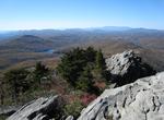
Hike Daniel Boone Scout Trail at Grandfather Mountain, North Carolina
Grandfather Mountain is a mountain and state park near Linville, North Carolina. At 5,946 feet (1,812 m), it is the highest peak on the eastern escarpment of the Blue Ridge Mountains, one of the major chains of the Appalachian Mountains. The Blue Ridge Parkway passes by the south side of the mountain. It is located at the meeting point of Avery, Caldwell (highest poin... -
Hike Dark Hollow Falls Trail, Shenandoah National Park, Virginia
Dark Hollow Falls is one of the closest scenic falls to the Skyline Drive in Shenandoah National Park. Naturalists and photographers Ann and Rob Simpson join NaturePods and EveryTrail to share their love of the natural and cultural history of this very special area. Learn about the CCC, black bears, wildflowers, and enjoy the falls as President Thomas Jefferson did ba...


Price: $224.21